Property Record
Rolling Mill Rd, Baltimore, MD 21224
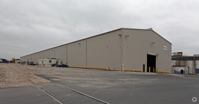
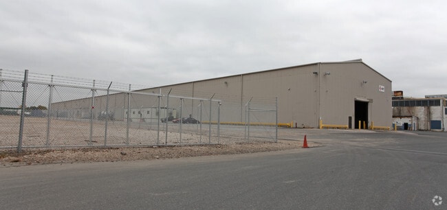
Property Detail
Rolling Mill Rd
15-2200022661
6.178 AC
Industrialgeneral
BALTIMORE
MH-IM
Maryland
AE The base floodplain where base flood elevations are provided. AE Zones are now used on new format FIRMs instead of A1-A30 Zones.
5.05 AC
2024
Baltimore County East
2025
Baltimore
260700
Baltimore-Columbia-Towson, MD
NEARBY LISTINGS FOR SALE OR LEASE
DEMOGRAPHICS near Rolling Mill Rd
1 mile
3 mile
5 mile
2025 Total Population
5,648
113,881
343,565
2030 Population
5,656
112,691
341,171
Pop Growth 2025-2030
+ 0.14%
(1.04%)
(0.70%)
Average Age
39
39
39
2025 Total Households
1,966
43,181
136,763
HH Growth 2025-2030
+ 0.15%
(1.13%)
(0.75%)
Median Household Inc
$48,871
$63,217
$66,949
Avg Household Size
2.70
2.60
2.40
2025 Avg HH Vehicles
2.00
2.00
1.00
Median Home Value
$190,754
$223,181
$246,766
Median Year Built
1953
1956
1954
Nearby Places
Map Layers
Map Styles
 Street
 Aerial
Transit
 Traffic
 Biking
Places
Listings with unknown addresses are not visible on the map
- Restaurants
- Banks
- Shops
- Fitness
- Groceries
PUBLIC TRANSPORTATION
COMMUTER RAIL
Martin Airport Marc Nb (PENN - WASHINGTON - Maryland Transit Administration)
Drive
Walk
Distance
Martin Airport Marc Nb (PENN - WASHINGTON - Maryland Transit Administration)
19 min
6.9 mi
Penn Station (PENN - WASHINGTON - Maryland Area Regional Commuter Trains (The MARC), Penn Line - Maryland Area Regional Commuter Trains (The MARC), Penn Station & Camden Yards - Maryland Area Regional Commuter Trains (The MARC))
Drive
Walk
Distance
Penn Station (PENN - WASHINGTON - Maryland Area Regional Commuter Trains (The MARC), Penn Line - Maryland Area Regional Commuter Trains (The MARC), Penn Station & Camden Yards - Maryland Area Regional Commuter Trains (The MARC))
20 min
7.2 mi
AIRPORT
Baltimore/Washington International Thurgood Marshall
Drive
Walk
Distance
Baltimore/Washington International Thurgood Marshall
32 min
17.2 mi
Freight Ports
Port of Baltimore
Drive
Walk
Distance
Port of Baltimore
18 min
7.6 mi
SALE & LEASE HISTORY
LISTING DATE
SALE/LEASE

Sep 16, 2020
For Lease
Nearby Properties
Address
Land Use
TOTAL SIZE
Lot Size
Zoning
Address
Land Use
TOTAL SIZE
Lot Size
Zoning
608,666 SF
8.42 AC
H
Address
Land Use
TOTAL SIZE
Lot Size
Zoning
268,543 SF
84.93 AC
H
Address
Land Use
TOTAL SIZE
Lot Size
Zoning
475,525 SF
4.22 AC
C-3
Address
Land Use
TOTAL SIZE
Lot Size
Zoning
347,000 SF
42.73 AC
DR
Address
Land Use
TOTAL SIZE
Lot Size
Zoning
619,700 SF
34.98 AC
I-2
Address
Land Use
TOTAL SIZE
Lot Size
Zoning
278,006 SF
49.85 AC
DR
Address
Land Use
TOTAL SIZE
Lot Size
Zoning
21.74 AC
DR16
Address
Land Use
TOTAL SIZE
Lot Size
Zoning
621,041 SF
32.69 AC
MH-IM
Address
Land Use
TOTAL SIZE
Lot Size
Zoning
126,507 SF
1.05 AC
H
Address
Land Use
TOTAL SIZE
Lot Size
Zoning
135,548 SF
13 AC
DR5.5
Address
Land Use
TOTAL SIZE
Lot Size
Zoning
227,772 SF
19.14 AC
2-1
Address
Land Use
TOTAL SIZE
Lot Size
Zoning
132,038 SF
5.38 AC
OIC
Address
Land Use
TOTAL SIZE
Lot Size
Zoning
97,784 SF
1.35 AC
DR10.
Address
Land Use
TOTAL SIZE
Lot Size
Zoning
507,600 SF
21.36 AC
MHIM
Address
Land Use
TOTAL SIZE
Lot Size
Zoning
105,384 SF
15.41 AC
Address
Land Use
TOTAL SIZE
Lot Size
Zoning
213,997 SF
45.22 AC
DR
Address
Land Use
TOTAL SIZE
Lot Size
Zoning
718,098 SF
83.20 AC
MH-IM
Address
Land Use
TOTAL SIZE
Lot Size
Zoning
271,370 SF
20.11 AC
BM
Address
Land Use
TOTAL SIZE
Lot Size
Zoning
117,170 SF
7.84 AC
BM
Address
Land Use
TOTAL SIZE
Lot Size
Zoning
13.72 AC
DR16
Address
Land Use
TOTAL SIZE
Lot Size
Zoning
82,800 SF
1.09 AC
C-3
Address
Land Use
TOTAL SIZE
Lot Size
Zoning
253,081 SF
42.21 AC
DR5.5
Address
Land Use
TOTAL SIZE
Lot Size
Zoning
135,931 SF
21.65 AC
DR5.5
Address
Land Use
TOTAL SIZE
Lot Size
Zoning
3,099 SF
16.10 AC
BM
Address
Land Use
TOTAL SIZE
Lot Size
Zoning
158,131 SF
13.02 AC
BM
Address
Land Use
TOTAL SIZE
Lot Size
Zoning
189,347 SF
28.24 AC
DR10
Address
Land Use
TOTAL SIZE
Lot Size
Zoning
28,963 SF
60.65 AC
BM-CT
Address
Land Use
TOTAL SIZE
Lot Size
Zoning
126,096 SF
14.68 AC
DR105
Address
Land Use
TOTAL SIZE
Lot Size
Zoning
88,579 SF
7.20 AC
C-3
Address
Land Use
TOTAL SIZE
Lot Size
Zoning
10.27 AC
DR16
The World's #1 Commercial Real Estate Marketplace
Connect with us
© 2026 CoStar Group
The information above has been obtained from sources believed reliable. While we do not doubt its accuracy we have not verified it and make no guarantee, warranty or representation about it. It is your responsibility to independently confirm its accuracy and completeness. Any projections, opinions, assumptions, or estimates used are for example only and do not represent the current or future performance of the property. The value of this transaction to you depends on tax and other factors which should be evaluated by your tax, financial, and legal advisors. You and your advisors should conduct a careful, independent investigation of the property to determine to your satisfaction the suitability of the property for your needs.