Property Record
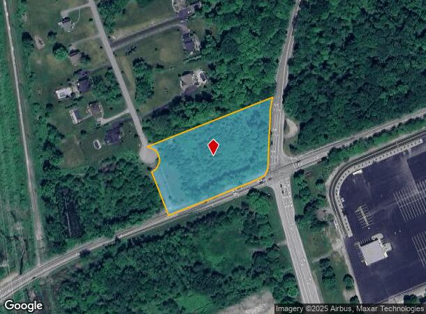
Round Hill Rd, Hopewell Junction, NY 12533
NEARBY LISTINGS FOR SALE OR LEASE
Property Detail
Round Hill Rd
132800-6356-04-776321-0000
Dutchess
Residentialacreage
New York
X
776
36079C0015E
3.43 AC
2025
Fishkill
2024
Westchester/So Connecticut
050203
Dutchess County-Putnam County, NY
DEMOGRAPHICS near Round Hill Rd
1 Mile
3 Mile
5 Mile
2024 Total Population
971
19,923
47,410
2029 Population
964
19,840
47,264
Pop Growth 2024-2029
(0.72%)
(0.42%)
(0.31%)
Average Age
42
43
43
2024 Total Households
348
7,275
17,779
HH Growth 2024-2029
(0.86%)
(0.38%)
(0.30%)
Median Household Inc
$138,662
$106,716
$106,915
Avg Household Size
2.80
2.70
2.60
2024 Avg HH Vehicles
2.00
2.00
2.00
Median Home Value
$408,139
$393,617
$389,157
Median Year Built
1975
1976
1976
Nearby Places
- Restaurants
- Banks
- Shops
- Fitness
- Groceries
PUBLIC TRANSPORTATION
COMMUTER RAIL
New Hamburg Station (Hudson Line - Metro-North Commuter Railroad Company (Metro-North))
DRIVE
WALK
Distance
New Hamburg Station (Hudson Line - Metro-North Commuter Railroad Company (Metro-North))
16 min
9.5 mi
Beacon Station (Hudson Line - Metro-North Commuter Railroad Company (Metro-North))
DRIVE
WALK
Distance
Beacon Station (Hudson Line - Metro-North Commuter Railroad Company (Metro-North))
17 min
9.7 mi
AIRPORT
New York Stewart International
DRIVE
WALK
Distance
New York Stewart International
30 min
18.2 mi
Freight Ports
Port of New Haven
DRIVE
WALK
Distance
Port of New Haven
90 min
64.8 mi
Nearby Properties
Address
Land Use
TOTAL SIZE
Lot Size
Zoning
Address
Land Use
TOTAL SIZE
Lot Size
Zoning
1,240,333 SF
120.58 AC
PI
Address
Land Use
TOTAL SIZE
Lot Size
Zoning
98.94 AC
I1
Address
Land Use
TOTAL SIZE
Lot Size
Zoning
137,278 SF
41.20 AC
R-50
Address
Land Use
TOTAL SIZE
Lot Size
Zoning
633,840 SF
93.64 AC
I1
Address
Land Use
TOTAL SIZE
Lot Size
Zoning
45.64 AC
I1
Address
Land Use
TOTAL SIZE
Lot Size
Zoning
800 SF
10.21 AC
R1
Address
Land Use
TOTAL SIZE
Lot Size
Zoning
73,316 SF
30 AC
R1
Address
Land Use
TOTAL SIZE
Lot Size
Zoning
Address
Land Use
TOTAL SIZE
Lot Size
Zoning
4,212 SF
13.84 AC
HC
Address
Land Use
TOTAL SIZE
Lot Size
Zoning
28,362 SF
1,116.34 AC
R4A
Address
Land Use
TOTAL SIZE
Lot Size
Zoning
203,657 SF
36.08 AC
R1
Address
Land Use
TOTAL SIZE
Lot Size
Zoning
105,500 SF
8.50 AC
RB
Address
Land Use
TOTAL SIZE
Lot Size
Zoning
54,595 SF
11 AC
R15
Address
Land Use
TOTAL SIZE
Lot Size
Zoning
56,824 SF
10 AC
RMF5
Address
Land Use
TOTAL SIZE
Lot Size
Zoning
12,550 SF
1.85 AC
R1
Address
Land Use
TOTAL SIZE
Lot Size
Zoning
25.03 AC
Address
Land Use
TOTAL SIZE
Lot Size
Zoning
68,660 SF
9.54 AC
B2
Address
Land Use
TOTAL SIZE
Lot Size
Zoning
Address
Land Use
TOTAL SIZE
Lot Size
Zoning
Address
Land Use
TOTAL SIZE
Lot Size
Zoning
52,731 SF
3.97 AC
B2
Address
Land Use
TOTAL SIZE
Lot Size
Zoning
29.42 AC
I1
Address
Land Use
TOTAL SIZE
Lot Size
Zoning
19,738 SF
14.20 AC
R40
Address
Land Use
TOTAL SIZE
Lot Size
Zoning
Address
Land Use
TOTAL SIZE
Lot Size
Zoning
2.52 AC
PI
Address
Land Use
TOTAL SIZE
Lot Size
Zoning
Address
Land Use
TOTAL SIZE
Lot Size
Zoning
43,800 SF
5.77 AC
RB
Address
Land Use
TOTAL SIZE
Lot Size
Zoning
59,814 SF
9.04 AC
PB
Address
Land Use
TOTAL SIZE
Lot Size
Zoning
29,400 SF
5 AC
RB
Address
Land Use
TOTAL SIZE
Lot Size
Zoning
Address
Land Use
TOTAL SIZE
Lot Size
Zoning
3,799 SF
164.90 AC
R1/3
The World's #1 Commercial Real Estate Marketplace
Connect with us
© 2025 CoStar Group
The information above has been obtained from sources believed reliable. While we do not doubt its accuracy we have not verified it and make no guarantee, warranty or representation about it. It is your responsibility to independently confirm its accuracy and completeness. Any projections, opinions, assumptions, or estimates used are for example only and do not represent the current or future performance of the property. The value of this transaction to you depends on tax and other factors which should be evaluated by your tax, financial, and legal advisors. You and your advisors should conduct a careful, independent investigation of the property to determine to your satisfaction the suitability of the property for your needs.