Property Record
Route 13, Bristol, PA 19007
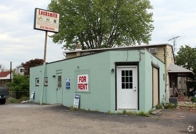


Property Detail
Route 13
04-010-186
LOT NE COR 6TH AVE & US 1 3 P/O LOTS #20-22-24
Storebuilding
BUCKS
HC
Pennsylvania
AE The base floodplain where base flood elevations are provided. AE Zones are now used on new format FIRMs instead of A1-A30 Zones.
20
2024
0.06 AC
2025
Lower Bucks County
100303
Philadelphia
703 SF
Philadelphia-Camden-Wilmington, PA-NJ-DE-MD
NEARBY LISTINGS FOR SALE OR LEASE
DEMOGRAPHICS near Route 13
1 mile
3 mile
5 mile
2025 Total Population
13,568
78,067
207,944
2030 Population
13,637
78,660
209,668
Pop Growth 2025-2030
+ 0.51%
+ 0.76%
+ 0.83%
Average Age
41
41
42
2025 Total Households
5,318
29,799
78,035
HH Growth 2025-2030
+ 0.47%
+ 0.76%
+ 0.83%
Median Household Inc
$73,432
$80,838
$89,992
Avg Household Size
2.40
2.50
2.60
2025 Avg HH Vehicles
2.00
2.00
2.00
Median Home Value
$264,168
$300,715
$332,759
Median Year Built
1948
1956
1962
Nearby Places
Map Layers
Map Styles
 Street
 Aerial
Transit
 Traffic
 Biking
Places
Listings with unknown addresses are not visible on the map
- Restaurants
- Banks
- Shops
- Fitness
- Groceries
PUBLIC TRANSPORTATION
TRANSIT/SUBWAY
Bristol (R7 - Southeastern Pennsylvania Transportation Authority Regional Rail (SEPTA Regional Rail))
Drive
Walk
Distance
Bristol (R7 - Southeastern Pennsylvania Transportation Authority Regional Rail (SEPTA Regional Rail))
2 min
10 min
0.5 mi
COMMUTER RAIL
Bristol (R7 - Southeastern Pennsylvania Transportation Authority Regional Rail (SEPTA Regional Rail))
Drive
Walk
Distance
Bristol (R7 - Southeastern Pennsylvania Transportation Authority Regional Rail (SEPTA Regional Rail))
2 min
8 min
0.4 mi
Levittown (R7 - Southeastern Pennsylvania Transportation Authority Regional Rail (SEPTA Regional Rail))
Drive
Walk
Distance
Levittown (R7 - Southeastern Pennsylvania Transportation Authority Regional Rail (SEPTA Regional Rail))
6 min
3.0 mi
AIRPORT
Trenton Mercer
Drive
Walk
Distance
Trenton Mercer
26 min
15.0 mi
Philadelphia International
Drive
Walk
Distance
Philadelphia International
50 min
32.3 mi
Freight Ports
Port of Philadelphia
Drive
Walk
Distance
Port of Philadelphia
30 min
18.7 mi
Nearby Properties
Address
Land Use
TOTAL SIZE
Lot Size
Zoning
Address
Land Use
TOTAL SIZE
Lot Size
Zoning
65.99 AC
Address
Land Use
TOTAL SIZE
Lot Size
Zoning
22,300 SF
59.13 AC
Address
Land Use
TOTAL SIZE
Lot Size
Zoning
16,960 SF
107.84 AC
Address
Land Use
TOTAL SIZE
Lot Size
Zoning
77.35 AC
I-2
Address
Land Use
TOTAL SIZE
Lot Size
Zoning
2,019 SF
28.85 AC
I-2
Address
Land Use
TOTAL SIZE
Lot Size
Zoning
486,812 SF
44.42 AC
Address
Land Use
TOTAL SIZE
Lot Size
Zoning
Address
Land Use
TOTAL SIZE
Lot Size
Zoning
46.66 AC
I-1
Address
Land Use
TOTAL SIZE
Lot Size
Zoning
Address
Land Use
TOTAL SIZE
Lot Size
Zoning
19,188 SF
29.52 AC
Address
Land Use
TOTAL SIZE
Lot Size
Zoning
23.38 AC
Address
Land Use
TOTAL SIZE
Lot Size
Zoning
27.99 AC
Address
Land Use
TOTAL SIZE
Lot Size
Zoning
37.98 AC
I-2
Address
Land Use
TOTAL SIZE
Lot Size
Zoning
16.23 AC
R-3
Address
Land Use
TOTAL SIZE
Lot Size
Zoning
23.14 AC
I-2
Address
Land Use
TOTAL SIZE
Lot Size
Zoning
23,591 SF
72.69 AC
I-1
Address
Land Use
TOTAL SIZE
Lot Size
Zoning
14.78 AC
R-20
Address
Land Use
TOTAL SIZE
Lot Size
Zoning
27,600 SF
13.26 AC
I-2
Address
Land Use
TOTAL SIZE
Lot Size
Zoning
11 AC
TRN
Address
Land Use
TOTAL SIZE
Lot Size
Zoning
Address
Land Use
TOTAL SIZE
Lot Size
Zoning
22.45 AC
I-2
Address
Land Use
TOTAL SIZE
Lot Size
Zoning
4,313 SF
1.25 AC
HC-2
Address
Land Use
TOTAL SIZE
Lot Size
Zoning
131,702 SF
10.21 AC
Address
Land Use
TOTAL SIZE
Lot Size
Zoning
15.09 AC
I-1
Address
Land Use
TOTAL SIZE
Lot Size
Zoning
29 AC
I-2
Address
Land Use
TOTAL SIZE
Lot Size
Zoning
24,328 SF
16.99 AC
I-2
Address
Land Use
TOTAL SIZE
Lot Size
Zoning
13.67 AC
I-2
Address
Land Use
TOTAL SIZE
Lot Size
Zoning
148 SF
8.88 AC
B-2
Address
Land Use
TOTAL SIZE
Lot Size
Zoning
8.60 AC
R-1
Address
Land Use
TOTAL SIZE
Lot Size
Zoning
2.43 AC
W-1
The World's #1 Commercial Real Estate Marketplace
Connect with us
© 2026 CoStar Group
The information above has been obtained from sources believed reliable. While we do not doubt its accuracy we have not verified it and make no guarantee, warranty or representation about it. It is your responsibility to independently confirm its accuracy and completeness. Any projections, opinions, assumptions, or estimates used are for example only and do not represent the current or future performance of the property. The value of this transaction to you depends on tax and other factors which should be evaluated by your tax, financial, and legal advisors. You and your advisors should conduct a careful, independent investigation of the property to determine to your satisfaction the suitability of the property for your needs.