Property Record
Route 147, Halifax, PA 17032

Property Detail
Route 147
29-013-036
DAUPHIN
Vacantlandnec
Pennsylvania
B and X Area of moderate flood hazard, usually the area between the limits of the 100-year and 500-year floods.
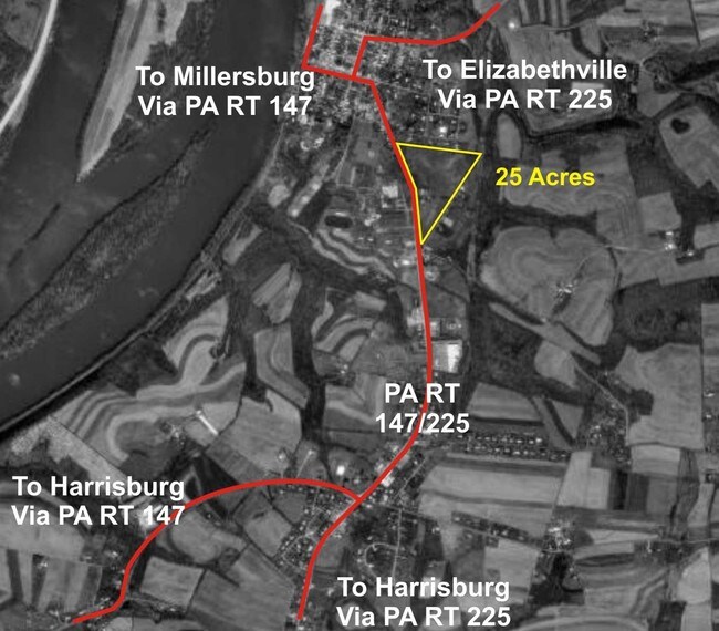
2 AC
2026
Harrisburg Area East
2026
Philadelphia
024801
Harrisburg-Carlisle, PA
NEARBY LISTINGS FOR SALE OR LEASE
-
-
View all Halifax listings for lease on LoopNet.com
DEMOGRAPHICS near Route 147
1 mile
3 mile
5 mile
2025 Total Population
1,501
4,602
8,475
2030 Population
1,520
4,701
8,667
Pop Growth 2025-2030
+ 1.27%
+ 2.15%
+ 2.27%
Average Age
43
44
44
2025 Total Households
632
1,899
3,475
HH Growth 2025-2030
+ 1.42%
+ 2.21%
+ 2.30%
Median Household Inc
$62,500
$69,362
$73,028
Avg Household Size
2.40
2.40
2.40
2025 Avg HH Vehicles
2.00
2.00
2.00
Median Home Value
$200,350
$215,900
$231,295
Median Year Built
1957
1973
1975
Nearby Places
Map Layers
Map Styles
 Street
 Aerial
Layers
 Traffic
 Biking
Places
Listings with unknown addresses are not visible on the map
- Restaurants
- Banks
- Shops
- Fitness
- Groceries
PUBLIC TRANSPORTATION
AIRPORT
Harrisburg International
Drive
Walk
Distance
Harrisburg International
43 min
28.5 mi
Freight Ports
Port of Baltimore
Drive
Walk
Distance
Port of Baltimore
138 min
98.7 mi
SALE & LEASE HISTORY
LISTING DATE
SALE/LEASE

Mar 28, 2017
For Lease
Nearby Properties
Address
Land Use
TOTAL SIZE
Lot Size
Zoning
Address
Land Use
TOTAL SIZE
Lot Size
Zoning
115,525 SF
25.50 AC
Address
Land Use
TOTAL SIZE
Lot Size
Zoning
70,973 SF
7.30 AC
Address
Land Use
TOTAL SIZE
Lot Size
Zoning
5.13 AC
RUR
Address
Land Use
TOTAL SIZE
Lot Size
Zoning
1,320 SF
7.65 AC
Address
Land Use
TOTAL SIZE
Lot Size
Zoning
608 SF
185.68 AC
Address
Land Use
TOTAL SIZE
Lot Size
Zoning
87,500 SF
45 AC
Address
Land Use
TOTAL SIZE
Lot Size
Zoning
113,820 SF
128.42 AC
Address
Land Use
TOTAL SIZE
Lot Size
Zoning
6.17 AC
MIX
Address
Land Use
TOTAL SIZE
Lot Size
Zoning
11,180 SF
10 AC
Address
Land Use
TOTAL SIZE
Lot Size
Zoning
1.86 AC
MIX
Address
Land Use
TOTAL SIZE
Lot Size
Zoning
1.05 AC
MIX
Address
Land Use
TOTAL SIZE
Lot Size
Zoning
37,500 SF
15.99 AC
Address
Land Use
TOTAL SIZE
Lot Size
Zoning
6,062 SF
1.84 AC
Address
Land Use
TOTAL SIZE
Lot Size
Zoning
1.34 AC
RUR
Address
Land Use
TOTAL SIZE
Lot Size
Zoning
43,488 SF
2.41 AC
Address
Land Use
TOTAL SIZE
Lot Size
Zoning
1.32 AC
MIX
Address
Land Use
TOTAL SIZE
Lot Size
Zoning
6,912 SF
2.29 AC
Address
Land Use
TOTAL SIZE
Lot Size
Zoning
1,076 SF
3.84 AC
Address
Land Use
TOTAL SIZE
Lot Size
Zoning
2.45 AC
MIX
Address
Land Use
TOTAL SIZE
Lot Size
Zoning
11,979 SF
4.90 AC
Address
Land Use
TOTAL SIZE
Lot Size
Zoning
146 AC
RUR
Address
Land Use
TOTAL SIZE
Lot Size
Zoning
2,730 SF
78 AC
RUR
Address
Land Use
TOTAL SIZE
Lot Size
Zoning
5,316 SF
29.99 AC
Address
Land Use
TOTAL SIZE
Lot Size
Zoning
1,668 SF
2.30 AC
Address
Land Use
TOTAL SIZE
Lot Size
Zoning
3,857 SF
112.26 AC
Address
Land Use
TOTAL SIZE
Lot Size
Zoning
1,792 SF
53.76 AC
RUR
Address
Land Use
TOTAL SIZE
Lot Size
Zoning
1.32 AC
MIX
Address
Land Use
TOTAL SIZE
Lot Size
Zoning
806 SF
44 AC
Address
Land Use
TOTAL SIZE
Lot Size
Zoning
79.61 AC
RUR
Address
Land Use
TOTAL SIZE
Lot Size
Zoning
2,280 SF
171.41 AC
The World's #1 Commercial Real Estate Marketplace
Connect with us
© 2026 CoStar Group
The information above has been obtained from sources believed reliable. While we do not doubt its accuracy we have not verified it and make no guarantee, warranty or representation about it. It is your responsibility to independently confirm its accuracy and completeness. Any projections, opinions, assumptions, or estimates used are for example only and do not represent the current or future performance of the property. The value of this transaction to you depends on tax and other factors which should be evaluated by your tax, financial, and legal advisors. You and your advisors should conduct a careful, independent investigation of the property to determine to your satisfaction the suitability of the property for your needs.