Property Record
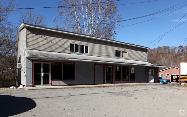
Route 152, Wayne, WV 25570


NEARBY LISTINGS FOR SALE OR LEASE
Property Detail
Route 152
10-26-00520001
PARCEL
Storebuilding
Wayne
AE
West Virginia
54099C0185C
0.26 AC
2025
Wayne County
2025
Huntington/Ashland
020500
Huntington-Ashland, WV-KY-OH
DEMOGRAPHICS near Route 152
1 Mile
3 Mile
5 Mile
2024 Total Population
621
3,556
7,029
2029 Population
608
3,444
6,822
Pop Growth 2024-2029
(2.09%)
(3.15%)
(2.94%)
Average Age
44
44
43
2024 Total Households
277
1,539
2,941
HH Growth 2024-2029
(1.81%)
(2.79%)
(2.58%)
Median Household Inc
$31,875
$36,655
$40,904
Avg Household Size
2.20
2.30
2.30
2024 Avg HH Vehicles
1.00
2.00
2.00
Median Home Value
$100,909
$123,619
$142,772
Median Year Built
1981
1980
1979
Nearby Places
Map Layers
Map Styles
 Street
 Aerial
- Restaurants
- Banks
- Shops
- Fitness
- Groceries
PUBLIC TRANSPORTATION
AIRPORT
Tri-State/Milton J Ferguson Field
DRIVE
WALK
Distance
Tri-State/Milton J Ferguson Field
30 min
18.3 mi
Freight Ports
Port of Toledo
DRIVE
WALK
Distance
Port of Toledo
368 min
284.8 mi
Nearby Properties
Address
Land Use
TOTAL SIZE
Lot Size
Zoning
Address
Land Use
TOTAL SIZE
Lot Size
Zoning
4.02 AC
Address
Land Use
TOTAL SIZE
Lot Size
Zoning
0.92 AC
Address
Land Use
TOTAL SIZE
Lot Size
Zoning
11.77 AC
Address
Land Use
TOTAL SIZE
Lot Size
Zoning
6.50 AC
Address
Land Use
TOTAL SIZE
Lot Size
Zoning
1.34 AC
Address
Land Use
TOTAL SIZE
Lot Size
Zoning
123.41 AC
Address
Land Use
TOTAL SIZE
Lot Size
Zoning
1.80 AC
Address
Land Use
TOTAL SIZE
Lot Size
Zoning
2.14 AC
Address
Land Use
TOTAL SIZE
Lot Size
Zoning
1.93 AC
Address
Land Use
TOTAL SIZE
Lot Size
Zoning
3.39 AC
Address
Land Use
TOTAL SIZE
Lot Size
Zoning
0.41 AC
Address
Land Use
TOTAL SIZE
Lot Size
Zoning
2.18 AC
Address
Land Use
TOTAL SIZE
Lot Size
Zoning
10.24 AC
Address
Land Use
TOTAL SIZE
Lot Size
Zoning
8.89 AC
Address
Land Use
TOTAL SIZE
Lot Size
Zoning
0.37 AC
Address
Land Use
TOTAL SIZE
Lot Size
Zoning
0.29 AC
Address
Land Use
TOTAL SIZE
Lot Size
Zoning
0.96 AC
Address
Land Use
TOTAL SIZE
Lot Size
Zoning
1.03 AC
Address
Land Use
TOTAL SIZE
Lot Size
Zoning
1.24 AC
Address
Land Use
TOTAL SIZE
Lot Size
Zoning
0.73 AC
Address
Land Use
TOTAL SIZE
Lot Size
Zoning
0.92 AC
Address
Land Use
TOTAL SIZE
Lot Size
Zoning
23.25 AC
Address
Land Use
TOTAL SIZE
Lot Size
Zoning
0.69 AC
Address
Land Use
TOTAL SIZE
Lot Size
Zoning
1.84 AC
Address
Land Use
TOTAL SIZE
Lot Size
Zoning
0.81 AC
Address
Land Use
TOTAL SIZE
Lot Size
Zoning
0.24 AC
Address
Land Use
TOTAL SIZE
Lot Size
Zoning
8.65 AC
Address
Land Use
TOTAL SIZE
Lot Size
Zoning
1.72 AC
Address
Land Use
TOTAL SIZE
Lot Size
Zoning
1.16 AC
Address
Land Use
TOTAL SIZE
Lot Size
Zoning
0.70 AC
The World's #1 Commercial Real Estate Marketplace
Connect with us
© 2026 CoStar Group
The information above has been obtained from sources believed reliable. While we do not doubt its accuracy we have not verified it and make no guarantee, warranty or representation about it. It is your responsibility to independently confirm its accuracy and completeness. Any projections, opinions, assumptions, or estimates used are for example only and do not represent the current or future performance of the property. The value of this transaction to you depends on tax and other factors which should be evaluated by your tax, financial, and legal advisors. You and your advisors should conduct a careful, independent investigation of the property to determine to your satisfaction the suitability of the property for your needs.