Property Record
Route 19, Cranberry Township, PA 16066

NEARBY LISTINGS FOR SALE OR LEASE
Property Detail
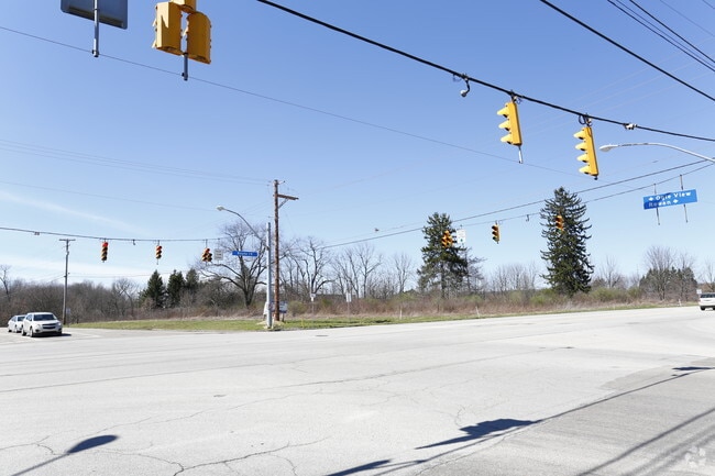
Route 19
Pittsburgh, PA
Cranberry Promenade
130-4F108-11L-0000
1.01 ACS
Vacantlandnec
Butler
X
Pennsylvania
42019C0503D
2.09 AC
2025
Butler County
2025
Pittsburgh
912001
DEMOGRAPHICS near Route 19
1 Mile
3 Mile
5 Mile
2024 Total Population
3,831
40,837
69,937
2029 Population
4,049
41,775
70,958
Pop Growth 2024-2029
+ 5.69%
+ 2.30%
+ 1.46%
Average Age
42
40
41
2024 Total Households
1,657
15,902
26,771
HH Growth 2024-2029
+ 6.34%
+ 2.58%
+ 1.63%
Median Household Inc
$93,868
$115,451
$119,164
Avg Household Size
2.20
2.50
2.60
2024 Avg HH Vehicles
1.00
2.00
2.00
Median Home Value
$357,843
$364,365
$373,307
Median Year Built
1990
1996
1996
Nearby Places
Map Layers
Map Styles
 Street
 Aerial
- Restaurants
- Banks
- Shops
- Fitness
- Groceries
PUBLIC TRANSPORTATION
AIRPORT
Pittsburgh International
DRIVE
WALK
Distance
Pittsburgh International
40 min
22.0 mi
Freight Ports
Port of Toledo
DRIVE
WALK
Distance
Port of Toledo
241 min
213.5 mi
Nearby Properties
Address
Land Use
TOTAL SIZE
Lot Size
Zoning
Address
Land Use
TOTAL SIZE
Lot Size
Zoning
80.58 AC
Address
Land Use
TOTAL SIZE
Lot Size
Zoning
47,000 SF
52.99 AC
Address
Land Use
TOTAL SIZE
Lot Size
Zoning
23.48 AC
Address
Land Use
TOTAL SIZE
Lot Size
Zoning
Address
Land Use
TOTAL SIZE
Lot Size
Zoning
Address
Land Use
TOTAL SIZE
Lot Size
Zoning
12.44 AC
Address
Land Use
TOTAL SIZE
Lot Size
Zoning
11.95 AC
Address
Land Use
TOTAL SIZE
Lot Size
Zoning
13.59 AC
Address
Land Use
TOTAL SIZE
Lot Size
Zoning
6,240 SF
40.21 AC
Address
Land Use
TOTAL SIZE
Lot Size
Zoning
32.41 AC
Address
Land Use
TOTAL SIZE
Lot Size
Zoning
Address
Land Use
TOTAL SIZE
Lot Size
Zoning
1,431 SF
40.30 AC
Address
Land Use
TOTAL SIZE
Lot Size
Zoning
88,000 SF
19.74 AC
Address
Land Use
TOTAL SIZE
Lot Size
Zoning
8.26 AC
Address
Land Use
TOTAL SIZE
Lot Size
Zoning
Address
Land Use
TOTAL SIZE
Lot Size
Zoning
8.86 AC
Address
Land Use
TOTAL SIZE
Lot Size
Zoning
Address
Land Use
TOTAL SIZE
Lot Size
Zoning
12.84 AC
Address
Land Use
TOTAL SIZE
Lot Size
Zoning
Address
Land Use
TOTAL SIZE
Lot Size
Zoning
8.44 AC
Address
Land Use
TOTAL SIZE
Lot Size
Zoning
13.02 AC
Address
Land Use
TOTAL SIZE
Lot Size
Zoning
Address
Land Use
TOTAL SIZE
Lot Size
Zoning
Address
Land Use
TOTAL SIZE
Lot Size
Zoning
13.58 AC
Address
Land Use
TOTAL SIZE
Lot Size
Zoning
Address
Land Use
TOTAL SIZE
Lot Size
Zoning
20.14 AC
Address
Land Use
TOTAL SIZE
Lot Size
Zoning
9.32 AC
Address
Land Use
TOTAL SIZE
Lot Size
Zoning
11.60 AC
Address
Land Use
TOTAL SIZE
Lot Size
Zoning
Address
Land Use
TOTAL SIZE
Lot Size
Zoning
The World's #1 Commercial Real Estate Marketplace
Connect with us
© 2026 CoStar Group
The information above has been obtained from sources believed reliable. While we do not doubt its accuracy we have not verified it and make no guarantee, warranty or representation about it. It is your responsibility to independently confirm its accuracy and completeness. Any projections, opinions, assumptions, or estimates used are for example only and do not represent the current or future performance of the property. The value of this transaction to you depends on tax and other factors which should be evaluated by your tax, financial, and legal advisors. You and your advisors should conduct a careful, independent investigation of the property to determine to your satisfaction the suitability of the property for your needs.