Property Record
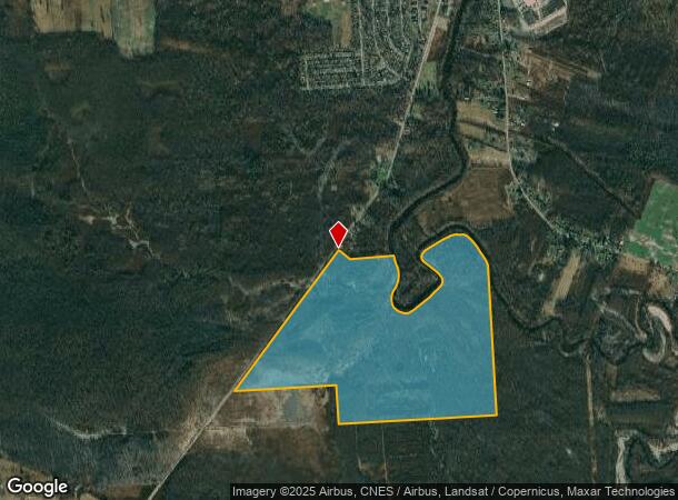
Route 298, Kirkville, NY 13082
NEARBY LISTINGS FOR SALE OR LEASE
-
-
View all Kirkville listings for sale on LoopNet.com
Property Detail
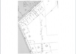
Route 298
312289-066-000-0001-001-000-0000
GLAHN EST CICERO SWAMP 0660101 4200000701002
Lakeriverbeach
Onondaga
AE
New York
36067C0138F
1.000
0
300.40 AC
2024
Other Market Areas
030403
Syracuse, NY
DEMOGRAPHICS near Route 298
1 Mile
3 Mile
5 Mile
2024 Total Population
349
5,185
16,395
2029 Population
346
5,185
16,444
Pop Growth 2024-2029
(0.86%)
0.00%
+ 0.30%
Average Age
43
43
42
2024 Total Households
147
2,065
6,560
HH Growth 2024-2029
(0.68%)
(0.15%)
+ 0.21%
Median Household Inc
$48,437
$51,337
$57,288
Avg Household Size
2.40
2.50
2.50
2024 Avg HH Vehicles
2.00
2.00
2.00
Median Home Value
$84,285
$139,536
$148,992
Median Year Built
1963
1967
1969
Nearby Places
- Restaurants
- Banks
- Shops
- Fitness
- Groceries
PUBLIC TRANSPORTATION
AIRPORT
Syracuse Hancock International
DRIVE
WALK
Distance
Syracuse Hancock International
19 min
10.6 mi
Freight Ports
Albany, NY Port
DRIVE
WALK
Distance
Albany, NY Port
168 min
136.4 mi
Nearby Properties
Address
Land Use
TOTAL SIZE
Lot Size
Zoning
Address
Land Use
TOTAL SIZE
Lot Size
Zoning
32,520 SF
31.41 AC
Address
Land Use
TOTAL SIZE
Lot Size
Zoning
5,256 SF
5.56 AC
Address
Land Use
TOTAL SIZE
Lot Size
Zoning
7,008 SF
7.75 AC
Address
Land Use
TOTAL SIZE
Lot Size
Zoning
16,890 SF
2.07 AC
Address
Land Use
TOTAL SIZE
Lot Size
Zoning
6,794 SF
79.10 AC
RA
Address
Land Use
TOTAL SIZE
Lot Size
Zoning
700 SF
45.42 AC
04
Address
Land Use
TOTAL SIZE
Lot Size
Zoning
2,520 SF
19.70 AC
Address
Land Use
TOTAL SIZE
Lot Size
Zoning
6,093 SF
271.33 AC
Address
Land Use
TOTAL SIZE
Lot Size
Zoning
4,850 SF
1.73 AC
Address
Land Use
TOTAL SIZE
Lot Size
Zoning
1,436 SF
3.20 AC
Address
Land Use
TOTAL SIZE
Lot Size
Zoning
3,008 SF
131.14 AC
RA
Address
Land Use
TOTAL SIZE
Lot Size
Zoning
8,400 SF
5.26 AC
BUS
Address
Land Use
TOTAL SIZE
Lot Size
Zoning
9,863 SF
4.12 AC
Address
Land Use
TOTAL SIZE
Lot Size
Zoning
1,848 SF
2.71 AC
CB
Address
Land Use
TOTAL SIZE
Lot Size
Zoning
9,075 SF
1.41 AC
Address
Land Use
TOTAL SIZE
Lot Size
Zoning
10,156 SF
2.52 AC
05 - COMME
Address
Land Use
TOTAL SIZE
Lot Size
Zoning
Address
Land Use
TOTAL SIZE
Lot Size
Zoning
910 SF
47.41 AC
PUD-R
Address
Land Use
TOTAL SIZE
Lot Size
Zoning
3,024 SF
30.41 AC
Address
Land Use
TOTAL SIZE
Lot Size
Zoning
2,476 SF
2.23 AC
BUS
Address
Land Use
TOTAL SIZE
Lot Size
Zoning
2,250 SF
1.57 AC
05 - COMME
Address
Land Use
TOTAL SIZE
Lot Size
Zoning
9,000 SF
5.14 AC
05 - COMME
Address
Land Use
TOTAL SIZE
Lot Size
Zoning
2,378 SF
0.69 AC
Address
Land Use
TOTAL SIZE
Lot Size
Zoning
14,340 SF
0.83 AC
R-10
Address
Land Use
TOTAL SIZE
Lot Size
Zoning
107.77 AC
Address
Land Use
TOTAL SIZE
Lot Size
Zoning
8,000 SF
74.99 AC
AG,R-8
Address
Land Use
TOTAL SIZE
Lot Size
Zoning
1,892 SF
1.09 AC
Address
Land Use
TOTAL SIZE
Lot Size
Zoning
4,264 SF
5.29 AC
02 - SINGL
Address
Land Use
TOTAL SIZE
Lot Size
Zoning
3,358 SF
1.60 AC
Address
Land Use
TOTAL SIZE
Lot Size
Zoning
2,456 SF
1.13 AC
RA
The World's #1 Commercial Real Estate Marketplace
Connect with us
© 2025 CoStar Group
The information above has been obtained from sources believed reliable. While we do not doubt its accuracy we have not verified it and make no guarantee, warranty or representation about it. It is your responsibility to independently confirm its accuracy and completeness. Any projections, opinions, assumptions, or estimates used are for example only and do not represent the current or future performance of the property. The value of this transaction to you depends on tax and other factors which should be evaluated by your tax, financial, and legal advisors. You and your advisors should conduct a careful, independent investigation of the property to determine to your satisfaction the suitability of the property for your needs.