Property Record
Route 35, Katonah, NY 10536
NEARBY LISTINGS FOR SALE OR LEASE
Property Detail
Route 35
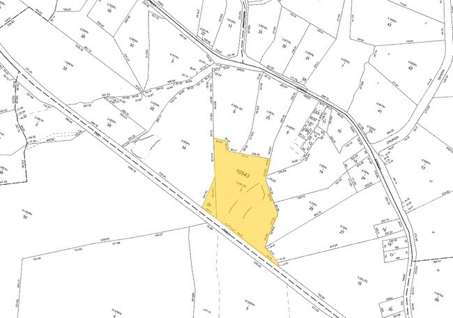
3000-039-000-10543-000-0029
Westchester
Residentialacreage
New York
X
3.9
36119C0142F
0.37 AC
2025
North
2024
Westchester/So Connecticut
012502
New York-Jersey City-White Plains, NY-NJ
DEMOGRAPHICS near Route 35
1 Mile
3 Mile
5 Mile
2024 Total Population
1,287
16,506
39,003
2029 Population
1,268
16,424
38,889
Pop Growth 2024-2029
(1.48%)
(0.50%)
(0.29%)
Average Age
43
43
43
2024 Total Households
471
6,074
13,975
HH Growth 2024-2029
(1.70%)
(0.56%)
(0.39%)
Median Household Inc
$166,791
$162,099
$184,150
Avg Household Size
2.70
2.70
2.80
2024 Avg HH Vehicles
2.00
2.00
2.00
Median Home Value
$668,432
$743,238
$770,816
Median Year Built
1972
1970
1971
Nearby Places
- Restaurants
- Banks
- Shops
- Fitness
- Groceries
PUBLIC TRANSPORTATION
COMMUTER RAIL
Katonah Station (Harlem Line - Metro-North Commuter Railroad Company (Metro-North))
DRIVE
WALK
Distance
Katonah Station (Harlem Line - Metro-North Commuter Railroad Company (Metro-North))
3 min
12 min
0.7 mi
Bedford Hills Station (Harlem Line - Metro-North Commuter Railroad Company (Metro-North))
DRIVE
WALK
Distance
Bedford Hills Station (Harlem Line - Metro-North Commuter Railroad Company (Metro-North))
6 min
2.6 mi
AIRPORT
Westchester County
DRIVE
WALK
Distance
Westchester County
23 min
15.6 mi
New York Stewart International
DRIVE
WALK
Distance
New York Stewart International
64 min
39.5 mi
Freight Ports
Port of New Haven
DRIVE
WALK
Distance
Port of New Haven
81 min
56.0 mi
Nearby Properties
Address
Land Use
TOTAL SIZE
Lot Size
Zoning
Address
Land Use
TOTAL SIZE
Lot Size
Zoning
1,168.28 AC
Address
Land Use
TOTAL SIZE
Lot Size
Zoning
80.80 AC
Address
Land Use
TOTAL SIZE
Lot Size
Zoning
540,000 SF
206.12 AC
Address
Land Use
TOTAL SIZE
Lot Size
Zoning
1,984 SF
17.90 AC
R-120
Address
Land Use
TOTAL SIZE
Lot Size
Zoning
92.34 AC
Address
Land Use
TOTAL SIZE
Lot Size
Zoning
18.08 AC
Address
Land Use
TOTAL SIZE
Lot Size
Zoning
2,431 SF
58.02 AC
R-80
Address
Land Use
TOTAL SIZE
Lot Size
Zoning
54.14 AC
Address
Land Use
TOTAL SIZE
Lot Size
Zoning
143.80 AC
Address
Land Use
TOTAL SIZE
Lot Size
Zoning
1,795 SF
25.31 AC
R-120
Address
Land Use
TOTAL SIZE
Lot Size
Zoning
Address
Land Use
TOTAL SIZE
Lot Size
Zoning
80.94 AC
Address
Land Use
TOTAL SIZE
Lot Size
Zoning
9.80 AC
Address
Land Use
TOTAL SIZE
Lot Size
Zoning
Address
Land Use
TOTAL SIZE
Lot Size
Zoning
130.31 AC
Address
Land Use
TOTAL SIZE
Lot Size
Zoning
Address
Land Use
TOTAL SIZE
Lot Size
Zoning
Address
Land Use
TOTAL SIZE
Lot Size
Zoning
Address
Land Use
TOTAL SIZE
Lot Size
Zoning
14 AC
R-4A
Address
Land Use
TOTAL SIZE
Lot Size
Zoning
Address
Land Use
TOTAL SIZE
Lot Size
Zoning
16.60 AC
Address
Land Use
TOTAL SIZE
Lot Size
Zoning
Address
Land Use
TOTAL SIZE
Lot Size
Zoning
Address
Land Use
TOTAL SIZE
Lot Size
Zoning
0.42 AC
Address
Land Use
TOTAL SIZE
Lot Size
Zoning
Address
Land Use
TOTAL SIZE
Lot Size
Zoning
4.40 AC
Address
Land Use
TOTAL SIZE
Lot Size
Zoning
8.97 AC
RB
Address
Land Use
TOTAL SIZE
Lot Size
Zoning
Address
Land Use
TOTAL SIZE
Lot Size
Zoning
Address
Land Use
TOTAL SIZE
Lot Size
Zoning
2.36 AC
The World's #1 Commercial Real Estate Marketplace
Connect with us
© 2025 CoStar Group
The information above has been obtained from sources believed reliable. While we do not doubt its accuracy we have not verified it and make no guarantee, warranty or representation about it. It is your responsibility to independently confirm its accuracy and completeness. Any projections, opinions, assumptions, or estimates used are for example only and do not represent the current or future performance of the property. The value of this transaction to you depends on tax and other factors which should be evaluated by your tax, financial, and legal advisors. You and your advisors should conduct a careful, independent investigation of the property to determine to your satisfaction the suitability of the property for your needs.