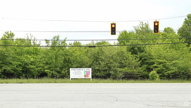
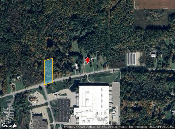
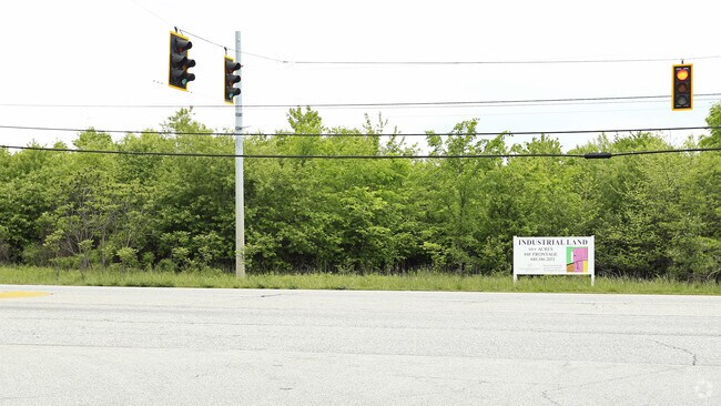
Property Record
12836 Main Market Rd, Burton, OH 44021
NEARBY LISTINGS FOR SALE OR LEASE
Property Detail
12836 Main Market Rd
32-074043
SEC 23
Vacantlandnec
Geauga
X
Ohio
39055C0245D
2 AC
2024
Geauga County
2024
Cleveland
312000
Cleveland-Elyria, OH
DEMOGRAPHICS near 12836 Main Market Rd
1 Mile
3 Mile
5 Mile
2024 Total Population
645
3,678
10,232
2029 Population
642
3,660
10,156
Pop Growth 2024-2029
(0.47%)
(0.49%)
(0.74%)
Average Age
49
42
41
2024 Total Households
291
1,333
3,607
HH Growth 2024-2029
(1.03%)
(0.60%)
(0.75%)
Median Household Inc
$71,666
$103,054
$101,969
Avg Household Size
2.20
2.70
2.70
2024 Avg HH Vehicles
2.00
2.00
2.00
Median Home Value
$127,272
$249,273
$265,053
Median Year Built
1984
1989
1978
Nearby Places
Map Layers
Map Styles
 Street
 Aerial
- Restaurants
- Banks
- Shops
- Fitness
- Groceries
SALE & LEASE HISTORY
LISTING DATE
SALE/LEASE

Nov 18, 2016
For Sale
Nearby Properties
Address
Land Use
TOTAL SIZE
Lot Size
Zoning
Address
Land Use
TOTAL SIZE
Lot Size
Zoning
334,594 SF
73.32 AC
M1
Address
Land Use
TOTAL SIZE
Lot Size
Zoning
56,278 SF
17.43 AC
M1
Address
Land Use
TOTAL SIZE
Lot Size
Zoning
82,352 SF
12.19 AC
M1
Address
Land Use
TOTAL SIZE
Lot Size
Zoning
68,148 SF
12.98 AC
M1
Address
Land Use
TOTAL SIZE
Lot Size
Zoning
41.07 AC
MHP
Address
Land Use
TOTAL SIZE
Lot Size
Zoning
28,628 SF
5.02 AC
R5
Address
Land Use
TOTAL SIZE
Lot Size
Zoning
40,590 SF
6.16 AC
M1
Address
Land Use
TOTAL SIZE
Lot Size
Zoning
3,235 SF
157.22 AC
R2
Address
Land Use
TOTAL SIZE
Lot Size
Zoning
15,403 SF
5.24 AC
M1
Address
Land Use
TOTAL SIZE
Lot Size
Zoning
8.99 AC
B1
Address
Land Use
TOTAL SIZE
Lot Size
Zoning
243.68 AC
OS1
Address
Land Use
TOTAL SIZE
Lot Size
Zoning
0.59 AC
R5
Address
Land Use
TOTAL SIZE
Lot Size
Zoning
624 SF
241.29 AC
Address
Land Use
TOTAL SIZE
Lot Size
Zoning
1,452 SF
53.50 AC
R3
Address
Land Use
TOTAL SIZE
Lot Size
Zoning
6,385 SF
5.16 AC
M1
Address
Land Use
TOTAL SIZE
Lot Size
Zoning
5,677 SF
60.39 AC
R3
Address
Land Use
TOTAL SIZE
Lot Size
Zoning
2,568 SF
10.93 AC
M1
Address
Land Use
TOTAL SIZE
Lot Size
Zoning
4,691 SF
66.62 AC
R5
Address
Land Use
TOTAL SIZE
Lot Size
Zoning
3,296 SF
58.51 AC
R1
Address
Land Use
TOTAL SIZE
Lot Size
Zoning
6,622 SF
31.73 AC
OS1
Address
Land Use
TOTAL SIZE
Lot Size
Zoning
4,313 SF
34.98 AC
R2
Address
Land Use
TOTAL SIZE
Lot Size
Zoning
9,157 SF
3 AC
R5
Address
Land Use
TOTAL SIZE
Lot Size
Zoning
1,166 SF
145.18 AC
R3
Address
Land Use
TOTAL SIZE
Lot Size
Zoning
2,840 SF
60.53 AC
R2
Address
Land Use
TOTAL SIZE
Lot Size
Zoning
17,124 SF
4.60 AC
B1A
Address
Land Use
TOTAL SIZE
Lot Size
Zoning
3,422 SF
26.15 AC
R1
Address
Land Use
TOTAL SIZE
Lot Size
Zoning
8,400 SF
183.95 AC
R5
Address
Land Use
TOTAL SIZE
Lot Size
Zoning
222.50 AC
OS1
Address
Land Use
TOTAL SIZE
Lot Size
Zoning
11,006 SF
16.56 AC
B1
Address
Land Use
TOTAL SIZE
Lot Size
Zoning
2,572 SF
100.54 AC
R3
The World's #1 Commercial Real Estate Marketplace
Connect with us
© 2025 CoStar Group
The information above has been obtained from sources believed reliable. While we do not doubt its accuracy we have not verified it and make no guarantee, warranty or representation about it. It is your responsibility to independently confirm its accuracy and completeness. Any projections, opinions, assumptions, or estimates used are for example only and do not represent the current or future performance of the property. The value of this transaction to you depends on tax and other factors which should be evaluated by your tax, financial, and legal advisors. You and your advisors should conduct a careful, independent investigation of the property to determine to your satisfaction the suitability of the property for your needs.