Property Record
Route 68, , WV


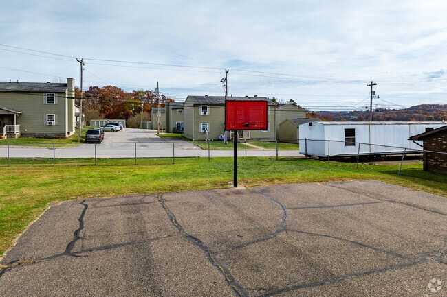
Property Detail
Route 68
Parkersburg-Vienna, WV
8.4 A WV RT 68
02-230-000C0000
WOOD
Gardenaptcourtapt5plusunits
West Virginia
B and X Area of moderate flood hazard, usually the area between the limits of the 100-year and 500-year floods.
8.40 AC
2025
West Virginia North Area
2025
Other Market Areas
010800
NEARBY LISTINGS FOR SALE OR LEASE
DEMOGRAPHICS near Route 68
1 mile
3 mile
5 mile
2025 Total Population
2,318
24,425
52,650
2030 Population
2,317
24,171
51,984
Pop Growth 2025-2030
(0.04%)
(1.04%)
(1.26%)
Average Age
40
42
43
2025 Total Households
1,003
10,729
23,243
HH Growth 2025-2030
(0.10%)
(1.15%)
(1.34%)
Median Household Inc
$42,871
$51,134
$48,932
Avg Household Size
2.30
2.20
2.20
2025 Avg HH Vehicles
2.00
2.00
2.00
Median Home Value
$168,420
$151,125
$146,661
Median Year Built
1980
1965
1962
Nearby Places
Map Layers
Map Styles
 Street
 Aerial
Transit
 Traffic
 Biking
Places
Listings with unknown addresses are not visible on the map
- Restaurants
- Banks
- Shops
- Fitness
- Groceries
Nearby Properties
Address
Land Use
TOTAL SIZE
Lot Size
Zoning
Address
Land Use
TOTAL SIZE
Lot Size
Zoning
Address
Land Use
TOTAL SIZE
Lot Size
Zoning
5.85 AC
Address
Land Use
TOTAL SIZE
Lot Size
Zoning
1.01 AC
Address
Land Use
TOTAL SIZE
Lot Size
Zoning
Address
Land Use
TOTAL SIZE
Lot Size
Zoning
2.23 AC
Address
Land Use
TOTAL SIZE
Lot Size
Zoning
40,548 SF
1.23 AC
Address
Land Use
TOTAL SIZE
Lot Size
Zoning
Address
Land Use
TOTAL SIZE
Lot Size
Zoning
0.46 AC
Address
Land Use
TOTAL SIZE
Lot Size
Zoning
Address
Land Use
TOTAL SIZE
Lot Size
Zoning
Address
Land Use
TOTAL SIZE
Lot Size
Zoning
1.22 AC
Address
Land Use
TOTAL SIZE
Lot Size
Zoning
0.21 AC
Address
Land Use
TOTAL SIZE
Lot Size
Zoning
Address
Land Use
TOTAL SIZE
Lot Size
Zoning
Address
Land Use
TOTAL SIZE
Lot Size
Zoning
0.81 AC
Address
Land Use
TOTAL SIZE
Lot Size
Zoning
24,645 SF
1.38 AC
Address
Land Use
TOTAL SIZE
Lot Size
Zoning
Address
Land Use
TOTAL SIZE
Lot Size
Zoning
1.33 AC
Address
Land Use
TOTAL SIZE
Lot Size
Zoning
46,710 SF
3.26 AC
Address
Land Use
TOTAL SIZE
Lot Size
Zoning
16.42 AC
Address
Land Use
TOTAL SIZE
Lot Size
Zoning
0.05 AC
Address
Land Use
TOTAL SIZE
Lot Size
Zoning
Address
Land Use
TOTAL SIZE
Lot Size
Zoning
0.28 AC
Address
Land Use
TOTAL SIZE
Lot Size
Zoning
0.33 AC
Address
Land Use
TOTAL SIZE
Lot Size
Zoning
Address
Land Use
TOTAL SIZE
Lot Size
Zoning
1.27 AC
Address
Land Use
TOTAL SIZE
Lot Size
Zoning
17,286 SF
1.79 AC
Address
Land Use
TOTAL SIZE
Lot Size
Zoning
1.01 AC
Address
Land Use
TOTAL SIZE
Lot Size
Zoning
0.20 AC
The World's #1 Commercial Real Estate Marketplace
Connect with us
© 2026 CoStar Group
The information above has been obtained from sources believed reliable. While we do not doubt its accuracy we have not verified it and make no guarantee, warranty or representation about it. It is your responsibility to independently confirm its accuracy and completeness. Any projections, opinions, assumptions, or estimates used are for example only and do not represent the current or future performance of the property. The value of this transaction to you depends on tax and other factors which should be evaluated by your tax, financial, and legal advisors. You and your advisors should conduct a careful, independent investigation of the property to determine to your satisfaction the suitability of the property for your needs.