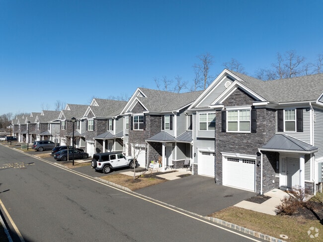
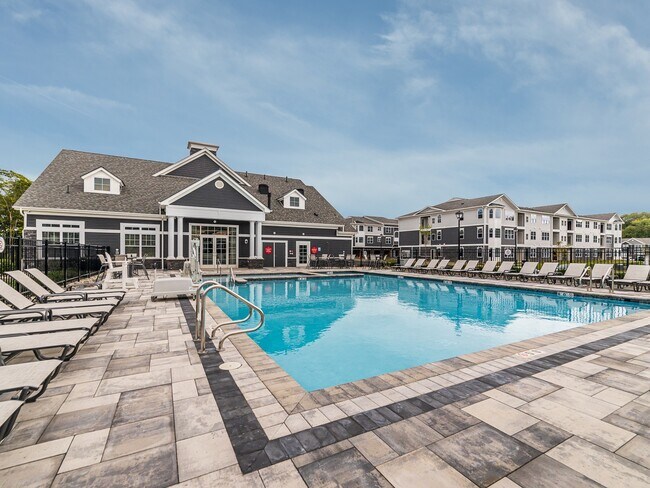
Property Record
Route 79, Marlboro, NJ 07746

Property Detail
Route 79
30-00150-0000-00002-01
MONMOUTH
Apartment
New Jersey
MFD2
2.1
B and X Area of moderate flood hazard, usually the area between the limits of the 100-year and 500-year floods.
26.68 AC
2024
West Monmouth County
2025
Northern New Jersey
809701
Lakewood-New Brunswick, NJ
NEARBY LISTINGS FOR SALE OR LEASE
-
-
View all Marlboro listings for sale on LoopNet.com
DEMOGRAPHICS near Route 79
1 mile
3 mile
5 mile
2025 Total Population
4,667
47,867
137,605
2030 Population
4,684
47,990
138,995
Pop Growth 2025-2030
+ 0.36%
+ 0.26%
+ 1.01%
Average Age
41
42
43
2025 Total Households
1,597
16,796
50,429
HH Growth 2025-2030
+ 0.19%
+ 0.02%
+ 1.01%
Median Household Inc
$153,600
$149,472
$124,631
Avg Household Size
2.90
2.80
2.70
2025 Avg HH Vehicles
2.00
2.00
2.00
Median Home Value
$694,042
$635,275
$587,088
Median Year Built
1991
1982
1976
Nearby Places
Map Layers
Map Styles
 Street
 Aerial
Layers
 Traffic
 Biking
Places
Listings with unknown addresses are not visible on the map
- Restaurants
- Banks
- Shops
- Fitness
- Groceries
PUBLIC TRANSPORTATION
COMMUTER RAIL
Aberdeen Matawan (North Jersey Coast Line - NJ Transit Commuter Rail (NJ Transit))
Drive
Walk
Distance
Aberdeen Matawan (North Jersey Coast Line - NJ Transit Commuter Rail (NJ Transit))
6 min
3.2 mi
Hazlet (North Jersey Coast Line - NJ Transit Commuter Rail (NJ Transit))
Drive
Walk
Distance
Hazlet (North Jersey Coast Line - NJ Transit Commuter Rail (NJ Transit))
9 min
4.3 mi
AIRPORT
Newark Liberty International
Drive
Walk
Distance
Newark Liberty International
43 min
33.1 mi
Freight Ports
New York Container Terminal
Drive
Walk
Distance
New York Container Terminal
37 min
25.2 mi
Nearby Properties
Address
Land Use
TOTAL SIZE
Lot Size
Zoning
Address
Land Use
TOTAL SIZE
Lot Size
Zoning
197,568 SF
28.01 AC
Address
Land Use
TOTAL SIZE
Lot Size
Zoning
3.98 AC
MUD
Address
Land Use
TOTAL SIZE
Lot Size
Zoning
30.96 AC
MFD
Address
Land Use
TOTAL SIZE
Lot Size
Zoning
192,538 SF
45.11 AC
SF10
Address
Land Use
TOTAL SIZE
Lot Size
Zoning
70,854 SF
14.30 AC
MF0
Address
Land Use
TOTAL SIZE
Lot Size
Zoning
7,902 SF
62.41 AC
R20
Address
Land Use
TOTAL SIZE
Lot Size
Zoning
26.84 AC
CF
Address
Land Use
TOTAL SIZE
Lot Size
Zoning
15.35 AC
Address
Land Use
TOTAL SIZE
Lot Size
Zoning
109,643 SF
1.87 AC
SB
Address
Land Use
TOTAL SIZE
Lot Size
Zoning
287,915 SF
31.10 AC
I0
Address
Land Use
TOTAL SIZE
Lot Size
Zoning
90,813 SF
8.92 AC
Address
Land Use
TOTAL SIZE
Lot Size
Zoning
91,171 SF
25.94 AC
SF05
Address
Land Use
TOTAL SIZE
Lot Size
Zoning
98,617 SF
10 AC
ALC
Address
Land Use
TOTAL SIZE
Lot Size
Zoning
15.92 AC
R20
Address
Land Use
TOTAL SIZE
Lot Size
Zoning
1,824 SF
21.72 AC
R40B
Address
Land Use
TOTAL SIZE
Lot Size
Zoning
6.87 AC
MF0
Address
Land Use
TOTAL SIZE
Lot Size
Zoning
46,120 SF
7.04 AC
RC
Address
Land Use
TOTAL SIZE
Lot Size
Zoning
24,760 SF
3.58 AC
GB
Address
Land Use
TOTAL SIZE
Lot Size
Zoning
12,108 SF
0.70 AC
GB
Address
Land Use
TOTAL SIZE
Lot Size
Zoning
18,752 SF
0.17 AC
MU0
Address
Land Use
TOTAL SIZE
Lot Size
Zoning
2,719 SF
67 AC
P
Address
Land Use
TOTAL SIZE
Lot Size
Zoning
3.91 AC
GB
Address
Land Use
TOTAL SIZE
Lot Size
Zoning
9.14 AC
SC
Address
Land Use
TOTAL SIZE
Lot Size
Zoning
74,632 SF
14.66 AC
R40B
Address
Land Use
TOTAL SIZE
Lot Size
Zoning
411 AC
ROS
Address
Land Use
TOTAL SIZE
Lot Size
Zoning
4.63 AC
RM
Address
Land Use
TOTAL SIZE
Lot Size
Zoning
4 AC
RM
Address
Land Use
TOTAL SIZE
Lot Size
Zoning
5.42 AC
RM
Address
Land Use
TOTAL SIZE
Lot Size
Zoning
57,271 SF
11.57 AC
PC
The World's #1 Commercial Real Estate Marketplace
Connect with us
© 2026 CoStar Group
The information above has been obtained from sources believed reliable. While we do not doubt its accuracy we have not verified it and make no guarantee, warranty or representation about it. It is your responsibility to independently confirm its accuracy and completeness. Any projections, opinions, assumptions, or estimates used are for example only and do not represent the current or future performance of the property. The value of this transaction to you depends on tax and other factors which should be evaluated by your tax, financial, and legal advisors. You and your advisors should conduct a careful, independent investigation of the property to determine to your satisfaction the suitability of the property for your needs.