Property Record
Route 9, Sullivan, NH 03445


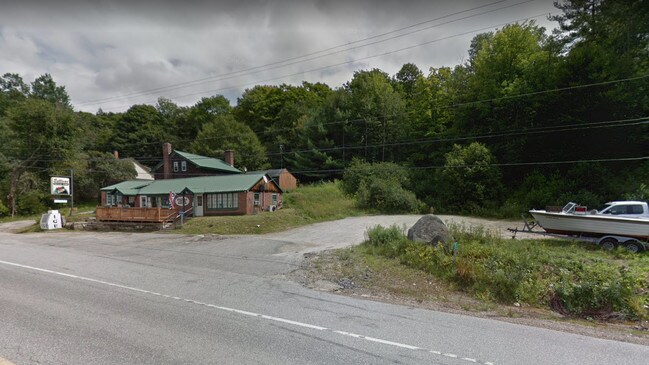
Property Detail
Route 9
SULL M:00006 B:000041 L:000000
CHESHIRE
Residentialacreage
New Hampshire
RURAL
28.20 AC
B and X Area of moderate flood hazard, usually the area between the limits of the 100-year and 500-year floods.
Manchester/New Hampshire South Area
2024
Other Market Areas
2024
Keene, NH
970402
NEARBY LISTINGS FOR SALE OR LEASE
-
-
View all Sullivan listings for sale on LoopNet.com
DEMOGRAPHICS near Route 9
1 mile
3 mile
5 mile
2025 Total Population
211
1,073
4,172
2030 Population
220
1,114
4,271
Pop Growth 2025-2030
+ 4.27%
+ 3.82%
+ 2.37%
Average Age
48
47
45
2025 Total Households
92
465
1,773
HH Growth 2025-2030
+ 4.35%
+ 3.66%
+ 2.37%
Median Household Inc
$101,923
$101,136
$95,562
Avg Household Size
2.30
2.30
2.30
2025 Avg HH Vehicles
2.00
2.00
2.00
Median Home Value
$436,363
$422,641
$371,649
Median Year Built
1974
1975
1963
Nearby Places
Map Layers
Map Styles
 Street
 Aerial
Transit
 Traffic
 Biking
Places
Listings with unknown addresses are not visible on the map
- Restaurants
- Banks
- Shops
- Fitness
- Groceries
SALE & LEASE HISTORY
LISTING DATE
SALE/LEASE

Nov 27, 2019
For Sale
Nearby Properties
Address
Land Use
TOTAL SIZE
Lot Size
Zoning
Address
Land Use
TOTAL SIZE
Lot Size
Zoning
2,635 SF
39.29 AC
RURAL
Address
Land Use
TOTAL SIZE
Lot Size
Zoning
1,200 SF
74.57 AC
RURAL
Address
Land Use
TOTAL SIZE
Lot Size
Zoning
7,257 SF
41 AC
RURAL
Address
Land Use
TOTAL SIZE
Lot Size
Zoning
7,476 SF
1.63 AC
RURAL
Address
Land Use
TOTAL SIZE
Lot Size
Zoning
5,639 SF
18.32 AC
RURAL
Address
Land Use
TOTAL SIZE
Lot Size
Zoning
3,710 SF
100 AC
RURAL
Address
Land Use
TOTAL SIZE
Lot Size
Zoning
5,328 SF
1.34 AC
RURAL
Address
Land Use
TOTAL SIZE
Lot Size
Zoning
4,307 SF
54.80 AC
RURAL
Address
Land Use
TOTAL SIZE
Lot Size
Zoning
2,481 SF
RURAL
Address
Land Use
TOTAL SIZE
Lot Size
Zoning
4,856 SF
89.50 AC
RURAL
Address
Land Use
TOTAL SIZE
Lot Size
Zoning
3,885 SF
5.80 AC
RURAL
Address
Land Use
TOTAL SIZE
Lot Size
Zoning
4,654 SF
6.10 AC
RURAL
Address
Land Use
TOTAL SIZE
Lot Size
Zoning
2,307 SF
16.30 AC
RURAL
Address
Land Use
TOTAL SIZE
Lot Size
Zoning
1,920 SF
55 AC
R
Address
Land Use
TOTAL SIZE
Lot Size
Zoning
4,073 SF
13.17 AC
RURAL
Address
Land Use
TOTAL SIZE
Lot Size
Zoning
138.40 AC
RURAL
Address
Land Use
TOTAL SIZE
Lot Size
Zoning
5,058 SF
1.38 AC
RURAL
Address
Land Use
TOTAL SIZE
Lot Size
Zoning
827 SF
89.60 AC
LS SLV
Address
Land Use
TOTAL SIZE
Lot Size
Zoning
2,530 SF
1.84 AC
RURAL
Address
Land Use
TOTAL SIZE
Lot Size
Zoning
3,308 SF
21.65 AC
RURAL
Address
Land Use
TOTAL SIZE
Lot Size
Zoning
1,294 SF
5 AC
RURAL
Address
Land Use
TOTAL SIZE
Lot Size
Zoning
275.05 AC
RURAL
Address
Land Use
TOTAL SIZE
Lot Size
Zoning
0.86 AC
RURAL
Address
Land Use
TOTAL SIZE
Lot Size
Zoning
3,688 SF
56.50 AC
RURAL
Address
Land Use
TOTAL SIZE
Lot Size
Zoning
84.71 AC
R
Address
Land Use
TOTAL SIZE
Lot Size
Zoning
3,296 SF
3.70 AC
RURAL
Address
Land Use
TOTAL SIZE
Lot Size
Zoning
2,940 SF
12.07 AC
RURAL
Address
Land Use
TOTAL SIZE
Lot Size
Zoning
4,293 SF
12.20 AC
RURAL
Address
Land Use
TOTAL SIZE
Lot Size
Zoning
2,248 SF
1.50 AC
RURAL
Address
Land Use
TOTAL SIZE
Lot Size
Zoning
1,338 SF
6.50 AC
RURAL
The World's #1 Commercial Real Estate Marketplace
Connect with us
© 2026 CoStar Group
The information above has been obtained from sources believed reliable. While we do not doubt its accuracy we have not verified it and make no guarantee, warranty or representation about it. It is your responsibility to independently confirm its accuracy and completeness. Any projections, opinions, assumptions, or estimates used are for example only and do not represent the current or future performance of the property. The value of this transaction to you depends on tax and other factors which should be evaluated by your tax, financial, and legal advisors. You and your advisors should conduct a careful, independent investigation of the property to determine to your satisfaction the suitability of the property for your needs.