Property Record
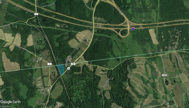
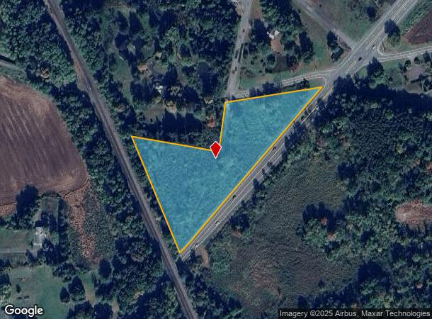
Route 9, Valatie, NY 12184
NEARBY LISTINGS FOR SALE OR LEASE
Property Detail
Route 9
104489-013-000-0001-004-000-0000
Columbia
Residentialacreage
New York
ARE
4.000
36083C0477D
3.87 AC
2025
Columbia County
2024
Albany/Schenectady/Troy
000402
Hudson, NY
DEMOGRAPHICS near Route 9
1 Mile
3 Mile
5 Mile
2024 Total Population
281
4,974
12,974
2029 Population
278
4,876
12,706
Pop Growth 2024-2029
(1.07%)
(1.97%)
(2.07%)
Average Age
44
44
44
2024 Total Households
113
2,063
5,265
HH Growth 2024-2029
(0.88%)
(2.13%)
(2.20%)
Median Household Inc
$80,469
$86,580
$90,823
Avg Household Size
2.30
2.30
2.40
2024 Avg HH Vehicles
2.00
2.00
2.00
Median Home Value
$287,499
$274,999
$261,101
Median Year Built
1974
1972
1969
Nearby Places
Map Layers
Map Styles
 Street
 Aerial
- Restaurants
- Banks
- Shops
- Fitness
- Groceries
PUBLIC TRANSPORTATION
AIRPORT
Albany International
DRIVE
WALK
Distance
Albany International
36 min
24.5 mi
Freight Ports
Albany, NY Port
DRIVE
WALK
Distance
Albany, NY Port
23 min
16.9 mi
SALE & LEASE HISTORY
LISTING DATE
SALE/LEASE

Sep 01, 2021
For Sale
Oct 05, 2021
For Sale
Jun 27, 2019
For Sale
Nearby Properties
Address
Land Use
TOTAL SIZE
Lot Size
Zoning
Address
Land Use
TOTAL SIZE
Lot Size
Zoning
488,000 SF
101.90 AC
HC
Address
Land Use
TOTAL SIZE
Lot Size
Zoning
59,049 SF
233 AC
07 - MIXED
Address
Land Use
TOTAL SIZE
Lot Size
Zoning
23,200 SF
16.71 AC
HC
Address
Land Use
TOTAL SIZE
Lot Size
Zoning
7,384 SF
4.13 AC
HC
Address
Land Use
TOTAL SIZE
Lot Size
Zoning
78,000 SF
8.76 AC
HC
Address
Land Use
TOTAL SIZE
Lot Size
Zoning
4,436 SF
16 AC
08 - GOVER
Address
Land Use
TOTAL SIZE
Lot Size
Zoning
6,362 SF
166.30 AC
05 - COMME
Address
Land Use
TOTAL SIZE
Lot Size
Zoning
1,544 SF
4.60 AC
05 - COMME
Address
Land Use
TOTAL SIZE
Lot Size
Zoning
6,440 SF
7.54 AC
PD-1
Address
Land Use
TOTAL SIZE
Lot Size
Zoning
11,838 SF
4.55 AC
07 - MIXED
Address
Land Use
TOTAL SIZE
Lot Size
Zoning
82,771 SF
10.50 AC
07 - MIXED
Address
Land Use
TOTAL SIZE
Lot Size
Zoning
33,172 SF
41 AC
05 - COMME
Address
Land Use
TOTAL SIZE
Lot Size
Zoning
84.40 AC
Address
Land Use
TOTAL SIZE
Lot Size
Zoning
18,831 SF
25 AC
PD-4
Address
Land Use
TOTAL SIZE
Lot Size
Zoning
1,810 SF
185.02 AC
04 - FARM
Address
Land Use
TOTAL SIZE
Lot Size
Zoning
8,080 SF
10.82 AC
05 - COMME
Address
Land Use
TOTAL SIZE
Lot Size
Zoning
31,920 SF
7.68 AC
HC
Address
Land Use
TOTAL SIZE
Lot Size
Zoning
3,872 SF
17.81 AC
HC
Address
Land Use
TOTAL SIZE
Lot Size
Zoning
14,400 SF
20 AC
05 - COMME
Address
Land Use
TOTAL SIZE
Lot Size
Zoning
25,810 SF
4.75 AC
HC
Address
Land Use
TOTAL SIZE
Lot Size
Zoning
9,624 SF
21.08 AC
08 - GOVER
Address
Land Use
TOTAL SIZE
Lot Size
Zoning
13,440 SF
2.40 AC
05 - COMME
Address
Land Use
TOTAL SIZE
Lot Size
Zoning
1,200 SF
15.40 AC
07 - MIXED
Address
Land Use
TOTAL SIZE
Lot Size
Zoning
1,050 SF
7.50 AC
05 - COMME
Address
Land Use
TOTAL SIZE
Lot Size
Zoning
7,448 SF
1.36 AC
05 - COMME
Address
Land Use
TOTAL SIZE
Lot Size
Zoning
1,950 SF
26 AC
02 - SINGL
Address
Land Use
TOTAL SIZE
Lot Size
Zoning
9,288 SF
1.44 AC
02 - SINGL
Address
Land Use
TOTAL SIZE
Lot Size
Zoning
16,800 SF
8.57 AC
HC
Address
Land Use
TOTAL SIZE
Lot Size
Zoning
12,300 SF
5.90 AC
05 - COMME
Address
Land Use
TOTAL SIZE
Lot Size
Zoning
5,152 SF
26.16 AC
PD-1
The World's #1 Commercial Real Estate Marketplace
Connect with us
© 2026 CoStar Group
The information above has been obtained from sources believed reliable. While we do not doubt its accuracy we have not verified it and make no guarantee, warranty or representation about it. It is your responsibility to independently confirm its accuracy and completeness. Any projections, opinions, assumptions, or estimates used are for example only and do not represent the current or future performance of the property. The value of this transaction to you depends on tax and other factors which should be evaluated by your tax, financial, and legal advisors. You and your advisors should conduct a careful, independent investigation of the property to determine to your satisfaction the suitability of the property for your needs.