Property Record
Rr, Campbell, NY 14821

Property Detail
Rr
Corning, NY
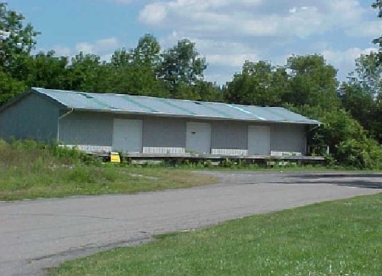
MAIN TRACKSIDNG&WIRE LND GRNDNGMN SIGHALS IDA LEASED TO BNH: PILOT
463000-242-000-0002-021-000
STEUBEN
Railroadfacility
New York
COMM
21.000
2025
82.20 AC
2025
Ithaca/Elmira
961700
Other Market Areas
1,480 SF
NEARBY LISTINGS FOR SALE OR LEASE
-
-
View all Campbell listings for sale on LoopNet.com
DEMOGRAPHICS near Rr
1 mile
3 mile
5 mile
2025 Total Population
824
2,501
5,150
2030 Population
812
2,471
5,067
Pop Growth 2025-2030
(1.46%)
(1.20%)
(1.61%)
Average Age
44
44
44
2025 Total Households
342
1,049
2,163
HH Growth 2025-2030
(1.17%)
(1.05%)
(1.62%)
Median Household Inc
$86,666
$76,250
$71,630
Avg Household Size
2.30
2.30
2.30
2025 Avg HH Vehicles
2.00
2.00
2.00
Median Home Value
$154,950
$139,347
$134,186
Median Year Built
1976
1976
1973
Nearby Places
Map Layers
Map Styles
 Street
 Aerial
Layers
 Traffic
 Biking
Places
Listings with unknown addresses are not visible on the map
- Restaurants
- Banks
- Shops
- Fitness
- Groceries
PUBLIC TRANSPORTATION
AIRPORT
Elmira/Corning Regional
Drive
Walk
Distance
Elmira/Corning Regional
29 min
18.7 mi
Freight Ports
Albany, NY Port
Drive
Walk
Distance
Albany, NY Port
265 min
220.4 mi
Nearby Properties
Address
Land Use
TOTAL SIZE
Lot Size
Zoning
Address
Land Use
TOTAL SIZE
Lot Size
Zoning
406.35 AC
Address
Land Use
TOTAL SIZE
Lot Size
Zoning
17,892 SF
217.66 AC
COMM
Address
Land Use
TOTAL SIZE
Lot Size
Zoning
25.81 AC
COMM
Address
Land Use
TOTAL SIZE
Lot Size
Zoning
2.35 AC
Address
Land Use
TOTAL SIZE
Lot Size
Zoning
48,360 SF
10.44 AC
07 - MIXED
Address
Land Use
TOTAL SIZE
Lot Size
Zoning
840 SF
21.25 AC
07 - MIXED
Address
Land Use
TOTAL SIZE
Lot Size
Zoning
338 SF
49.80 AC
COMM
Address
Land Use
TOTAL SIZE
Lot Size
Zoning
1,200 SF
76.83 AC
07 - MIXED
Address
Land Use
TOTAL SIZE
Lot Size
Zoning
27,000 SF
4.17 AC
Address
Land Use
TOTAL SIZE
Lot Size
Zoning
27,000 SF
Address
Land Use
TOTAL SIZE
Lot Size
Zoning
22,360 SF
12.31 AC
COMM
Address
Land Use
TOTAL SIZE
Lot Size
Zoning
19,840 SF
29.72 AC
COMM
Address
Land Use
TOTAL SIZE
Lot Size
Zoning
9,100 SF
0.84 AC
COMM
Address
Land Use
TOTAL SIZE
Lot Size
Zoning
980 SF
6.41 AC
07 - MIXED
Address
Land Use
TOTAL SIZE
Lot Size
Zoning
4,900 SF
2.25 AC
COMM
Address
Land Use
TOTAL SIZE
Lot Size
Zoning
234 SF
3.49 AC
COMM
Address
Land Use
TOTAL SIZE
Lot Size
Zoning
1,408 SF
100.95 AC
CONF
Address
Land Use
TOTAL SIZE
Lot Size
Zoning
3,600 SF
3.42 AC
Address
Land Use
TOTAL SIZE
Lot Size
Zoning
2,400 SF
284.50 AC
Address
Land Use
TOTAL SIZE
Lot Size
Zoning
7,200 SF
0.55 AC
07 - MIXED
Address
Land Use
TOTAL SIZE
Lot Size
Zoning
2,340 SF
215.20 AC
COMM
Address
Land Use
TOTAL SIZE
Lot Size
Zoning
31.32 AC
Address
Land Use
TOTAL SIZE
Lot Size
Zoning
Address
Land Use
TOTAL SIZE
Lot Size
Zoning
3,000 SF
5 AC
05 - COMME
Address
Land Use
TOTAL SIZE
Lot Size
Zoning
231.06 AC
CONF
Address
Land Use
TOTAL SIZE
Lot Size
Zoning
2,400 SF
53.64 AC
COMM
Address
Land Use
TOTAL SIZE
Lot Size
Zoning
1,260 SF
263.80 AC
CONF
Address
Land Use
TOTAL SIZE
Lot Size
Zoning
952 SF
3.90 AC
COMM
Address
Land Use
TOTAL SIZE
Lot Size
Zoning
5,216 SF
2.56 AC
The World's #1 Commercial Real Estate Marketplace
Connect with us
© 2026 CoStar Group
The information above has been obtained from sources believed reliable. While we do not doubt its accuracy we have not verified it and make no guarantee, warranty or representation about it. It is your responsibility to independently confirm its accuracy and completeness. Any projections, opinions, assumptions, or estimates used are for example only and do not represent the current or future performance of the property. The value of this transaction to you depends on tax and other factors which should be evaluated by your tax, financial, and legal advisors. You and your advisors should conduct a careful, independent investigation of the property to determine to your satisfaction the suitability of the property for your needs.