Property Record
Rt 42 St, Mount Gilead, OH 43338
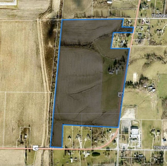


This Property Is For Sale
Property Detail
Rt 42 St
Columbus, OH
NW 1/4 TRACT #5 RTS:211314
G19-001-00-230-00
MORROW
Cropfieldcropsrowcropsallsoilclasses
Ohio
B and X Area of moderate flood hazard, usually the area between the limits of the 100-year and 500-year floods.
4.52 AC
2025
Morrow County
2025
Columbus
965201
NEARBY LISTINGS FOR SALE OR LEASE
-
-
View all Mount Gilead listings for sale on LoopNet.com
DEMOGRAPHICS near Rt 42 St
1 mile
3 mile
5 mile
2025 Total Population
298
6,139
12,109
2030 Population
303
6,296
12,495
Pop Growth 2025-2030
+ 1.68%
+ 2.56%
+ 3.19%
Average Age
44
42
42
2025 Total Households
119
2,529
4,808
HH Growth 2025-2030
+ 1.68%
+ 2.61%
+ 3.18%
Median Household Inc
$81,250
$63,378
$67,044
Avg Household Size
2.50
2.40
2.50
2025 Avg HH Vehicles
3.00
2.00
2.00
Median Home Value
$265,714
$185,335
$180,883
Median Year Built
1971
1971
1975
Nearby Places
Map Layers
Map Styles
 Street
 Aerial
Layers
 Traffic
 Biking
Places
Listings with unknown addresses are not visible on the map
- Restaurants
- Banks
- Shops
- Fitness
- Groceries
Nearby Properties
Address
Land Use
TOTAL SIZE
Lot Size
Zoning
Address
Land Use
TOTAL SIZE
Lot Size
Zoning
87,403 SF
27.93 AC
Address
Land Use
TOTAL SIZE
Lot Size
Zoning
30,842 SF
9.80 AC
Address
Land Use
TOTAL SIZE
Lot Size
Zoning
20,642 SF
4.30 AC
Address
Land Use
TOTAL SIZE
Lot Size
Zoning
40,428 SF
17.25 AC
Address
Land Use
TOTAL SIZE
Lot Size
Zoning
3.48 AC
Address
Land Use
TOTAL SIZE
Lot Size
Zoning
50,993 SF
19.24 AC
Address
Land Use
TOTAL SIZE
Lot Size
Zoning
32,984 SF
4.67 AC
Address
Land Use
TOTAL SIZE
Lot Size
Zoning
34,666 SF
8.53 AC
Address
Land Use
TOTAL SIZE
Lot Size
Zoning
10,980 SF
2.68 AC
Address
Land Use
TOTAL SIZE
Lot Size
Zoning
51,443 SF
9.56 AC
Address
Land Use
TOTAL SIZE
Lot Size
Zoning
38,143 SF
5.01 AC
Address
Land Use
TOTAL SIZE
Lot Size
Zoning
27,896 SF
7 AC
Address
Land Use
TOTAL SIZE
Lot Size
Zoning
26,226 SF
7.87 AC
Address
Land Use
TOTAL SIZE
Lot Size
Zoning
9,979 SF
2.69 AC
Address
Land Use
TOTAL SIZE
Lot Size
Zoning
7,472 SF
12.15 AC
Address
Land Use
TOTAL SIZE
Lot Size
Zoning
2,688 SF
4.73 AC
Address
Land Use
TOTAL SIZE
Lot Size
Zoning
608 SF
27.21 AC
Address
Land Use
TOTAL SIZE
Lot Size
Zoning
10,958 SF
3.59 AC
Address
Land Use
TOTAL SIZE
Lot Size
Zoning
10,928 SF
7 AC
Address
Land Use
TOTAL SIZE
Lot Size
Zoning
7,318 SF
0.14 AC
Address
Land Use
TOTAL SIZE
Lot Size
Zoning
7,952 SF
0.15 AC
Address
Land Use
TOTAL SIZE
Lot Size
Zoning
4,000 SF
14.74 AC
Address
Land Use
TOTAL SIZE
Lot Size
Zoning
4,248 SF
86.99 AC
Address
Land Use
TOTAL SIZE
Lot Size
Zoning
28,521 SF
3.87 AC
Address
Land Use
TOTAL SIZE
Lot Size
Zoning
10,640 SF
1.77 AC
Address
Land Use
TOTAL SIZE
Lot Size
Zoning
4,430 SF
0.97 AC
Address
Land Use
TOTAL SIZE
Lot Size
Zoning
1,960 SF
33.37 AC
Address
Land Use
TOTAL SIZE
Lot Size
Zoning
6,144 SF
1.60 AC
Address
Land Use
TOTAL SIZE
Lot Size
Zoning
3,633 SF
2.93 AC
Address
Land Use
TOTAL SIZE
Lot Size
Zoning
12,632 SF
0.20 AC
The World's #1 Commercial Real Estate Marketplace
Connect with us
© 2026 CoStar Group
The information above has been obtained from sources believed reliable. While we do not doubt its accuracy we have not verified it and make no guarantee, warranty or representation about it. It is your responsibility to independently confirm its accuracy and completeness. Any projections, opinions, assumptions, or estimates used are for example only and do not represent the current or future performance of the property. The value of this transaction to you depends on tax and other factors which should be evaluated by your tax, financial, and legal advisors. You and your advisors should conduct a careful, independent investigation of the property to determine to your satisfaction the suitability of the property for your needs.