Property Record
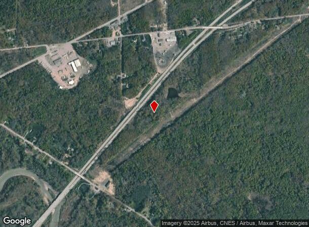
Rt 5 & 20, Irving, NY 14081
NEARBY LISTINGS FOR SALE OR LEASE
-
-
View all Irving listings for sale on LoopNet.com
Property Detail
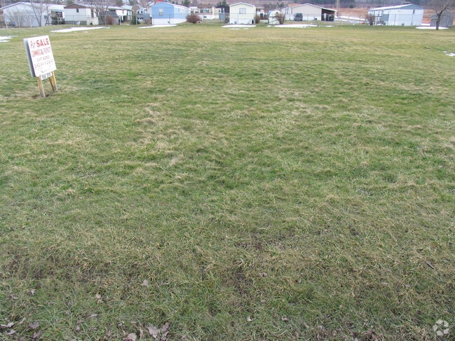
Rt 5 & 20
Other Market Areas
OLD APN: 064689 24-23-8
Jamestown-Dunkirk-Fredonia, NY
Chautauqua
064689-033-009-0001-017-000
New York
Commercialacreage
17.000
2025
0.28 AC
2024
New York West Area
940000
DEMOGRAPHICS near Rt 5 & 20
1 Mile
3 Mile
5 Mile
2024 Total Population
1,498
6,092
9,463
2029 Population
1,560
6,160
9,564
Pop Growth 2024-2029
+ 4.14%
+ 1.12%
+ 1.07%
Average Age
47
43
44
2024 Total Households
660
2,522
3,946
HH Growth 2024-2029
+ 4.24%
+ 0.95%
+ 0.96%
Median Household Inc
$38,738
$54,903
$53,053
Avg Household Size
2.10
2.30
2.30
2024 Avg HH Vehicles
2.00
2.00
2.00
Median Home Value
$126,515
$120,041
$125,404
Median Year Built
1953
1952
1953
Nearby Places
- Restaurants
- Banks
- Shops
- Fitness
- Groceries
Nearby Properties
Address
Land Use
TOTAL SIZE
Lot Size
Zoning
Address
Land Use
TOTAL SIZE
Lot Size
Zoning
10.30 AC
Address
Land Use
TOTAL SIZE
Lot Size
Zoning
19.70 AC
Address
Land Use
TOTAL SIZE
Lot Size
Zoning
2,262 SF
5 AC
C
Address
Land Use
TOTAL SIZE
Lot Size
Zoning
108.40 AC
AR
Address
Land Use
TOTAL SIZE
Lot Size
Zoning
1.90 AC
R
Address
Land Use
TOTAL SIZE
Lot Size
Zoning
672 SF
7.20 AC
C
Address
Land Use
TOTAL SIZE
Lot Size
Zoning
3,480 SF
5.70 AC
Address
Land Use
TOTAL SIZE
Lot Size
Zoning
6,926 SF
26 AC
C
Address
Land Use
TOTAL SIZE
Lot Size
Zoning
1,080 SF
3.70 AC
Address
Land Use
TOTAL SIZE
Lot Size
Zoning
1,680 SF
1.70 AC
C
Address
Land Use
TOTAL SIZE
Lot Size
Zoning
25,452 SF
1.32 AC
C
Address
Land Use
TOTAL SIZE
Lot Size
Zoning
7,553 SF
1.50 AC
C
Address
Land Use
TOTAL SIZE
Lot Size
Zoning
4,704 SF
1.40 AC
C
Address
Land Use
TOTAL SIZE
Lot Size
Zoning
2,910 SF
1 AC
C
Address
Land Use
TOTAL SIZE
Lot Size
Zoning
9,100 SF
1.56 AC
28300
Address
Land Use
TOTAL SIZE
Lot Size
Zoning
2,448 SF
9.06 AC
Address
Land Use
TOTAL SIZE
Lot Size
Zoning
54.40 AC
AR
Address
Land Use
TOTAL SIZE
Lot Size
Zoning
53.20 AC
C
Address
Land Use
TOTAL SIZE
Lot Size
Zoning
5,498 SF
1.20 AC
R
Address
Land Use
TOTAL SIZE
Lot Size
Zoning
2,200 SF
2.20 AC
Address
Land Use
TOTAL SIZE
Lot Size
Zoning
20,832 SF
0.96 AC
C
Address
Land Use
TOTAL SIZE
Lot Size
Zoning
8,225 SF
13.70 AC
C
Address
Land Use
TOTAL SIZE
Lot Size
Zoning
5,600 SF
37.40 AC
Address
Land Use
TOTAL SIZE
Lot Size
Zoning
5,188 SF
4.43 AC
AR
Address
Land Use
TOTAL SIZE
Lot Size
Zoning
7,877 SF
1.21 AC
Address
Land Use
TOTAL SIZE
Lot Size
Zoning
1,800 SF
4.70 AC
Address
Land Use
TOTAL SIZE
Lot Size
Zoning
1.90 AC
R
Address
Land Use
TOTAL SIZE
Lot Size
Zoning
6,300 SF
5.70 AC
C
Address
Land Use
TOTAL SIZE
Lot Size
Zoning
79,242 SF
5.20 AC
C
Address
Land Use
TOTAL SIZE
Lot Size
Zoning
14,000 SF
1.70 AC
AR
The World's #1 Commercial Real Estate Marketplace
Connect with us
© 2025 CoStar Group
The information above has been obtained from sources believed reliable. While we do not doubt its accuracy we have not verified it and make no guarantee, warranty or representation about it. It is your responsibility to independently confirm its accuracy and completeness. Any projections, opinions, assumptions, or estimates used are for example only and do not represent the current or future performance of the property. The value of this transaction to you depends on tax and other factors which should be evaluated by your tax, financial, and legal advisors. You and your advisors should conduct a careful, independent investigation of the property to determine to your satisfaction the suitability of the property for your needs.