Property Record
Rt 6, Slate Hill, NY 10973

NEARBY LISTINGS FOR SALE OR LEASE
-
-
View all Slate Hill listings for sale on LoopNet.com
Property Detail
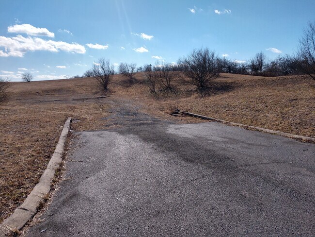
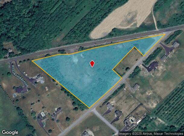
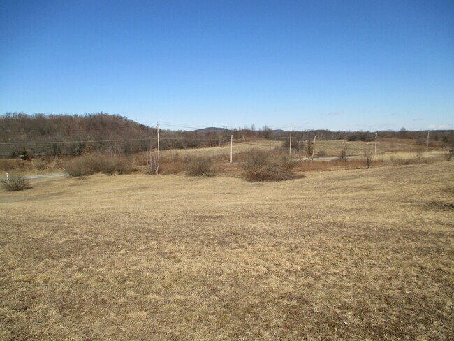
Rt 6
New York-Jersey City-White Plains, NY-NJ
MAP L79-93
335600-018-000-0001-011.700-0000
Orange
Residentialacreage
New York
X
11.70
36071C0265E
8 AC
2024
Monroe
2024
Northern New Jersey
011801
DEMOGRAPHICS near Rt 6
1 Mile
3 Mile
5 Mile
2024 Total Population
785
6,499
23,261
2029 Population
791
6,564
23,702
Pop Growth 2024-2029
+ 0.76%
+ 1.00%
+ 1.90%
Average Age
40
41
40
2024 Total Households
267
2,205
8,480
HH Growth 2024-2029
+ 0.75%
+ 1.09%
+ 2.11%
Median Household Inc
$96,484
$113,438
$93,284
Avg Household Size
2.90
2.90
2.70
2024 Avg HH Vehicles
2.00
2.00
2.00
Median Home Value
$313,793
$345,126
$322,240
Median Year Built
1976
1980
1984
Nearby Places
- Restaurants
- Banks
- Shops
- Fitness
- Groceries
PUBLIC TRANSPORTATION
AIRPORT
New York Stewart International
DRIVE
WALK
Distance
New York Stewart International
36 min
26.1 mi
Freight Ports
Port Newark Container Terminal
DRIVE
WALK
Distance
Port Newark Container Terminal
99 min
74.8 mi
SALE & LEASE HISTORY
LISTING DATE
SALE/LEASE

Feb 20, 2020
For Sale
Nearby Properties
Address
Land Use
TOTAL SIZE
Lot Size
Zoning
Address
Land Use
TOTAL SIZE
Lot Size
Zoning
129.70 AC
AR
Address
Land Use
TOTAL SIZE
Lot Size
Zoning
499,762 SF
67.30 AC
SR-MC1
Address
Land Use
TOTAL SIZE
Lot Size
Zoning
2,576 SF
146.70 AC
AR
Address
Land Use
TOTAL SIZE
Lot Size
Zoning
4 AC
TC2
Address
Land Use
TOTAL SIZE
Lot Size
Zoning
60,321 SF
10.70 AC
TC2
Address
Land Use
TOTAL SIZE
Lot Size
Zoning
62.90 AC
AR
Address
Land Use
TOTAL SIZE
Lot Size
Zoning
104,070 SF
10 AC
MC 1
Address
Land Use
TOTAL SIZE
Lot Size
Zoning
19,555 SF
10.10 AC
MC 1
Address
Land Use
TOTAL SIZE
Lot Size
Zoning
25,357 SF
13.40 AC
AR
Address
Land Use
TOTAL SIZE
Lot Size
Zoning
23.60 AC
AR
Address
Land Use
TOTAL SIZE
Lot Size
Zoning
7,922 SF
162.90 AC
AR
Address
Land Use
TOTAL SIZE
Lot Size
Zoning
4,464 SF
2.50 AC
TC2
Address
Land Use
TOTAL SIZE
Lot Size
Zoning
13,632 SF
12.70 AC
TC2
Address
Land Use
TOTAL SIZE
Lot Size
Zoning
105.80 AC
SR
Address
Land Use
TOTAL SIZE
Lot Size
Zoning
24,534 SF
14.60 AC
SR
Address
Land Use
TOTAL SIZE
Lot Size
Zoning
16,080 SF
7.30 AC
TC-1
Address
Land Use
TOTAL SIZE
Lot Size
Zoning
3,368 SF
147.60 AC
AB
Address
Land Use
TOTAL SIZE
Lot Size
Zoning
7,242 SF
133.30 AC
TC2
Address
Land Use
TOTAL SIZE
Lot Size
Zoning
43.80 AC
AR
Address
Land Use
TOTAL SIZE
Lot Size
Zoning
11,700 SF
2.70 AC
TC-1
Address
Land Use
TOTAL SIZE
Lot Size
Zoning
19.40 AC
AR
Address
Land Use
TOTAL SIZE
Lot Size
Zoning
114.40 AC
MC 1
Address
Land Use
TOTAL SIZE
Lot Size
Zoning
3,369 SF
1 AC
TC-1
Address
Land Use
TOTAL SIZE
Lot Size
Zoning
9,752 SF
64.30 AC
TC2
Address
Land Use
TOTAL SIZE
Lot Size
Zoning
6,088 SF
70.40 AC
MC 1
Address
Land Use
TOTAL SIZE
Lot Size
Zoning
3,520 SF
0.67 AC
TC1
Address
Land Use
TOTAL SIZE
Lot Size
Zoning
12,258 SF
3 AC
H
Address
Land Use
TOTAL SIZE
Lot Size
Zoning
1,632 SF
91 AC
AR
Address
Land Use
TOTAL SIZE
Lot Size
Zoning
6,576 SF
5.30 AC
TC2
Address
Land Use
TOTAL SIZE
Lot Size
Zoning
7,570 SF
34.60 AC
MC 1
The World's #1 Commercial Real Estate Marketplace
Connect with us
© 2025 CoStar Group
The information above has been obtained from sources believed reliable. While we do not doubt its accuracy we have not verified it and make no guarantee, warranty or representation about it. It is your responsibility to independently confirm its accuracy and completeness. Any projections, opinions, assumptions, or estimates used are for example only and do not represent the current or future performance of the property. The value of this transaction to you depends on tax and other factors which should be evaluated by your tax, financial, and legal advisors. You and your advisors should conduct a careful, independent investigation of the property to determine to your satisfaction the suitability of the property for your needs.