Property Record
Rt 6, Wawayanda, NY 10973
Property Detail
Rt 6
Kiryas Joel-Poughkeepsie-Newburgh, NY
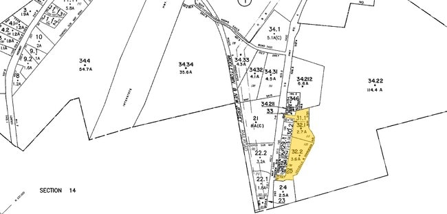
LT 1 COVIELLO & SCHROEDERSUB MAP 5785
335600-011-000-0001-032.100-0000
ORANGE
Commercialacreage
New York
MC 1
32.10
B and X Area of moderate flood hazard, usually the area between the limits of the 100-year and 500-year floods.
2.70 AC
2024
Monroe
2024
Northern New Jersey
011801
NEARBY LISTINGS FOR SALE OR LEASE
DEMOGRAPHICS near Rt 6
1 mile
3 mile
5 mile
2025 Total Population
704
13,381
49,081
2030 Population
711
13,673
49,882
Pop Growth 2025-2030
+ 0.99%
+ 2.18%
+ 1.63%
Average Age
41
40
39
2025 Total Households
238
5,198
17,696
HH Growth 2025-2030
+ 1.26%
+ 2.44%
+ 1.81%
Median Household Inc
$130,357
$94,029
$89,330
Avg Household Size
2.90
2.50
2.60
2025 Avg HH Vehicles
2.00
2.00
2.00
Median Home Value
$426,389
$358,324
$342,495
Median Year Built
1979
1988
1971
Nearby Places
Map Layers
Map Styles
 Street
 Aerial
Transit
 Traffic
 Biking
Places
Listings with unknown addresses are not visible on the map
- Restaurants
- Banks
- Shops
- Fitness
- Groceries
PUBLIC TRANSPORTATION
COMMUTER RAIL
Middletown New York (Bergen County/Port Jervis Line - NJ Transit Commuter Rail (NJ Transit), Main/Port Jervis Line - NJ Transit Commuter Rail (NJ Transit))
Drive
Walk
Distance
Middletown New York (Bergen County/Port Jervis Line - NJ Transit Commuter Rail (NJ Transit), Main/Port Jervis Line - NJ Transit Commuter Rail (NJ Transit))
15 min
8.6 mi
AIRPORT
New York Stewart International
Drive
Walk
Distance
New York Stewart International
32 min
23.8 mi
Freight Ports
Port Newark Container Terminal
Drive
Walk
Distance
Port Newark Container Terminal
96 min
72.4 mi
Nearby Properties
Address
Land Use
TOTAL SIZE
Lot Size
Zoning
Address
Land Use
TOTAL SIZE
Lot Size
Zoning
72.50 AC
MC 1
Address
Land Use
TOTAL SIZE
Lot Size
Zoning
499,762 SF
67.30 AC
SR-MC1
Address
Land Use
TOTAL SIZE
Lot Size
Zoning
40.40 AC
I-2
Address
Land Use
TOTAL SIZE
Lot Size
Zoning
240,800 SF
29.50 AC
MC 1
Address
Land Use
TOTAL SIZE
Lot Size
Zoning
29,950 SF
3 AC
TC-1
Address
Land Use
TOTAL SIZE
Lot Size
Zoning
26,659 SF
15.80 AC
MC 2
Address
Land Use
TOTAL SIZE
Lot Size
Zoning
50,700 SF
7.70 AC
TC-1
Address
Land Use
TOTAL SIZE
Lot Size
Zoning
26,156 SF
0.01 AC
TC-1
Address
Land Use
TOTAL SIZE
Lot Size
Zoning
5,832 SF
2.30 AC
TC-1
Address
Land Use
TOTAL SIZE
Lot Size
Zoning
4 AC
TC2
Address
Land Use
TOTAL SIZE
Lot Size
Zoning
7 AC
C-3
Address
Land Use
TOTAL SIZE
Lot Size
Zoning
60,321 SF
10.70 AC
TC2
Address
Land Use
TOTAL SIZE
Lot Size
Zoning
6.80 AC
MC 1
Address
Land Use
TOTAL SIZE
Lot Size
Zoning
41,728 SF
5 AC
TC-1
Address
Land Use
TOTAL SIZE
Lot Size
Zoning
726 SF
40.30 AC
C-3
Address
Land Use
TOTAL SIZE
Lot Size
Zoning
4.90 AC
Address
Land Use
TOTAL SIZE
Lot Size
Zoning
207.90 AC
04200
Address
Land Use
TOTAL SIZE
Lot Size
Zoning
62.90 AC
AR
Address
Land Use
TOTAL SIZE
Lot Size
Zoning
11.50 AC
SR-3B
Address
Land Use
TOTAL SIZE
Lot Size
Zoning
24.70 AC
MC 1
Address
Land Use
TOTAL SIZE
Lot Size
Zoning
22,144 SF
5.60 AC
MC 2
Address
Land Use
TOTAL SIZE
Lot Size
Zoning
19.20 AC
C-3
Address
Land Use
TOTAL SIZE
Lot Size
Zoning
7,161 SF
2.40 AC
SR-MC2
Address
Land Use
TOTAL SIZE
Lot Size
Zoning
104,070 SF
10 AC
MC 1
Address
Land Use
TOTAL SIZE
Lot Size
Zoning
19,555 SF
10.10 AC
MC 1
Address
Land Use
TOTAL SIZE
Lot Size
Zoning
21.20 AC
Address
Land Use
TOTAL SIZE
Lot Size
Zoning
69,777 SF
12.90 AC
04200
Address
Land Use
TOTAL SIZE
Lot Size
Zoning
21,134 SF
4.70 AC
TC-1
Address
Land Use
TOTAL SIZE
Lot Size
Zoning
726 SF
33.90 AC
C-3
Address
Land Use
TOTAL SIZE
Lot Size
Zoning
12,152 SF
3.60 AC
TC-1
The World's #1 Commercial Real Estate Marketplace
Connect with us
© 2026 CoStar Group
The information above has been obtained from sources believed reliable. While we do not doubt its accuracy we have not verified it and make no guarantee, warranty or representation about it. It is your responsibility to independently confirm its accuracy and completeness. Any projections, opinions, assumptions, or estimates used are for example only and do not represent the current or future performance of the property. The value of this transaction to you depends on tax and other factors which should be evaluated by your tax, financial, and legal advisors. You and your advisors should conduct a careful, independent investigation of the property to determine to your satisfaction the suitability of the property for your needs.