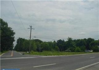
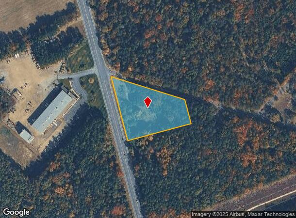
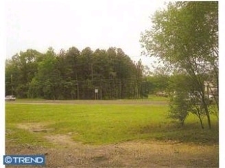
Property Record
192 N Route 73, Berlin, NJ 08009

NEARBY LISTINGS FOR SALE OR LEASE
Property Detail
192 N Route 73
36-03204-0000-00001
Camden
Vacantlandnec
New Jersey
X
1
34007C0206E
2.35 AC
2024
South Camden County
2025
Philadelphia
609103
Philadelphia-Camden-Wilmington, PA-NJ-DE-MD
DEMOGRAPHICS near 192 N Route 73
1 Mile
3 Mile
5 Mile
2024 Total Population
624
20,872
70,669
2029 Population
623
21,008
71,041
Pop Growth 2024-2029
(0.16%)
+ 0.65%
+ 0.53%
Average Age
41
42
41
2024 Total Households
237
7,964
25,714
HH Growth 2024-2029
0.00%
+ 0.77%
+ 0.60%
Median Household Inc
$111,479
$88,030
$90,488
Avg Household Size
2.60
2.60
2.70
2024 Avg HH Vehicles
2.00
2.00
2.00
Median Home Value
$296,609
$257,195
$252,815
Median Year Built
1986
1981
1983
Nearby Places
Map Layers
Map Styles
 Street
 Aerial
- Restaurants
- Banks
- Shops
- Fitness
- Groceries
PUBLIC TRANSPORTATION
COMMUTER RAIL
Atco (Atlantic City Line - NJ Transit Commuter Rail (NJ Transit))
DRIVE
WALK
Distance
Atco (Atlantic City Line - NJ Transit Commuter Rail (NJ Transit))
5 min
3.4 mi
Lindenwold (NJT) (Atlantic City Line - NJ Transit Commuter Rail (NJ Transit))
DRIVE
WALK
Distance
Lindenwold (NJT) (Atlantic City Line - NJ Transit Commuter Rail (NJ Transit))
19 min
9.8 mi
AIRPORT
Atlantic City International
DRIVE
WALK
Distance
Atlantic City International
47 min
31.1 mi
Philadelphia International
DRIVE
WALK
Distance
Philadelphia International
43 min
33.5 mi
Freight Ports
South Jersey Port
DRIVE
WALK
Distance
South Jersey Port
1 min
18.1 mi
Nearby Properties
Address
Land Use
TOTAL SIZE
Lot Size
Zoning
Address
Land Use
TOTAL SIZE
Lot Size
Zoning
6,208 SF
30.73 AC
PARC
Address
Land Use
TOTAL SIZE
Lot Size
Zoning
137.33 AC
PR3
Address
Land Use
TOTAL SIZE
Lot Size
Zoning
88.36 AC
PR4
Address
Land Use
TOTAL SIZE
Lot Size
Zoning
73.95 AC
PI3
Address
Land Use
TOTAL SIZE
Lot Size
Zoning
27.18 AC
PR4
Address
Land Use
TOTAL SIZE
Lot Size
Zoning
155 AC
PI
Address
Land Use
TOTAL SIZE
Lot Size
Zoning
30.01 AC
PR2
Address
Land Use
TOTAL SIZE
Lot Size
Zoning
22.93 AC
PC-2
Address
Land Use
TOTAL SIZE
Lot Size
Zoning
8.56 AC
PARC
Address
Land Use
TOTAL SIZE
Lot Size
Zoning
30 AC
PR2
Address
Land Use
TOTAL SIZE
Lot Size
Zoning
5.06 AC
PF
Address
Land Use
TOTAL SIZE
Lot Size
Zoning
4,200 SF
13.22 AC
PC1
Address
Land Use
TOTAL SIZE
Lot Size
Zoning
1,718 SF
68.48 AC
PR2
Address
Land Use
TOTAL SIZE
Lot Size
Zoning
7.07 AC
PF
Address
Land Use
TOTAL SIZE
Lot Size
Zoning
6.20 AC
Address
Land Use
TOTAL SIZE
Lot Size
Zoning
73.95 AC
PI3
Address
Land Use
TOTAL SIZE
Lot Size
Zoning
1,341 SF
1.98 AC
PHB
Address
Land Use
TOTAL SIZE
Lot Size
Zoning
Address
Land Use
TOTAL SIZE
Lot Size
Zoning
38.85 AC
PHB
Address
Land Use
TOTAL SIZE
Lot Size
Zoning
15.94 AC
C
Address
Land Use
TOTAL SIZE
Lot Size
Zoning
6.29 AC
C
Address
Land Use
TOTAL SIZE
Lot Size
Zoning
10.72 AC
PI1
Address
Land Use
TOTAL SIZE
Lot Size
Zoning
4.67 AC
PC2
Address
Land Use
TOTAL SIZE
Lot Size
Zoning
85.89 AC
PI
Address
Land Use
TOTAL SIZE
Lot Size
Zoning
2.23 AC
Address
Land Use
TOTAL SIZE
Lot Size
Zoning
9,900 SF
154 AC
RPF
Address
Land Use
TOTAL SIZE
Lot Size
Zoning
14,594 SF
1.67 AC
PHB
Address
Land Use
TOTAL SIZE
Lot Size
Zoning
5.76 AC
PHB
Address
Land Use
TOTAL SIZE
Lot Size
Zoning
10,785 SF
220.26 AC
RL
Address
Land Use
TOTAL SIZE
Lot Size
Zoning
57,854 SF
13.89 AC
PC1
The World's #1 Commercial Real Estate Marketplace
Connect with us
© 2025 CoStar Group
The information above has been obtained from sources believed reliable. While we do not doubt its accuracy we have not verified it and make no guarantee, warranty or representation about it. It is your responsibility to independently confirm its accuracy and completeness. Any projections, opinions, assumptions, or estimates used are for example only and do not represent the current or future performance of the property. The value of this transaction to you depends on tax and other factors which should be evaluated by your tax, financial, and legal advisors. You and your advisors should conduct a careful, independent investigation of the property to determine to your satisfaction the suitability of the property for your needs.