Property Record
Rte 10, Mohnton, PA 19540
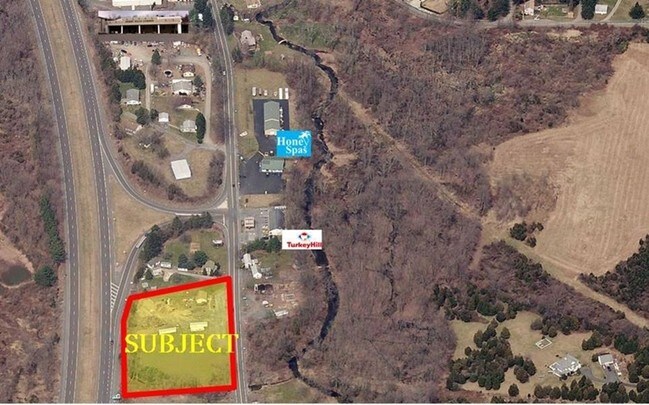
Property Detail
Rte 10
73-5313-01-29-6850
BERKS
Horticulturegrowinghousesagricultural
Pennsylvania
AE The base floodplain where base flood elevations are provided. AE Zones are now used on new format FIRMs instead of A1-A30 Zones.
0.83 AC
2026
Berks County
2026
Philadelphia
011602
Reading, PA
NEARBY LISTINGS FOR SALE OR LEASE
-
-
View all Mohnton listings for sale on LoopNet.com
DEMOGRAPHICS near Rte 10
1 mile
3 mile
5 mile
2025 Total Population
547
9,095
52,398
2030 Population
564
9,285
53,492
Pop Growth 2025-2030
+ 3.11%
+ 2.09%
+ 2.09%
Average Age
44
46
42
2025 Total Households
213
3,963
20,808
HH Growth 2025-2030
+ 3.29%
+ 2.20%
+ 2.10%
Median Household Inc
$94,499
$90,915
$82,271
Avg Household Size
2.60
2.30
2.40
2025 Avg HH Vehicles
2.00
2.00
2.00
Median Home Value
$339,772
$339,274
$255,842
Median Year Built
1981
1979
1973
Nearby Places
Map Layers
Map Styles
 Street
 Aerial
Layers
 Traffic
 Biking
Places
Listings with unknown addresses are not visible on the map
- Restaurants
- Banks
- Shops
- Fitness
- Groceries
SALE & LEASE HISTORY
LISTING DATE
SALE/LEASE

Sep 24, 2016
For Sale
Nearby Properties
Address
Land Use
TOTAL SIZE
Lot Size
Zoning
Address
Land Use
TOTAL SIZE
Lot Size
Zoning
392,251 SF
78.10 AC
Address
Land Use
TOTAL SIZE
Lot Size
Zoning
241,645 SF
37.72 AC
Address
Land Use
TOTAL SIZE
Lot Size
Zoning
129,363 SF
12.14 AC
Address
Land Use
TOTAL SIZE
Lot Size
Zoning
84,599 SF
28.56 AC
Address
Land Use
TOTAL SIZE
Lot Size
Zoning
120,390 SF
12.65 AC
Address
Land Use
TOTAL SIZE
Lot Size
Zoning
41,112 SF
1.16 AC
Address
Land Use
TOTAL SIZE
Lot Size
Zoning
28,140 SF
208.09 AC
Address
Land Use
TOTAL SIZE
Lot Size
Zoning
35,982 SF
1.16 AC
Address
Land Use
TOTAL SIZE
Lot Size
Zoning
30,929 SF
2.54 AC
Address
Land Use
TOTAL SIZE
Lot Size
Zoning
11,194 SF
100.83 AC
Address
Land Use
TOTAL SIZE
Lot Size
Zoning
19,320 SF
4.24 AC
Address
Land Use
TOTAL SIZE
Lot Size
Zoning
22,505 SF
0.71 AC
Address
Land Use
TOTAL SIZE
Lot Size
Zoning
22,908 SF
0.75 AC
Address
Land Use
TOTAL SIZE
Lot Size
Zoning
35,391 SF
14.47 AC
Address
Land Use
TOTAL SIZE
Lot Size
Zoning
23,146 SF
1.56 AC
Address
Land Use
TOTAL SIZE
Lot Size
Zoning
18,876 SF
2.30 AC
Address
Land Use
TOTAL SIZE
Lot Size
Zoning
23,014 SF
0.57 AC
Address
Land Use
TOTAL SIZE
Lot Size
Zoning
22,722 SF
0.67 AC
Address
Land Use
TOTAL SIZE
Lot Size
Zoning
21,660 SF
0.66 AC
Address
Land Use
TOTAL SIZE
Lot Size
Zoning
30,158 SF
1.46 AC
Address
Land Use
TOTAL SIZE
Lot Size
Zoning
18,672 SF
0.57 AC
Address
Land Use
TOTAL SIZE
Lot Size
Zoning
26,805 SF
2.23 AC
Address
Land Use
TOTAL SIZE
Lot Size
Zoning
18,286 SF
1.72 AC
Address
Land Use
TOTAL SIZE
Lot Size
Zoning
19,860 SF
1.51 AC
Address
Land Use
TOTAL SIZE
Lot Size
Zoning
18,154 SF
1.22 AC
Address
Land Use
TOTAL SIZE
Lot Size
Zoning
32,257 SF
4.58 AC
Address
Land Use
TOTAL SIZE
Lot Size
Zoning
19,456 SF
1.30 AC
Address
Land Use
TOTAL SIZE
Lot Size
Zoning
7,697 SF
1.75 AC
Address
Land Use
TOTAL SIZE
Lot Size
Zoning
18,380 SF
40.50 AC
Address
Land Use
TOTAL SIZE
Lot Size
Zoning
18,383 SF
1.69 AC
The World's #1 Commercial Real Estate Marketplace
Connect with us
© 2026 CoStar Group
The information above has been obtained from sources believed reliable. While we do not doubt its accuracy we have not verified it and make no guarantee, warranty or representation about it. It is your responsibility to independently confirm its accuracy and completeness. Any projections, opinions, assumptions, or estimates used are for example only and do not represent the current or future performance of the property. The value of this transaction to you depends on tax and other factors which should be evaluated by your tax, financial, and legal advisors. You and your advisors should conduct a careful, independent investigation of the property to determine to your satisfaction the suitability of the property for your needs.