Property Record
Rte 66, Apollo, PA 15613
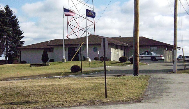

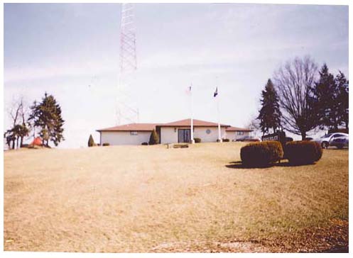

Property Detail
Rte 66
Pittsburgh, PA
BLDG LOT 1 SILAS WEST PLAN & PCL
63-05-00-0-224
WESTMORELAND
Commercialofficeresidentialmixeduse
Pennsylvania
B and X Area of moderate flood hazard, usually the area between the limits of the 100-year and 500-year floods.
1
2025
1.70 AC
2026
Westmoreland County
801703
Pittsburgh
5,766 SF
NEARBY LISTINGS FOR SALE OR LEASE
-
-
View all Apollo listings for lease on LoopNet.com
DEMOGRAPHICS near Rte 66
1 mile
3 mile
5 mile
2025 Total Population
1,280
7,807
24,861
2030 Population
1,280
7,685
24,629
Pop Growth 2025-2030
0.00%
(1.56%)
(0.93%)
Average Age
50
48
45
2025 Total Households
563
3,414
10,721
HH Growth 2025-2030
0.00%
(1.70%)
(1.01%)
Median Household Inc
$78,194
$72,159
$64,086
Avg Household Size
2.20
2.20
2.30
2025 Avg HH Vehicles
2.00
2.00
2.00
Median Home Value
$220,833
$169,732
$158,074
Median Year Built
1971
1963
1958
Nearby Places
Map Layers
Map Styles
 Street
 Aerial
Transit
 Traffic
 Biking
Places
Listings with unknown addresses are not visible on the map
- Restaurants
- Banks
- Shops
- Fitness
- Groceries
PUBLIC TRANSPORTATION
AIRPORT
Arnold Palmer Regional
Drive
Walk
Distance
Arnold Palmer Regional
48 min
29.3 mi
Freight Ports
Port of Baltimore
Drive
Walk
Distance
Port of Baltimore
285 min
240.3 mi
SALE & LEASE HISTORY
LISTING DATE
SALE/LEASE

Nov 01, 2018
For Lease
Nearby Properties
Address
Land Use
TOTAL SIZE
Lot Size
Zoning
Address
Land Use
TOTAL SIZE
Lot Size
Zoning
39,556 SF
7.59 AC
Address
Land Use
TOTAL SIZE
Lot Size
Zoning
23,088 SF
1.54 AC
RESIDENTIA
Address
Land Use
TOTAL SIZE
Lot Size
Zoning
140.40 AC
Address
Land Use
TOTAL SIZE
Lot Size
Zoning
44,062 SF
1.14 AC
LIGHT INDU
Address
Land Use
TOTAL SIZE
Lot Size
Zoning
7,328 SF
18.69 AC
Address
Land Use
TOTAL SIZE
Lot Size
Zoning
19,701 SF
0.37 AC
RESIDENTIA
Address
Land Use
TOTAL SIZE
Lot Size
Zoning
1,848 SF
5.32 AC
Address
Land Use
TOTAL SIZE
Lot Size
Zoning
16,419 SF
0.35 AC
BUSINESS
Address
Land Use
TOTAL SIZE
Lot Size
Zoning
15.80 AC
Address
Land Use
TOTAL SIZE
Lot Size
Zoning
16,800 SF
62 AC
Address
Land Use
TOTAL SIZE
Lot Size
Zoning
Address
Land Use
TOTAL SIZE
Lot Size
Zoning
2,203 SF
7.42 AC
Address
Land Use
TOTAL SIZE
Lot Size
Zoning
512.70 AC
Address
Land Use
TOTAL SIZE
Lot Size
Zoning
9,736 SF
0.47 AC
Address
Land Use
TOTAL SIZE
Lot Size
Zoning
4,686 SF
42.08 AC
Address
Land Use
TOTAL SIZE
Lot Size
Zoning
6,629 SF
0.40 AC
BUSINESS
Address
Land Use
TOTAL SIZE
Lot Size
Zoning
3.30 AC
Address
Land Use
TOTAL SIZE
Lot Size
Zoning
10,293 SF
158.04 AC
Address
Land Use
TOTAL SIZE
Lot Size
Zoning
9,060 SF
0.25 AC
BUSINESS
Address
Land Use
TOTAL SIZE
Lot Size
Zoning
11,868 SF
0.91 AC
Address
Land Use
TOTAL SIZE
Lot Size
Zoning
8,980 SF
1.27 AC
Address
Land Use
TOTAL SIZE
Lot Size
Zoning
29,190 SF
7.50 AC
Address
Land Use
TOTAL SIZE
Lot Size
Zoning
15,620 SF
2.50 AC
Address
Land Use
TOTAL SIZE
Lot Size
Zoning
10,950 SF
0.17 AC
RESIDENTIA
Address
Land Use
TOTAL SIZE
Lot Size
Zoning
1.09 AC
Address
Land Use
TOTAL SIZE
Lot Size
Zoning
6,689 SF
12.79 AC
Address
Land Use
TOTAL SIZE
Lot Size
Zoning
17.10 AC
Address
Land Use
TOTAL SIZE
Lot Size
Zoning
5.76 AC
Address
Land Use
TOTAL SIZE
Lot Size
Zoning
9,224 SF
0.50 AC
RESIDENTIA
Address
Land Use
TOTAL SIZE
Lot Size
Zoning
30,680 SF
29.40 AC
The World's #1 Commercial Real Estate Marketplace
Connect with us
© 2026 CoStar Group
The information above has been obtained from sources believed reliable. While we do not doubt its accuracy we have not verified it and make no guarantee, warranty or representation about it. It is your responsibility to independently confirm its accuracy and completeness. Any projections, opinions, assumptions, or estimates used are for example only and do not represent the current or future performance of the property. The value of this transaction to you depends on tax and other factors which should be evaluated by your tax, financial, and legal advisors. You and your advisors should conduct a careful, independent investigation of the property to determine to your satisfaction the suitability of the property for your needs.