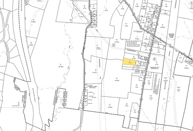
Property Record
Rte 9W, Athens, NY 12015

Property Detail
Rte 9W
192289-104-000-0006-022-000-0000
GREENE
Residentialacreage
New York
08 - GOVER
22.000
B and X Area of moderate flood hazard, usually the area between the limits of the 100-year and 500-year floods.
3.01 AC
2025
Greene County
2025
Albany/Schenectady/Troy
080900
NEARBY LISTINGS FOR SALE OR LEASE
-
-
View all Athens listings for sale on LoopNet.com
DEMOGRAPHICS near Rte 9W
1 mile
3 mile
5 mile
2025 Total Population
199
4,037
18,758
2030 Population
190
4,010
18,445
Pop Growth 2025-2030
(4.52%)
(0.67%)
(1.67%)
Average Age
46
46
44
2025 Total Households
89
1,795
8,451
HH Growth 2025-2030
(5.62%)
(0.56%)
(1.59%)
Median Household Inc
$66,923
$79,874
$67,426
Avg Household Size
2.30
2.20
2.10
2025 Avg HH Vehicles
2.00
2.00
2.00
Median Home Value
$202,174
$287,089
$287,786
Median Year Built
1968
1982
1959
Nearby Places
Map Layers
Map Styles
 Street
 Aerial
Layers
 Traffic
 Biking
Places
Listings with unknown addresses are not visible on the map
- Restaurants
- Banks
- Shops
- Fitness
- Groceries
PUBLIC TRANSPORTATION
COMMUTER RAIL
Hudson Amtrak Station (Adirondack - Amtrak, Empire Service - Amtrak, Ethan Allen Express - Amtrak, Maple Leaf - Amtrak)
Drive
Walk
Distance
Hudson Amtrak Station (Adirondack - Amtrak, Empire Service - Amtrak, Ethan Allen Express - Amtrak, Maple Leaf - Amtrak)
17 min
9.6 mi
Freight Ports
Albany, NY Port
Drive
Walk
Distance
Albany, NY Port
35 min
25.9 mi
SALE & LEASE HISTORY
LISTING DATE
SALE/LEASE

Sep 24, 2016
For Sale
Nearby Properties
Address
Land Use
TOTAL SIZE
Lot Size
Zoning
Address
Land Use
TOTAL SIZE
Lot Size
Zoning
83.45 AC
02 - SINGL
Address
Land Use
TOTAL SIZE
Lot Size
Zoning
0.97 AC
03 - MULTI
Address
Land Use
TOTAL SIZE
Lot Size
Zoning
4,250 SF
33.20 AC
06 - INDUS
Address
Land Use
TOTAL SIZE
Lot Size
Zoning
126.10 AC
02 - SINGL
Address
Land Use
TOTAL SIZE
Lot Size
Zoning
Address
Land Use
TOTAL SIZE
Lot Size
Zoning
1,920 SF
32.24 AC
06 - INDUS
Address
Land Use
TOTAL SIZE
Lot Size
Zoning
Address
Land Use
TOTAL SIZE
Lot Size
Zoning
15,750 SF
77.20 AC
02 - SINGL
Address
Land Use
TOTAL SIZE
Lot Size
Zoning
22,500 SF
53.93 AC
06 - INDUS
Address
Land Use
TOTAL SIZE
Lot Size
Zoning
43,945 SF
20.60 AC
03 - MULTI
Address
Land Use
TOTAL SIZE
Lot Size
Zoning
22,954 SF
144.64 AC
02 - SINGL
Address
Land Use
TOTAL SIZE
Lot Size
Zoning
22,346 SF
4.67 AC
06 - INDUS
Address
Land Use
TOTAL SIZE
Lot Size
Zoning
Address
Land Use
TOTAL SIZE
Lot Size
Zoning
Address
Land Use
TOTAL SIZE
Lot Size
Zoning
Address
Land Use
TOTAL SIZE
Lot Size
Zoning
Address
Land Use
TOTAL SIZE
Lot Size
Zoning
2,925 SF
1.76 AC
07 - MIXED
Address
Land Use
TOTAL SIZE
Lot Size
Zoning
Address
Land Use
TOTAL SIZE
Lot Size
Zoning
10,200 SF
14.07 AC
03 - MULTI
Address
Land Use
TOTAL SIZE
Lot Size
Zoning
19,744 SF
0.90 AC
03 - MULTI
Address
Land Use
TOTAL SIZE
Lot Size
Zoning
Address
Land Use
TOTAL SIZE
Lot Size
Zoning
Address
Land Use
TOTAL SIZE
Lot Size
Zoning
960 SF
57.60 AC
99
Address
Land Use
TOTAL SIZE
Lot Size
Zoning
20,808 SF
31 AC
06 - INDUS
Address
Land Use
TOTAL SIZE
Lot Size
Zoning
7,488 SF
3.96 AC
06 - INDUS
Address
Land Use
TOTAL SIZE
Lot Size
Zoning
15,648 SF
1.38 AC
03 - MULTI
Address
Land Use
TOTAL SIZE
Lot Size
Zoning
3,528 SF
0.36 AC
03 - MULTI
Address
Land Use
TOTAL SIZE
Lot Size
Zoning
0.01 AC
06
Address
Land Use
TOTAL SIZE
Lot Size
Zoning
Address
Land Use
TOTAL SIZE
Lot Size
Zoning
The World's #1 Commercial Real Estate Marketplace
Connect with us
© 2026 CoStar Group
The information above has been obtained from sources believed reliable. While we do not doubt its accuracy we have not verified it and make no guarantee, warranty or representation about it. It is your responsibility to independently confirm its accuracy and completeness. Any projections, opinions, assumptions, or estimates used are for example only and do not represent the current or future performance of the property. The value of this transaction to you depends on tax and other factors which should be evaluated by your tax, financial, and legal advisors. You and your advisors should conduct a careful, independent investigation of the property to determine to your satisfaction the suitability of the property for your needs.