Property Record
Russell St, Peabody, MA 01960
Save to a Folder
{{folder.Name}}
{{folder.ListingIds.length}} Properties
{{folder.ListingIds.length}} Property
Create a New Folder
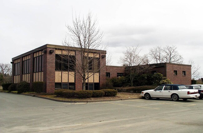
Property Detail
Russell St
PEAB-000016-000000-000042
ESSEX
Residentialacreage
Massachusetts
R1
2.46 AC
B and X Area of moderate flood hazard, usually the area between the limits of the 100-year and 500-year floods.
Peabody/Salem
2025
Boston
2025
Boston-Cambridge-Newton, MA-NH
210100
NEARBY LISTINGS FOR SALE OR LEASE
DEMOGRAPHICS near Russell St
1 mile
3 mile
5 mile
2025 Total Population
5,850
46,640
139,501
2030 Population
5,988
47,956
143,254
Pop Growth 2025-2030
+ 2.36%
+ 2.82%
+ 2.69%
Average Age
46
46
44
2025 Total Households
2,112
18,305
53,768
HH Growth 2025-2030
+ 2.27%
+ 2.86%
+ 2.67%
Median Household Inc
$148,599
$123,310
$116,408
Avg Household Size
2.70
2.50
2.50
2025 Avg HH Vehicles
2.00
2.00
2.00
Median Home Value
$714,511
$719,945
$720,715
Median Year Built
1967
1977
1967
Nearby Places
Map Layers
Map Styles
 Street
 Aerial
Layers
 Traffic
 Biking
Places
Listings with unknown addresses are not visible on the map
- Restaurants
- Banks
- Shops
- Fitness
- Groceries
PUBLIC TRANSPORTATION
COMMUTER RAIL
Wakefield (Haverhill Line - MBTA)
Drive
Walk
Distance
Wakefield (Haverhill Line - MBTA)
17 min
7.5 mi
Reading (Haverhill Line - MBTA)
Drive
Walk
Distance
Reading (Haverhill Line - MBTA)
18 min
9.0 mi
AIRPORT
General Edward Lawrence Logan International
Drive
Walk
Distance
General Edward Lawrence Logan International
33 min
19.0 mi
Freight Ports
Port of Boston
Drive
Walk
Distance
Port of Boston
36 min
22.0 mi
Nearby Properties
Address
Land Use
TOTAL SIZE
Lot Size
Zoning
Address
Land Use
TOTAL SIZE
Lot Size
Zoning
747,237 SF
36.70 AC
HW
Address
Land Use
TOTAL SIZE
Lot Size
Zoning
17 AC
R4
Address
Land Use
TOTAL SIZE
Lot Size
Zoning
198.74 AC
R3
Address
Land Use
TOTAL SIZE
Lot Size
Zoning
13.04 AC
HC
Address
Land Use
TOTAL SIZE
Lot Size
Zoning
49.85 AC
R1B
Address
Land Use
TOTAL SIZE
Lot Size
Zoning
101,389 SF
20 AC
I
Address
Land Use
TOTAL SIZE
Lot Size
Zoning
65.79 AC
I1
Address
Land Use
TOTAL SIZE
Lot Size
Zoning
40.20 AC
R1B
Address
Land Use
TOTAL SIZE
Lot Size
Zoning
206.65 AC
R1B
Address
Land Use
TOTAL SIZE
Lot Size
Zoning
54,302 SF
83.70 AC
R3
Address
Land Use
TOTAL SIZE
Lot Size
Zoning
249,587 SF
5.79 AC
DDD
Address
Land Use
TOTAL SIZE
Lot Size
Zoning
93,789 SF
8.22 AC
HW
Address
Land Use
TOTAL SIZE
Lot Size
Zoning
19.10 AC
R114
Address
Land Use
TOTAL SIZE
Lot Size
Zoning
15.32 AC
HC
Address
Land Use
TOTAL SIZE
Lot Size
Zoning
71.68 AC
R3
Address
Land Use
TOTAL SIZE
Lot Size
Zoning
15.88 AC
BR
Address
Land Use
TOTAL SIZE
Lot Size
Zoning
24.54 AC
M1
Address
Land Use
TOTAL SIZE
Lot Size
Zoning
36,156 SF
754.25 AC
R1A
Address
Land Use
TOTAL SIZE
Lot Size
Zoning
110,812 SF
32.87 AC
RA
Address
Land Use
TOTAL SIZE
Lot Size
Zoning
624 SF
45.60 AC
DDD
Address
Land Use
TOTAL SIZE
Lot Size
Zoning
81,746 SF
10.50 AC
R1A
Address
Land Use
TOTAL SIZE
Lot Size
Zoning
4.26 AC
R114
Address
Land Use
TOTAL SIZE
Lot Size
Zoning
111,000 SF
0.90 AC
DDD
Address
Land Use
TOTAL SIZE
Lot Size
Zoning
24.87 AC
R3
Address
Land Use
TOTAL SIZE
Lot Size
Zoning
181,659 SF
11.57 AC
R114
Address
Land Use
TOTAL SIZE
Lot Size
Zoning
136,661 SF
27.50 AC
RB
Address
Land Use
TOTAL SIZE
Lot Size
Zoning
89,742 SF
10.78 AC
RC
Address
Land Use
TOTAL SIZE
Lot Size
Zoning
175,699 SF
22.91 AC
R3
Address
Land Use
TOTAL SIZE
Lot Size
Zoning
127,748 SF
13.64 AC
HC
Address
Land Use
TOTAL SIZE
Lot Size
Zoning
13.80 AC
BN2
The World's #1 Commercial Real Estate Marketplace
Connect with us
© 2026 CoStar Group
The information above has been obtained from sources believed reliable. While we do not doubt its accuracy we have not verified it and make no guarantee, warranty or representation about it. It is your responsibility to independently confirm its accuracy and completeness. Any projections, opinions, assumptions, or estimates used are for example only and do not represent the current or future performance of the property. The value of this transaction to you depends on tax and other factors which should be evaluated by your tax, financial, and legal advisors. You and your advisors should conduct a careful, independent investigation of the property to determine to your satisfaction the suitability of the property for your needs.