Property Record
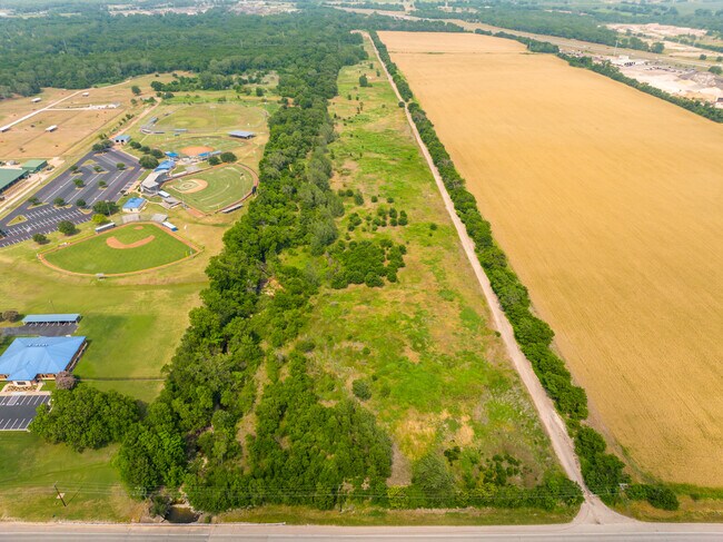
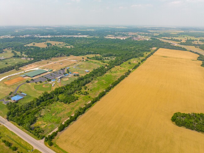
S 3Rd St, Waco, TX 76706

Property Detail
S 3Rd St
Waco, TX
OCAMPO C TRACT 10 ACRES 126.415
48-031703-064000-6
MCLENNAN
Miscellaneous
Texas
R1A
10
A Areas with a 1% annual chance of flooding and a 26% chance of flooding over the life of a 30-year mortgage.
126.42 AC
2024
Waco
2025
Other Market Areas
002100
NEARBY LISTINGS FOR SALE OR LEASE
DEMOGRAPHICS near S 3Rd St
1 mile
3 mile
5 mile
2025 Total Population
2,067
31,555
90,157
2030 Population
2,140
32,720
93,781
Pop Growth 2025-2030
+ 3.53%
+ 3.69%
+ 4.02%
Average Age
32
29
34
2025 Total Households
840
11,044
32,367
HH Growth 2025-2030
+ 3.45%
+ 4.17%
+ 4.23%
Median Household Inc
$31,048
$31,915
$41,692
Avg Household Size
2.40
2.30
2.50
2025 Avg HH Vehicles
2.00
2.00
2.00
Median Home Value
$150,515
$146,408
$172,005
Median Year Built
2002
1989
1977
Nearby Places
Map Layers
Map Styles
 Street
 Aerial
Transit
 Traffic
 Biking
Places
Listings with unknown addresses are not visible on the map
- Restaurants
- Banks
- Shops
- Fitness
- Groceries
PUBLIC TRANSPORTATION
AIRPORT
Waco Regional
Drive
Walk
Distance
Waco Regional
28 min
13.2 mi
Freight Ports
Port of Houston
Drive
Walk
Distance
Port of Houston
216 min
184.9 mi
SALE & LEASE HISTORY
LISTING DATE
SALE/LEASE

Jun 30, 2022
For Sale
Nearby Properties
Address
Land Use
TOTAL SIZE
Lot Size
Zoning
Address
Land Use
TOTAL SIZE
Lot Size
Zoning
93.17 AC
2007 TIF
Address
Land Use
TOTAL SIZE
Lot Size
Zoning
549,274 SF
34.05 AC
O2
Address
Land Use
TOTAL SIZE
Lot Size
Zoning
120,623 SF
55.15 AC
2007 TIF
Address
Land Use
TOTAL SIZE
Lot Size
Zoning
560,620 SF
3.70 AC
O2
Address
Land Use
TOTAL SIZE
Lot Size
Zoning
576,501 SF
4.21 AC
Address
Land Use
TOTAL SIZE
Lot Size
Zoning
394,674 SF
21.31 AC
O2
Address
Land Use
TOTAL SIZE
Lot Size
Zoning
206,452 SF
11.97 AC
2007 TIF
Address
Land Use
TOTAL SIZE
Lot Size
Zoning
88 AC
O1
Address
Land Use
TOTAL SIZE
Lot Size
Zoning
339,476 SF
Address
Land Use
TOTAL SIZE
Lot Size
Zoning
250,924 SF
17.73 AC
O-2
Address
Land Use
TOTAL SIZE
Lot Size
Zoning
27.28 AC
C
Address
Land Use
TOTAL SIZE
Lot Size
Zoning
399,747 SF
2.86 AC
C-3,C
Address
Land Use
TOTAL SIZE
Lot Size
Zoning
139,104 SF
12.86 AC
M1
Address
Land Use
TOTAL SIZE
Lot Size
Zoning
24.75 AC
O2
Address
Land Use
TOTAL SIZE
Lot Size
Zoning
213,814 SF
7.05 AC
2007 TIF
Address
Land Use
TOTAL SIZE
Lot Size
Zoning
3,096 SF
51.73 AC
2007 TIF
Address
Land Use
TOTAL SIZE
Lot Size
Zoning
188,746 SF
1.14 AC
O2
Address
Land Use
TOTAL SIZE
Lot Size
Zoning
188,465 SF
5.85 AC
2007 TIF
Address
Land Use
TOTAL SIZE
Lot Size
Zoning
Address
Land Use
TOTAL SIZE
Lot Size
Zoning
136,295 SF
6.09 AC
2007 TIF
Address
Land Use
TOTAL SIZE
Lot Size
Zoning
237,081 SF
12.52 AC
2007 TIF
Address
Land Use
TOTAL SIZE
Lot Size
Zoning
16.78 AC
2007 TIF
Address
Land Use
TOTAL SIZE
Lot Size
Zoning
200,028 SF
9.23 AC
PUD
Address
Land Use
TOTAL SIZE
Lot Size
Zoning
200,951 SF
7.09 AC
R-3E
Address
Land Use
TOTAL SIZE
Lot Size
Zoning
77,089 SF
5.09 AC
O2
Address
Land Use
TOTAL SIZE
Lot Size
Zoning
155,900 SF
2.85 AC
O2
Address
Land Use
TOTAL SIZE
Lot Size
Zoning
13.31 AC
Address
Land Use
TOTAL SIZE
Lot Size
Zoning
3.29 AC
2007 TIF
Address
Land Use
TOTAL SIZE
Lot Size
Zoning
21.14 AC
2007 TIF
Address
Land Use
TOTAL SIZE
Lot Size
Zoning
5.57 AC
2007 TIF
The World's #1 Commercial Real Estate Marketplace
Connect with us
© 2026 CoStar Group
The information above has been obtained from sources believed reliable. While we do not doubt its accuracy we have not verified it and make no guarantee, warranty or representation about it. It is your responsibility to independently confirm its accuracy and completeness. Any projections, opinions, assumptions, or estimates used are for example only and do not represent the current or future performance of the property. The value of this transaction to you depends on tax and other factors which should be evaluated by your tax, financial, and legal advisors. You and your advisors should conduct a careful, independent investigation of the property to determine to your satisfaction the suitability of the property for your needs.