Property Record
S Arlington St S, , OH


Save to a Folder
{{folder.Name}}
{{folder.ListingIds.length}} Properties
{{folder.ListingIds.length}} Property
Create a New Folder
Property Detail
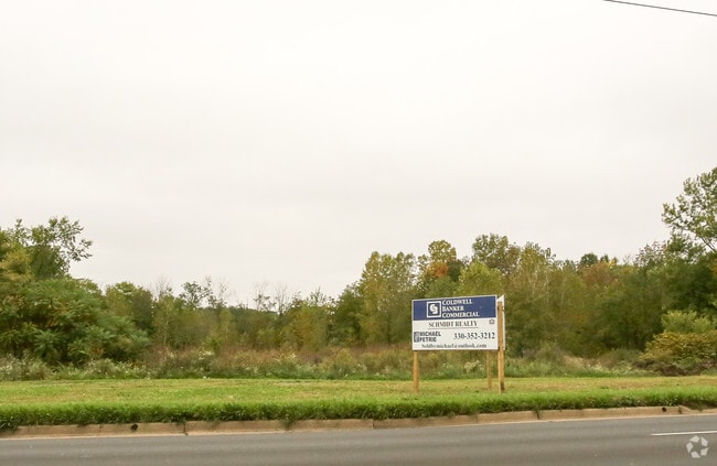
S Arlington St S
Akron, OH
TR 11 PT SUB 124 ARL WATERLOO ACS
68-06547
SUMMIT
Commercialacreage
Ohio
B and X Area of moderate flood hazard, usually the area between the limits of the 100-year and 500-year floods.
11
2025
0.20 AC
2026
Akron
503300
Cleveland
NEARBY LISTINGS FOR SALE OR LEASE
DEMOGRAPHICS near S Arlington St S
1 mile
3 mile
5 mile
2025 Total Population
5,176
56,387
168,313
2030 Population
5,148
56,634
169,182
Pop Growth 2025-2030
(0.54%)
+ 0.44%
+ 0.52%
Average Age
37
40
40
2025 Total Households
2,235
24,130
72,072
HH Growth 2025-2030
(0.58%)
+ 0.37%
+ 0.49%
Median Household Inc
$39,981
$51,650
$51,717
Avg Household Size
2.30
2.30
2.20
2025 Avg HH Vehicles
1.00
2.00
2.00
Median Home Value
$178,394
$137,992
$142,511
Median Year Built
1972
1955
1957
Nearby Places
Map Layers
Map Styles
 Street
 Aerial
Layers
 Traffic
 Biking
Places
Listings with unknown addresses are not visible on the map
- Restaurants
- Banks
- Shops
- Fitness
- Groceries
PUBLIC TRANSPORTATION
COMMUTER RAIL
Drive
Walk
Distance
11 min
5.8 mi
Drive
Walk
Distance
20 min
9.1 mi
AIRPORT
Akron-Canton Regional
Drive
Walk
Distance
Akron-Canton Regional
15 min
9.2 mi
Cleveland-Hopkins International
Drive
Walk
Distance
Cleveland-Hopkins International
63 min
45.6 mi
SALE & LEASE HISTORY
LISTING DATE
SALE/LEASE

Jan 03, 2019
For Sale
Nearby Properties
Address
Land Use
TOTAL SIZE
Lot Size
Zoning
Address
Land Use
TOTAL SIZE
Lot Size
Zoning
18.40 AC
Address
Land Use
TOTAL SIZE
Lot Size
Zoning
203,458 SF
10.41 AC
Address
Land Use
TOTAL SIZE
Lot Size
Zoning
9.19 AC
Address
Land Use
TOTAL SIZE
Lot Size
Zoning
5.61 AC
Address
Land Use
TOTAL SIZE
Lot Size
Zoning
Address
Land Use
TOTAL SIZE
Lot Size
Zoning
Address
Land Use
TOTAL SIZE
Lot Size
Zoning
57,369 SF
93.97 AC
Address
Land Use
TOTAL SIZE
Lot Size
Zoning
696,005 SF
Address
Land Use
TOTAL SIZE
Lot Size
Zoning
227,634 SF
21.46 AC
Address
Land Use
TOTAL SIZE
Lot Size
Zoning
99,003 SF
20.10 AC
Address
Land Use
TOTAL SIZE
Lot Size
Zoning
270,860 SF
131.89 AC
Address
Land Use
TOTAL SIZE
Lot Size
Zoning
22,589 SF
31.65 AC
Address
Land Use
TOTAL SIZE
Lot Size
Zoning
154,926 SF
12.38 AC
Address
Land Use
TOTAL SIZE
Lot Size
Zoning
196,767 SF
37.16 AC
Address
Land Use
TOTAL SIZE
Lot Size
Zoning
243,424 SF
13.24 AC
Address
Land Use
TOTAL SIZE
Lot Size
Zoning
639,478 SF
29.51 AC
Address
Land Use
TOTAL SIZE
Lot Size
Zoning
3.31 AC
Address
Land Use
TOTAL SIZE
Lot Size
Zoning
121,006 SF
6.09 AC
Address
Land Use
TOTAL SIZE
Lot Size
Zoning
62,984 SF
20 AC
Address
Land Use
TOTAL SIZE
Lot Size
Zoning
203,059 SF
55.62 AC
Address
Land Use
TOTAL SIZE
Lot Size
Zoning
22,977 SF
263.47 AC
Address
Land Use
TOTAL SIZE
Lot Size
Zoning
57,180 SF
6.67 AC
Address
Land Use
TOTAL SIZE
Lot Size
Zoning
187,454 SF
12.59 AC
Address
Land Use
TOTAL SIZE
Lot Size
Zoning
8.59 AC
Address
Land Use
TOTAL SIZE
Lot Size
Zoning
709,827 SF
8.82 AC
Address
Land Use
TOTAL SIZE
Lot Size
Zoning
15,248 SF
293.33 AC
Address
Land Use
TOTAL SIZE
Lot Size
Zoning
240,497 SF
13.37 AC
Address
Land Use
TOTAL SIZE
Lot Size
Zoning
51,520 SF
2.70 AC
Address
Land Use
TOTAL SIZE
Lot Size
Zoning
53,074 SF
7.29 AC
Address
Land Use
TOTAL SIZE
Lot Size
Zoning
258,686 SF
19.52 AC
The World's #1 Commercial Real Estate Marketplace
Connect with us
© 2026 CoStar Group
The information above has been obtained from sources believed reliable. While we do not doubt its accuracy we have not verified it and make no guarantee, warranty or representation about it. It is your responsibility to independently confirm its accuracy and completeness. Any projections, opinions, assumptions, or estimates used are for example only and do not represent the current or future performance of the property. The value of this transaction to you depends on tax and other factors which should be evaluated by your tax, financial, and legal advisors. You and your advisors should conduct a careful, independent investigation of the property to determine to your satisfaction the suitability of the property for your needs.