Property Record
S Belle Plain Rd, Harrisonville, MO 64701

Property Detail
S Belle Plain Rd
Kansas City, MO-KS
MEADOWLAND BUSINESS PK W PT LT 1, TR 1, 2 & 5
0782800
CASS
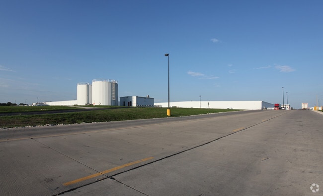
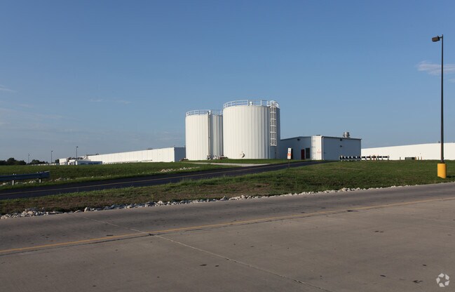
Officebuilding
Missouri
B and X Area of moderate flood hazard, usually the area between the limits of the 100-year and 500-year floods.
1
2024
75.28 AC
2025
Cass County
061400
Kansas City
996,962 SF
NEARBY LISTINGS FOR SALE OR LEASE
-
-
View all Harrisonville listings for sale on LoopNet.com
DEMOGRAPHICS near S Belle Plain Rd
1 mile
3 mile
5 mile
2025 Total Population
120
6,473
13,643
2030 Population
124
6,699
14,150
Pop Growth 2025-2030
+ 3.33%
+ 3.49%
+ 3.72%
Average Age
45
40
41
2025 Total Households
44
2,437
5,257
HH Growth 2025-2030
+ 4.55%
+ 3.69%
+ 3.92%
Median Household Inc
$93,749
$72,343
$76,045
Avg Household Size
2.80
2.50
2.50
2025 Avg HH Vehicles
3.00
2.00
2.00
Median Home Value
$299,999
$228,411
$259,573
Median Year Built
1979
1972
1977
Nearby Places
Map Layers
Map Styles
 Street
 Aerial
Layers
 Traffic
 Biking
Places
Listings with unknown addresses are not visible on the map
- Restaurants
- Banks
- Shops
- Fitness
- Groceries
Nearby Properties
Address
Land Use
TOTAL SIZE
Lot Size
Zoning
Address
Land Use
TOTAL SIZE
Lot Size
Zoning
197,883 SF
30 AC
Address
Land Use
TOTAL SIZE
Lot Size
Zoning
367,575 SF
53.34 AC
Address
Land Use
TOTAL SIZE
Lot Size
Zoning
219,735 SF
33.54 AC
Address
Land Use
TOTAL SIZE
Lot Size
Zoning
1,030,621 SF
43.38 AC
Address
Land Use
TOTAL SIZE
Lot Size
Zoning
55,413 SF
8 AC
Address
Land Use
TOTAL SIZE
Lot Size
Zoning
42,378 SF
14.20 AC
Address
Land Use
TOTAL SIZE
Lot Size
Zoning
Address
Land Use
TOTAL SIZE
Lot Size
Zoning
103,920 SF
12.29 AC
Address
Land Use
TOTAL SIZE
Lot Size
Zoning
53,673 SF
12.16 AC
Address
Land Use
TOTAL SIZE
Lot Size
Zoning
65,356 SF
6.21 AC
Address
Land Use
TOTAL SIZE
Lot Size
Zoning
19,600 SF
6.30 AC
Address
Land Use
TOTAL SIZE
Lot Size
Zoning
40,784 SF
0.45 AC
Address
Land Use
TOTAL SIZE
Lot Size
Zoning
460,328 SF
20 AC
Address
Land Use
TOTAL SIZE
Lot Size
Zoning
74,086 SF
5.39 AC
Address
Land Use
TOTAL SIZE
Lot Size
Zoning
21,310 SF
3.40 AC
Address
Land Use
TOTAL SIZE
Lot Size
Zoning
20,600 SF
3.90 AC
Address
Land Use
TOTAL SIZE
Lot Size
Zoning
107,500 SF
7.10 AC
Address
Land Use
TOTAL SIZE
Lot Size
Zoning
11,070 SF
10.15 AC
Address
Land Use
TOTAL SIZE
Lot Size
Zoning
90,300 SF
34.03 AC
Address
Land Use
TOTAL SIZE
Lot Size
Zoning
7,540 SF
0.82 AC
Address
Land Use
TOTAL SIZE
Lot Size
Zoning
17,589 SF
4.50 AC
Address
Land Use
TOTAL SIZE
Lot Size
Zoning
5,812 SF
19.87 AC
Address
Land Use
TOTAL SIZE
Lot Size
Zoning
5,355 SF
2.05 AC
Address
Land Use
TOTAL SIZE
Lot Size
Zoning
8,894 SF
0.22 AC
Address
Land Use
TOTAL SIZE
Lot Size
Zoning
14,736 SF
1.87 AC
Address
Land Use
TOTAL SIZE
Lot Size
Zoning
13,146 SF
1.80 AC
Address
Land Use
TOTAL SIZE
Lot Size
Zoning
13,875 SF
4.71 AC
Address
Land Use
TOTAL SIZE
Lot Size
Zoning
34,000 SF
32.56 AC
Address
Land Use
TOTAL SIZE
Lot Size
Zoning
24,164 SF
3.73 AC
The World's #1 Commercial Real Estate Marketplace
Connect with us
© 2026 CoStar Group
The information above has been obtained from sources believed reliable. While we do not doubt its accuracy we have not verified it and make no guarantee, warranty or representation about it. It is your responsibility to independently confirm its accuracy and completeness. Any projections, opinions, assumptions, or estimates used are for example only and do not represent the current or future performance of the property. The value of this transaction to you depends on tax and other factors which should be evaluated by your tax, financial, and legal advisors. You and your advisors should conduct a careful, independent investigation of the property to determine to your satisfaction the suitability of the property for your needs.