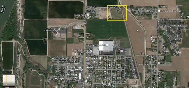
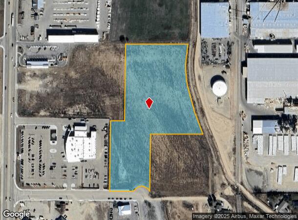
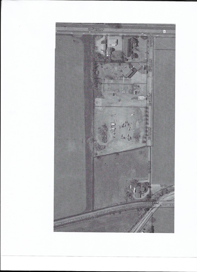
Property Record
S Bonita Way, Fruitland, ID 83619
NEARBY LISTINGS FOR SALE OR LEASE
Property Detail
S Bonita Way
Other Market Areas
In Swne Plat
Ontario, OR-ID
PLTD SEC 22-8-5 TAX 373 IN BLK 10 EX TAX 498 & 661 (IN SWNE)
08N05W221220
Payette
Commercialacreage
Idaho
2025
6.36 AC
2025
Idaho South Area
960302
DEMOGRAPHICS near S Bonita Way
1 Mile
3 Mile
5 Mile
2024 Total Population
5,423
17,410
33,778
2029 Population
6,366
19,283
37,652
Pop Growth 2024-2029
+ 17.39%
+ 10.76%
+ 11.47%
Average Age
39
37
39
2024 Total Households
1,962
6,310
12,542
HH Growth 2024-2029
+ 17.79%
+ 11.08%
+ 11.79%
Median Household Inc
$70,470
$56,133
$54,533
Avg Household Size
2.70
2.70
2.60
2024 Avg HH Vehicles
2.00
2.00
2.00
Median Home Value
$271,507
$218,806
$233,612
Median Year Built
1992
1977
1976
Nearby Places
Map Layers
Map Styles
 Street
 Aerial
- Restaurants
- Banks
- Shops
- Fitness
- Groceries
SALE & LEASE HISTORY
LISTING DATE
SALE/LEASE

Jul 05, 2017
For Sale
Aug 01, 2018
For Sale
Nearby Properties
Address
Land Use
TOTAL SIZE
Lot Size
Zoning
Address
Land Use
TOTAL SIZE
Lot Size
Zoning
50.97 AC
O-I2
Address
Land Use
TOTAL SIZE
Lot Size
Zoning
260,313 SF
5.15 AC
O-C1
Address
Land Use
TOTAL SIZE
Lot Size
Zoning
10 SF
89.11 AC
O-CD
Address
Land Use
TOTAL SIZE
Lot Size
Zoning
10 SF
6.75 AC
O-PF
Address
Land Use
TOTAL SIZE
Lot Size
Zoning
35.92 AC
Address
Land Use
TOTAL SIZE
Lot Size
Zoning
88,574 SF
18.39 AC
O-PF
Address
Land Use
TOTAL SIZE
Lot Size
Zoning
4.74 AC
O-PF
Address
Land Use
TOTAL SIZE
Lot Size
Zoning
50.97 AC
O-I2
Address
Land Use
TOTAL SIZE
Lot Size
Zoning
10 SF
6.57 AC
O-CD
Address
Land Use
TOTAL SIZE
Lot Size
Zoning
36,732 SF
7.14 AC
O-CD
Address
Land Use
TOTAL SIZE
Lot Size
Zoning
4.96 AC
O-C2
Address
Land Use
TOTAL SIZE
Lot Size
Zoning
197,522 SF
19.72 AC
O-C2
Address
Land Use
TOTAL SIZE
Lot Size
Zoning
71,504 SF
5.94 AC
Address
Land Use
TOTAL SIZE
Lot Size
Zoning
10.89 AC
INDUSTRIAL
Address
Land Use
TOTAL SIZE
Lot Size
Zoning
104,456 SF
8.71 AC
O-C2H
Address
Land Use
TOTAL SIZE
Lot Size
Zoning
42,807 SF
11.02 AC
Address
Land Use
TOTAL SIZE
Lot Size
Zoning
21,715 SF
4.94 AC
Address
Land Use
TOTAL SIZE
Lot Size
Zoning
39,162 SF
3.95 AC
Address
Land Use
TOTAL SIZE
Lot Size
Zoning
9.69 AC
INDUSTRIAL
Address
Land Use
TOTAL SIZE
Lot Size
Zoning
141.70 AC
O-I2
Address
Land Use
TOTAL SIZE
Lot Size
Zoning
Address
Land Use
TOTAL SIZE
Lot Size
Zoning
62,348 SF
2.24 AC
O-C2
Address
Land Use
TOTAL SIZE
Lot Size
Zoning
47,605 SF
9.07 AC
O-PF
Address
Land Use
TOTAL SIZE
Lot Size
Zoning
26,855 SF
1.85 AC
Address
Land Use
TOTAL SIZE
Lot Size
Zoning
48,892 SF
5.76 AC
O-C2H
Address
Land Use
TOTAL SIZE
Lot Size
Zoning
18.67 AC
Address
Land Use
TOTAL SIZE
Lot Size
Zoning
10.83 AC
COMMERCIAL
Address
Land Use
TOTAL SIZE
Lot Size
Zoning
1.53 AC
O-I2
Address
Land Use
TOTAL SIZE
Lot Size
Zoning
1,560 SF
37.06 AC
O-PF
Address
Land Use
TOTAL SIZE
Lot Size
Zoning
41.81 AC
O-I2+
The World's #1 Commercial Real Estate Marketplace
Connect with us
© 2025 CoStar Group
The information above has been obtained from sources believed reliable. While we do not doubt its accuracy we have not verified it and make no guarantee, warranty or representation about it. It is your responsibility to independently confirm its accuracy and completeness. Any projections, opinions, assumptions, or estimates used are for example only and do not represent the current or future performance of the property. The value of this transaction to you depends on tax and other factors which should be evaluated by your tax, financial, and legal advisors. You and your advisors should conduct a careful, independent investigation of the property to determine to your satisfaction the suitability of the property for your needs.