Property Record
S Browntown Rd, Rocky Mount, NC 27804

NEARBY LISTINGS FOR SALE OR LEASE
Property Detail
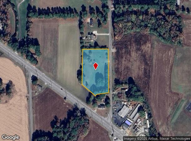
S Browntown Rd
3842-00-41-0201
2 63 AC, NORVILLE
Vacantlandnec
Nash
X
North Carolina
3720384200J
2.63 AC
2025
Rocky Mount/Wilson
2025
Other Market Areas
010505
Rocky Mount, NC
DEMOGRAPHICS near S Browntown Rd
1 mile
3 mile
5 mile
2024 Total Population
1,275
18,891
44,876
2029 Population
1,314
19,445
46,273
Pop Growth 2024-2029
+ 3.06%
+ 2.93%
+ 3.11%
Average Age
40
42
42
2024 Total Households
624
8,379
19,396
HH Growth 2024-2029
+ 2.88%
+ 2.83%
+ 3.07%
Median Household Inc
$43,614
$60,737
$55,691
Avg Household Size
2.00
2.20
2.20
2024 Avg HH Vehicles
2.00
2.00
2.00
Median Home Value
$170,999
$164,282
$158,893
Median Year Built
1994
1987
1983
Nearby Places
Map Layers
Map Styles
 Street
 Aerial
Transit
 Traffic
 Biking
Places
Listings with unknown addresses are not visible on the map
- Restaurants
- Banks
- Shops
- Fitness
- Groceries
PUBLIC TRANSPORTATION
COMMUTER RAIL
Rocky Mount (Carolinian - Amtrak, Palmetto - Amtrak, Silver Meteor - Amtrak, Silver Star - Amtrak)
Drive
Walk
Distance
Rocky Mount (Carolinian - Amtrak, Palmetto - Amtrak, Silver Meteor - Amtrak, Silver Star - Amtrak)
11 min
5.5 mi
Freight Ports
Virginia Port Authority - Portsmouth
Drive
Walk
Distance
Virginia Port Authority - Portsmouth
154 min
131.7 mi
Nearby Properties
Address
Land Use
TOTAL SIZE
Lot Size
Zoning
Address
Land Use
TOTAL SIZE
Lot Size
Zoning
133,154 SF
70.45 AC
MA
Address
Land Use
TOTAL SIZE
Lot Size
Zoning
104,995 SF
16.01 AC
Address
Land Use
TOTAL SIZE
Lot Size
Zoning
98,831 SF
5.40 AC
I
Address
Land Use
TOTAL SIZE
Lot Size
Zoning
6,976 SF
15.97 AC
R6
Address
Land Use
TOTAL SIZE
Lot Size
Zoning
65,826 SF
16.77 AC
Address
Land Use
TOTAL SIZE
Lot Size
Zoning
204,903 SF
23.07 AC
Address
Land Use
TOTAL SIZE
Lot Size
Zoning
85,766 SF
4.61 AC
B5
Address
Land Use
TOTAL SIZE
Lot Size
Zoning
98,065 SF
6.14 AC
I
Address
Land Use
TOTAL SIZE
Lot Size
Zoning
73,338 SF
2.81 AC
B5CU
Address
Land Use
TOTAL SIZE
Lot Size
Zoning
16,110 SF
17.49 AC
MA
Address
Land Use
TOTAL SIZE
Lot Size
Zoning
8,822 SF
9.70 AC
R6
Address
Land Use
TOTAL SIZE
Lot Size
Zoning
8,020 SF
13.81 AC
R6
Address
Land Use
TOTAL SIZE
Lot Size
Zoning
59,236 SF
2.18 AC
B5M
Address
Land Use
TOTAL SIZE
Lot Size
Zoning
51,543 SF
9.61 AC
I
Address
Land Use
TOTAL SIZE
Lot Size
Zoning
7,952 SF
8.59 AC
R6
Address
Land Use
TOTAL SIZE
Lot Size
Zoning
135,400 SF
21.45 AC
B2
Address
Land Use
TOTAL SIZE
Lot Size
Zoning
25,936 SF
22.35 AC
R15
Address
Land Use
TOTAL SIZE
Lot Size
Zoning
62,024 SF
5.39 AC
B5
Address
Land Use
TOTAL SIZE
Lot Size
Zoning
7,022 SF
14.89 AC
A1
Address
Land Use
TOTAL SIZE
Lot Size
Zoning
47,410 SF
2.58 AC
B5CU
Address
Land Use
TOTAL SIZE
Lot Size
Zoning
129,264 SF
31.28 AC
B3
Address
Land Use
TOTAL SIZE
Lot Size
Zoning
253,009 SF
52.80 AC
B3
Address
Land Use
TOTAL SIZE
Lot Size
Zoning
63,276 SF
3.07 AC
I
Address
Land Use
TOTAL SIZE
Lot Size
Zoning
36,151 SF
23.17 AC
R30
Address
Land Use
TOTAL SIZE
Lot Size
Zoning
61,944 SF
2.51 AC
B5
Address
Land Use
TOTAL SIZE
Lot Size
Zoning
9,736 SF
11.94 AC
R6
Address
Land Use
TOTAL SIZE
Lot Size
Zoning
7,224 SF
8.45 AC
R6
Address
Land Use
TOTAL SIZE
Lot Size
Zoning
50,305 SF
2.20 AC
B5
Address
Land Use
TOTAL SIZE
Lot Size
Zoning
46,533 SF
11.52 AC
B3
Address
Land Use
TOTAL SIZE
Lot Size
Zoning
19,532 SF
15.58 AC
R10
The World's #1 Commercial Real Estate Marketplace
Connect with us
© 2026 CoStar Group
The information above has been obtained from sources believed reliable. While we do not doubt its accuracy we have not verified it and make no guarantee, warranty or representation about it. It is your responsibility to independently confirm its accuracy and completeness. Any projections, opinions, assumptions, or estimates used are for example only and do not represent the current or future performance of the property. The value of this transaction to you depends on tax and other factors which should be evaluated by your tax, financial, and legal advisors. You and your advisors should conduct a careful, independent investigation of the property to determine to your satisfaction the suitability of the property for your needs.