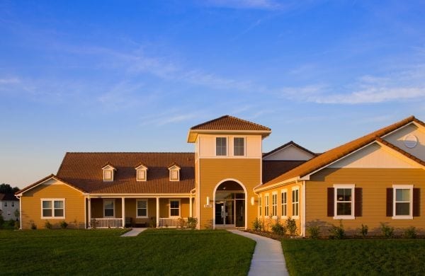
Property Record
S Capitol St Sw, Washington, DC 20032


NEARBY LISTINGS FOR SALE OR LEASE
Property Detail
S Capitol St Sw
Washington-Arlington-Alexandria, DC-VA-MD-WV
Congress Heights
6072-0818
SQUARE 6072 LOT 0818 NBHD: CONGRESS HEIGHTS
Miscellaneous
District of Columbia
X
District of Columbia
5155190035F
818
0
52.56 AC
2025
Bolling Air Force Base
009801
Washington, DC
420,000 SF
DEMOGRAPHICS near S Capitol St Sw
1 Mile
3 Mile
5 Mile
2024 Total Population
9,046
189,991
560,376
2029 Population
8,248
181,521
535,711
Pop Growth 2024-2029
(8.82%)
(4.46%)
(4.40%)
Average Age
35
37
38
2024 Total Households
3,399
87,222
264,355
HH Growth 2024-2029
(9.83%)
(4.49%)
(4.74%)
Median Household Inc
$62,707
$89,290
$96,747
Avg Household Size
2.40
2.10
2.00
2024 Avg HH Vehicles
1.00
1.00
1.00
Median Home Value
$416,071
$602,414
$572,725
Median Year Built
1976
1974
1972
Nearby Places
Map Layers
Map Styles
 Street
 Aerial
- Restaurants
- Banks
- Shops
- Fitness
- Groceries
PUBLIC TRANSPORTATION
COMMUTER RAIL
Alexandria (Fredericksburg Line - Virginia Railway Express, Manassas Line - Virginia Railway Express)
DRIVE
WALK
Distance
Alexandria (Fredericksburg Line - Virginia Railway Express, Manassas Line - Virginia Railway Express)
16 min
7.7 mi
Crystal City (Fredericksburg Line - Virginia Railway Express, Manassas Line - Virginia Railway Express)
DRIVE
WALK
Distance
Crystal City (Fredericksburg Line - Virginia Railway Express, Manassas Line - Virginia Railway Express)
16 min
8.5 mi
AIRPORT
Ronald Reagan Washington Ntl
DRIVE
WALK
Distance
Ronald Reagan Washington Ntl
19 min
9.8 mi
Baltimore/Washington International Thurgood Marshall
DRIVE
WALK
Distance
Baltimore/Washington International Thurgood Marshall
53 min
34.0 mi
Washington Dulles International
DRIVE
WALK
Distance
Washington Dulles International
57 min
34.2 mi
Freight Ports
Port of Baltimore
DRIVE
WALK
Distance
Port of Baltimore
63 min
40.6 mi
Nearby Properties
Address
Land Use
TOTAL SIZE
Lot Size
Zoning
Address
Land Use
TOTAL SIZE
Lot Size
Zoning
900,000 SF
11.10 AC
S-3A
Address
Land Use
TOTAL SIZE
Lot Size
Zoning
128,439 SF
373.22 AC
UNZONED
Address
Land Use
TOTAL SIZE
Lot Size
Zoning
19.46 AC
CG-4
Address
Land Use
TOTAL SIZE
Lot Size
Zoning
2,369,428 SF
7.93 AC
MU-10;SEFC
Address
Land Use
TOTAL SIZE
Lot Size
Zoning
1,719,751 SF
39.48 AC
PDR-3;UNZO
Address
Land Use
TOTAL SIZE
Lot Size
Zoning
782,765 SF
94.06 AC
CG-5;CG-6;
Address
Land Use
TOTAL SIZE
Lot Size
Zoning
437,938 SF
11.28 AC
CG-4
Address
Land Use
TOTAL SIZE
Lot Size
Zoning
4,000,000 SF
352.96 AC
UNZONED
Address
Land Use
TOTAL SIZE
Lot Size
Zoning
930,547 SF
1.90 AC
D-5
Address
Land Use
TOTAL SIZE
Lot Size
Zoning
508,547 SF
4.58 AC
C-O-2.5
Address
Land Use
TOTAL SIZE
Lot Size
Zoning
293,674 SF
13.45 AC
C-O-2.5
Address
Land Use
TOTAL SIZE
Lot Size
Zoning
40,891 SF
2.39 AC
C-O-2.5/C-
Address
Land Use
TOTAL SIZE
Lot Size
Zoning
904,502 SF
8.08 AC
UNZONED
Address
Land Use
TOTAL SIZE
Lot Size
Zoning
3,231,903 SF
173.70 AC
UNZONED
Address
Land Use
TOTAL SIZE
Lot Size
Zoning
35.71 AC
P-S/RA8-18
Address
Land Use
TOTAL SIZE
Lot Size
Zoning
928,014 SF
0.47 AC
MU-12
Address
Land Use
TOTAL SIZE
Lot Size
Zoning
336,904 SF
2.12 AC
CDD#15
Address
Land Use
TOTAL SIZE
Lot Size
Zoning
450,000 SF
37.35 AC
UNZONED
Address
Land Use
TOTAL SIZE
Lot Size
Zoning
514,892 SF
4.72 AC
C-O-2.5
Address
Land Use
TOTAL SIZE
Lot Size
Zoning
30,000 SF
819.17 AC
PDR-1;RA-1
Address
Land Use
TOTAL SIZE
Lot Size
Zoning
589,680 SF
3.11 AC
D-5
Address
Land Use
TOTAL SIZE
Lot Size
Zoning
0.25 AC
MU-12
Address
Land Use
TOTAL SIZE
Lot Size
Zoning
385,270 SF
1.30 AC
MU-8B
Address
Land Use
TOTAL SIZE
Lot Size
Zoning
5.85 AC
RA4.8
Address
Land Use
TOTAL SIZE
Lot Size
Zoning
356,000 SF
16.42 AC
RA-1;RF-1
Address
Land Use
TOTAL SIZE
Lot Size
Zoning
53,549 SF
3.50 AC
C-O
Address
Land Use
TOTAL SIZE
Lot Size
Zoning
16,782 SF
1.67 AC
C-O-1.5
Address
Land Use
TOTAL SIZE
Lot Size
Zoning
568,512 SF
2 AC
C-O
The World's #1 Commercial Real Estate Marketplace
Connect with us
© 2025 CoStar Group
The information above has been obtained from sources believed reliable. While we do not doubt its accuracy we have not verified it and make no guarantee, warranty or representation about it. It is your responsibility to independently confirm its accuracy and completeness. Any projections, opinions, assumptions, or estimates used are for example only and do not represent the current or future performance of the property. The value of this transaction to you depends on tax and other factors which should be evaluated by your tax, financial, and legal advisors. You and your advisors should conduct a careful, independent investigation of the property to determine to your satisfaction the suitability of the property for your needs.