Property Record
S Custer Rd, Monroe, MI 48161

NEARBY LISTINGS FOR SALE OR LEASE
Property Detail
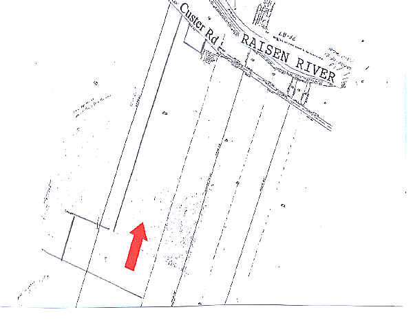
S Custer Rd
Monroe, MI
Suprvrs 1 - Monroe Township
12-220-072-50
SUPERVISOR'S PLAT NO. 1 0.5371 AC PARCEL A PT OF LOT 20 DESC AS COM AT INT OF E'LY LI OF LOT 20 WITH S'LY LI OF S CUSTER RD
Residentialacreage
Monroe
X
Michigan
26115C0237E
20
2024
82.52 AC
2025
Monroe County
832200
Detroit
DEMOGRAPHICS near S Custer Rd
1 Mile
3 Mile
5 Mile
2024 Total Population
2,765
24,514
49,702
2029 Population
2,815
24,932
50,485
Pop Growth 2024-2029
+ 1.81%
+ 1.71%
+ 1.58%
Average Age
45
42
42
2024 Total Households
1,077
10,375
20,302
HH Growth 2024-2029
+ 1.86%
+ 1.62%
+ 1.50%
Median Household Inc
$85,116
$57,643
$60,221
Avg Household Size
2.50
2.30
2.30
2024 Avg HH Vehicles
2.00
2.00
2.00
Median Home Value
$248,989
$167,420
$173,476
Median Year Built
1997
1972
1969
Nearby Places
Map Layers
Map Styles
 Street
 Aerial
- Restaurants
- Banks
- Shops
- Fitness
- Groceries
PUBLIC TRANSPORTATION
AIRPORT
Detroit Metro Wayne County
DRIVE
WALK
Distance
Detroit Metro Wayne County
38 min
26.3 mi
Eugene F Kranz Toledo Express
DRIVE
WALK
Distance
Eugene F Kranz Toledo Express
69 min
42.8 mi
Freight Ports
Port of Toledo
DRIVE
WALK
Distance
Port of Toledo
45 min
26.9 mi
Nearby Properties
Address
Land Use
TOTAL SIZE
Lot Size
Zoning
Address
Land Use
TOTAL SIZE
Lot Size
Zoning
13.60 AC
Address
Land Use
TOTAL SIZE
Lot Size
Zoning
317,482 SF
20.53 AC
Address
Land Use
TOTAL SIZE
Lot Size
Zoning
3,822 SF
16.60 AC
R-1A
Address
Land Use
TOTAL SIZE
Lot Size
Zoning
41 AC
MHP
Address
Land Use
TOTAL SIZE
Lot Size
Zoning
149,282 SF
7.57 AC
R-1A
Address
Land Use
TOTAL SIZE
Lot Size
Zoning
13.38 AC
Address
Land Use
TOTAL SIZE
Lot Size
Zoning
6.78 AC
Address
Land Use
TOTAL SIZE
Lot Size
Zoning
85,062 SF
9.32 AC
Address
Land Use
TOTAL SIZE
Lot Size
Zoning
59,326 SF
6.21 AC
Address
Land Use
TOTAL SIZE
Lot Size
Zoning
16.65 AC
Address
Land Use
TOTAL SIZE
Lot Size
Zoning
104,117 SF
12.04 AC
Address
Land Use
TOTAL SIZE
Lot Size
Zoning
88,131 SF
10.18 AC
R-1A
Address
Land Use
TOTAL SIZE
Lot Size
Zoning
48,117 SF
8.13 AC
R-1A
Address
Land Use
TOTAL SIZE
Lot Size
Zoning
780.27 AC
Address
Land Use
TOTAL SIZE
Lot Size
Zoning
38,011 SF
4.02 AC
R-1A
Address
Land Use
TOTAL SIZE
Lot Size
Zoning
34,620 SF
3.85 AC
Address
Land Use
TOTAL SIZE
Lot Size
Zoning
57,022 SF
4 AC
R-1A
Address
Land Use
TOTAL SIZE
Lot Size
Zoning
29,100 SF
2.74 AC
Address
Land Use
TOTAL SIZE
Lot Size
Zoning
69,457 SF
30.30 AC
Address
Land Use
TOTAL SIZE
Lot Size
Zoning
26,864 SF
7.57 AC
Address
Land Use
TOTAL SIZE
Lot Size
Zoning
3,739 SF
64.10 AC
Address
Land Use
TOTAL SIZE
Lot Size
Zoning
66,912 SF
4.90 AC
Address
Land Use
TOTAL SIZE
Lot Size
Zoning
29.94 AC
Address
Land Use
TOTAL SIZE
Lot Size
Zoning
11,420 SF
200.20 AC
Address
Land Use
TOTAL SIZE
Lot Size
Zoning
55,923 SF
3.12 AC
R-1A
Address
Land Use
TOTAL SIZE
Lot Size
Zoning
9,108 SF
3.47 AC
R-1A
Address
Land Use
TOTAL SIZE
Lot Size
Zoning
63,152 SF
7.45 AC
Address
Land Use
TOTAL SIZE
Lot Size
Zoning
2.18 AC
Address
Land Use
TOTAL SIZE
Lot Size
Zoning
23.07 AC
R-1A
Address
Land Use
TOTAL SIZE
Lot Size
Zoning
73,356 SF
6.23 AC
The World's #1 Commercial Real Estate Marketplace
Connect with us
© 2025 CoStar Group
The information above has been obtained from sources believed reliable. While we do not doubt its accuracy we have not verified it and make no guarantee, warranty or representation about it. It is your responsibility to independently confirm its accuracy and completeness. Any projections, opinions, assumptions, or estimates used are for example only and do not represent the current or future performance of the property. The value of this transaction to you depends on tax and other factors which should be evaluated by your tax, financial, and legal advisors. You and your advisors should conduct a careful, independent investigation of the property to determine to your satisfaction the suitability of the property for your needs.