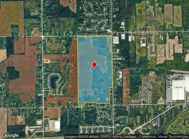
Property Record
S Elms Rd, Swartz Creek, MI 48473

NEARBY LISTINGS FOR SALE OR LEASE
Property Detail
S Elms Rd
04-25-200-003
E 1/2 OF SEC 25, EXCEPT W 340 FT OF E1250 FTOF S250 FT, ALSO EXC BRISTOL ELMS PARK CITY OF SWARTZ CREEK; ALSO EXCEPT A PARCEL
Residentialacreage
Genesee
X
Michigan
26049C0277D
298.64 AC
2024
Flint
2025
Detroit
012802
Flint, MI
DEMOGRAPHICS near S Elms Rd
1 Mile
3 Mile
5 Mile
2024 Total Population
1,976
16,770
46,792
2029 Population
1,927
16,298
45,480
Pop Growth 2024-2029
(2.48%)
(2.81%)
(2.80%)
Average Age
41
44
43
2024 Total Households
768
7,209
19,618
HH Growth 2024-2029
(2.60%)
(2.87%)
(2.89%)
Median Household Inc
$70,672
$58,501
$56,388
Avg Household Size
2.50
2.30
2.30
2024 Avg HH Vehicles
2.00
2.00
2.00
Median Home Value
$165,358
$163,199
$161,724
Median Year Built
1976
1973
1970
Nearby Places
Map Layers
Map Styles
 Street
 Aerial
- Restaurants
- Banks
- Shops
- Fitness
- Groceries
PUBLIC TRANSPORTATION
AIRPORT
Bishop International
DRIVE
WALK
Distance
Bishop International
18 min
5.5 mi
Freight Ports
Port of Toledo
DRIVE
WALK
Distance
Port of Toledo
137 min
115.9 mi
SALE & LEASE HISTORY
LISTING DATE
SALE/LEASE

Aug 11, 2020
For Sale
Nearby Properties
Address
Land Use
TOTAL SIZE
Lot Size
Zoning
Address
Land Use
TOTAL SIZE
Lot Size
Zoning
51.34 AC
I-2
Address
Land Use
TOTAL SIZE
Lot Size
Zoning
179,638 SF
17.78 AC
RM-1
Address
Land Use
TOTAL SIZE
Lot Size
Zoning
190,917 SF
58.79 AC
GBD
Address
Land Use
TOTAL SIZE
Lot Size
Zoning
585,182 SF
78.28 AC
Address
Land Use
TOTAL SIZE
Lot Size
Zoning
99,992 SF
8.39 AC
Address
Land Use
TOTAL SIZE
Lot Size
Zoning
460,000 SF
51.12 AC
PC
Address
Land Use
TOTAL SIZE
Lot Size
Zoning
85,936 SF
12.71 AC
Address
Land Use
TOTAL SIZE
Lot Size
Zoning
61,892 SF
10.61 AC
Address
Land Use
TOTAL SIZE
Lot Size
Zoning
153,343 SF
14.83 AC
Address
Land Use
TOTAL SIZE
Lot Size
Zoning
74.13 AC
I-2
Address
Land Use
TOTAL SIZE
Lot Size
Zoning
27,100 SF
4.73 AC
Address
Land Use
TOTAL SIZE
Lot Size
Zoning
91,712 SF
9 AC
RM-1
Address
Land Use
TOTAL SIZE
Lot Size
Zoning
127,924 SF
22.33 AC
RM-1
Address
Land Use
TOTAL SIZE
Lot Size
Zoning
207,043 SF
24.20 AC
Address
Land Use
TOTAL SIZE
Lot Size
Zoning
214,422 SF
208 AC
Address
Land Use
TOTAL SIZE
Lot Size
Zoning
92,158 SF
8.40 AC
FM,MULT
Address
Land Use
TOTAL SIZE
Lot Size
Zoning
187,019 SF
180 AC
Address
Land Use
TOTAL SIZE
Lot Size
Zoning
235,611 SF
24 AC
Address
Land Use
TOTAL SIZE
Lot Size
Zoning
254,935 SF
3.33 AC
Address
Land Use
TOTAL SIZE
Lot Size
Zoning
64,065 SF
9.19 AC
GBD
Address
Land Use
TOTAL SIZE
Lot Size
Zoning
95,300 SF
9.26 AC
Address
Land Use
TOTAL SIZE
Lot Size
Zoning
132,260 SF
14.50 AC
RM-1
Address
Land Use
TOTAL SIZE
Lot Size
Zoning
55,979 SF
13.87 AC
Address
Land Use
TOTAL SIZE
Lot Size
Zoning
44,297 SF
3.69 AC
GBD
Address
Land Use
TOTAL SIZE
Lot Size
Zoning
1,900 SF
13.71 AC
GC,GENE
Address
Land Use
TOTAL SIZE
Lot Size
Zoning
54,228 SF
4.50 AC
Address
Land Use
TOTAL SIZE
Lot Size
Zoning
95,813 SF
11.26 AC
Address
Land Use
TOTAL SIZE
Lot Size
Zoning
36,258 SF
5.39 AC
Address
Land Use
TOTAL SIZE
Lot Size
Zoning
135,350 SF
12.53 AC
Address
Land Use
TOTAL SIZE
Lot Size
Zoning
57,448 SF
3.50 AC
The World's #1 Commercial Real Estate Marketplace
Connect with us
© 2026 CoStar Group
The information above has been obtained from sources believed reliable. While we do not doubt its accuracy we have not verified it and make no guarantee, warranty or representation about it. It is your responsibility to independently confirm its accuracy and completeness. Any projections, opinions, assumptions, or estimates used are for example only and do not represent the current or future performance of the property. The value of this transaction to you depends on tax and other factors which should be evaluated by your tax, financial, and legal advisors. You and your advisors should conduct a careful, independent investigation of the property to determine to your satisfaction the suitability of the property for your needs.