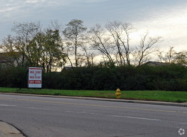
Property Record
S Gilmore Rd, Fairfield, OH 45014

Property Detail
S Gilmore Rd
Cincinnati, OH-KY-IN
365 S 199.08 OF N 764.00 OF W 329.46 LESS RD R/W SEE TIF PCL 050T - FF NORTHEAST-FAIRFIELD TIF
A0700-013-000-050
BUTLER
Commercialacreage
Ohio
B and X Area of moderate flood hazard, usually the area between the limits of the 100-year and 500-year floods.
365
2024
0.98 AC
2025
Butler County
010903
Cincinnati/Dayton
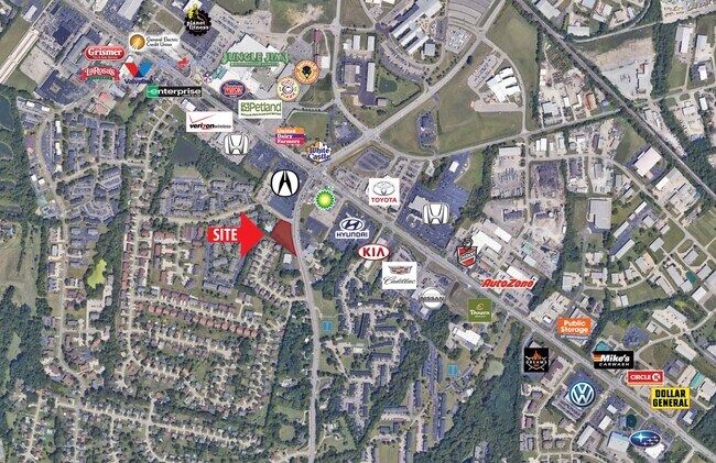
NEARBY LISTINGS FOR SALE OR LEASE
DEMOGRAPHICS near S Gilmore Rd
1 mile
3 mile
5 mile
2025 Total Population
11,094
66,344
167,184
2030 Population
11,471
67,901
170,783
Pop Growth 2025-2030
+ 3.40%
+ 2.35%
+ 2.15%
Average Age
38
40
40
2025 Total Households
4,706
26,797
64,171
HH Growth 2025-2030
+ 3.44%
+ 2.48%
+ 2.27%
Median Household Inc
$60,683
$69,366
$72,009
Avg Household Size
2.30
2.40
2.50
2025 Avg HH Vehicles
2.00
2.00
2.00
Median Home Value
$236,842
$218,620
$225,539
Median Year Built
1981
1976
1976
Nearby Places
Map Layers
Map Styles
 Street
 Aerial
Layers
 Traffic
 Biking
Places
Listings with unknown addresses are not visible on the map
- Restaurants
- Banks
- Shops
- Fitness
- Groceries
PUBLIC TRANSPORTATION
AIRPORT
Cincinnati/Northern Kentucky International
Drive
Walk
Distance
Cincinnati/Northern Kentucky International
57 min
35.8 mi
SALE & LEASE HISTORY
LISTING DATE
SALE/LEASE

Sep 24, 2016
For Sale
Nov 03, 2022
For Sale
Feb 15, 2022
For Lease
Nearby Properties
Address
Land Use
TOTAL SIZE
Lot Size
Zoning
Address
Land Use
TOTAL SIZE
Lot Size
Zoning
40,006 SF
17.23 AC
Address
Land Use
TOTAL SIZE
Lot Size
Zoning
38,880 SF
20.93 AC
Address
Land Use
TOTAL SIZE
Lot Size
Zoning
28.80 AC
Address
Land Use
TOTAL SIZE
Lot Size
Zoning
1,363,493 SF
75.28 AC
Address
Land Use
TOTAL SIZE
Lot Size
Zoning
559,332 SF
29.30 AC
Address
Land Use
TOTAL SIZE
Lot Size
Zoning
706,768 SF
35.92 AC
Address
Land Use
TOTAL SIZE
Lot Size
Zoning
510,080 SF
60.87 AC
Address
Land Use
TOTAL SIZE
Lot Size
Zoning
18.77 AC
Address
Land Use
TOTAL SIZE
Lot Size
Zoning
39.89 AC
Address
Land Use
TOTAL SIZE
Lot Size
Zoning
467,263 SF
27.27 AC
ADV
Address
Land Use
TOTAL SIZE
Lot Size
Zoning
54.77 AC
Address
Land Use
TOTAL SIZE
Lot Size
Zoning
567,230 SF
31.45 AC
Address
Land Use
TOTAL SIZE
Lot Size
Zoning
115,446 SF
20.08 AC
Address
Land Use
TOTAL SIZE
Lot Size
Zoning
438,182 SF
28.80 AC
Address
Land Use
TOTAL SIZE
Lot Size
Zoning
629,044 SF
35.83 AC
Address
Land Use
TOTAL SIZE
Lot Size
Zoning
482,499 SF
27.83 AC
Address
Land Use
TOTAL SIZE
Lot Size
Zoning
4,849 SF
19.98 AC
Address
Land Use
TOTAL SIZE
Lot Size
Zoning
1,700 SF
35.39 AC
Address
Land Use
TOTAL SIZE
Lot Size
Zoning
319,568 SF
23.73 AC
Address
Land Use
TOTAL SIZE
Lot Size
Zoning
111,993 SF
17.34 AC
Address
Land Use
TOTAL SIZE
Lot Size
Zoning
357,452 SF
26.77 AC
Address
Land Use
TOTAL SIZE
Lot Size
Zoning
279,161 SF
28.02 AC
Address
Land Use
TOTAL SIZE
Lot Size
Zoning
506,870 SF
22.20 AC
Address
Land Use
TOTAL SIZE
Lot Size
Zoning
287,433 SF
23.36 AC
Address
Land Use
TOTAL SIZE
Lot Size
Zoning
310,074 SF
21.65 AC
Address
Land Use
TOTAL SIZE
Lot Size
Zoning
374,160 SF
23.98 AC
Address
Land Use
TOTAL SIZE
Lot Size
Zoning
1,602,242 SF
53.34 AC
Address
Land Use
TOTAL SIZE
Lot Size
Zoning
273,436 SF
10.91 AC
Address
Land Use
TOTAL SIZE
Lot Size
Zoning
50,753 SF
19.74 AC
Address
Land Use
TOTAL SIZE
Lot Size
Zoning
24.45 AC
The World's #1 Commercial Real Estate Marketplace
Connect with us
© 2026 CoStar Group
The information above has been obtained from sources believed reliable. While we do not doubt its accuracy we have not verified it and make no guarantee, warranty or representation about it. It is your responsibility to independently confirm its accuracy and completeness. Any projections, opinions, assumptions, or estimates used are for example only and do not represent the current or future performance of the property. The value of this transaction to you depends on tax and other factors which should be evaluated by your tax, financial, and legal advisors. You and your advisors should conduct a careful, independent investigation of the property to determine to your satisfaction the suitability of the property for your needs.