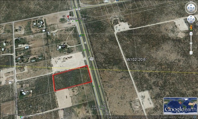
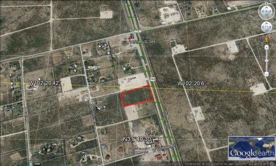
Property Record
S Highway 385, Odessa, TX 79766

Property Detail
S Highway 385
10930-00050-00000
GAGE ACRES BLOCK 1 LOT 5
Commercialnec
ECTOR
ES1
Texas
B and X Area of moderate flood hazard, usually the area between the limits of the 100-year and 500-year floods.
5
2025
4.44 AC
2025
Midland & Odessa
002200
Other Market Areas
9,000 SF
Odessa, TX
NEARBY LISTINGS FOR SALE OR LEASE
DEMOGRAPHICS near S Highway 385
1 mile
3 mile
5 mile
2025 Total Population
704
2,750
5,162
2030 Population
747
2,899
5,456
Pop Growth 2025-2030
+ 6.11%
+ 5.42%
+ 5.70%
Average Age
34
34
34
2025 Total Households
218
841
1,596
HH Growth 2025-2030
+ 7.34%
+ 6.54%
+ 6.89%
Median Household Inc
$59,297
$59,336
$59,269
Avg Household Size
3.20
3.10
3.10
2025 Avg HH Vehicles
3.00
3.00
3.00
Median Home Value
$119,117
$133,333
$133,274
Median Year Built
1993
1994
1993
Nearby Places
Map Layers
Map Styles
 Street
 Aerial
Layers
 Traffic
 Biking
Places
Listings with unknown addresses are not visible on the map
- Restaurants
- Banks
- Shops
- Fitness
- Groceries
PUBLIC TRANSPORTATION
AIRPORT
Midland International Air And Space Port
Drive
Walk
Distance
Midland International Air And Space Port
32 min
24.2 mi
Freight Ports
Port of Corpus Christi
Drive
Walk
Distance
Port of Corpus Christi
486 min
471.8 mi
SALE & LEASE HISTORY
LISTING DATE
SALE/LEASE

Dec 15, 2016
For Sale
Nearby Properties
Address
Land Use
TOTAL SIZE
Lot Size
Zoning
Address
Land Use
TOTAL SIZE
Lot Size
Zoning
9,100 SF
2.53 AC
ES2
Address
Land Use
TOTAL SIZE
Lot Size
Zoning
2,400 SF
4.91 AC
ES2
Address
Land Use
TOTAL SIZE
Lot Size
Zoning
1,400 SF
20.28 AC
ES2
Address
Land Use
TOTAL SIZE
Lot Size
Zoning
2,000 SF
4.91 AC
ES2
Address
Land Use
TOTAL SIZE
Lot Size
Zoning
6,000 SF
10 AC
ES2
Address
Land Use
TOTAL SIZE
Lot Size
Zoning
6,000 SF
7.22 AC
ES1
Address
Land Use
TOTAL SIZE
Lot Size
Zoning
2,000 SF
4.91 AC
ES2
Address
Land Use
TOTAL SIZE
Lot Size
Zoning
6,000 SF
1.26 AC
ES2
Address
Land Use
TOTAL SIZE
Lot Size
Zoning
3,080 SF
1.01 AC
ES2
Address
Land Use
TOTAL SIZE
Lot Size
Zoning
3,200 SF
4.58 AC
ES1
Address
Land Use
TOTAL SIZE
Lot Size
Zoning
4,320 SF
1.01 AC
ES2
Address
Land Use
TOTAL SIZE
Lot Size
Zoning
4,784 SF
4.37 AC
ES1
Address
Land Use
TOTAL SIZE
Lot Size
Zoning
4,800 SF
4.74 AC
ES2
Address
Land Use
TOTAL SIZE
Lot Size
Zoning
2,137 SF
4.39 AC
ES1
Address
Land Use
TOTAL SIZE
Lot Size
Zoning
750 SF
631.94 AC
ES2
Address
Land Use
TOTAL SIZE
Lot Size
Zoning
666.62 AC
ES2
Address
Land Use
TOTAL SIZE
Lot Size
Zoning
400 SF
1 AC
ES1
Address
Land Use
TOTAL SIZE
Lot Size
Zoning
660.78 AC
ES2
Address
Land Use
TOTAL SIZE
Lot Size
Zoning
3,750 SF
5.30 AC
ES2
Address
Land Use
TOTAL SIZE
Lot Size
Zoning
655.20 AC
ES2
Address
Land Use
TOTAL SIZE
Lot Size
Zoning
640.24 AC
ES1
Address
Land Use
TOTAL SIZE
Lot Size
Zoning
640 AC
ES1
Address
Land Use
TOTAL SIZE
Lot Size
Zoning
639.04 AC
ES1
Address
Land Use
TOTAL SIZE
Lot Size
Zoning
1,200 SF
2.38 AC
ES1
Address
Land Use
TOTAL SIZE
Lot Size
Zoning
900 SF
187.87 AC
ES1
Address
Land Use
TOTAL SIZE
Lot Size
Zoning
3,600 SF
4.78 AC
ES1
Address
Land Use
TOTAL SIZE
Lot Size
Zoning
4,048 SF
2 AC
ES1
Address
Land Use
TOTAL SIZE
Lot Size
Zoning
5,200 SF
1.41 AC
ES2
Address
Land Use
TOTAL SIZE
Lot Size
Zoning
1,600 SF
1.70 AC
ES2
The World's #1 Commercial Real Estate Marketplace
Connect with us
© 2026 CoStar Group
The information above has been obtained from sources believed reliable. While we do not doubt its accuracy we have not verified it and make no guarantee, warranty or representation about it. It is your responsibility to independently confirm its accuracy and completeness. Any projections, opinions, assumptions, or estimates used are for example only and do not represent the current or future performance of the property. The value of this transaction to you depends on tax and other factors which should be evaluated by your tax, financial, and legal advisors. You and your advisors should conduct a careful, independent investigation of the property to determine to your satisfaction the suitability of the property for your needs.