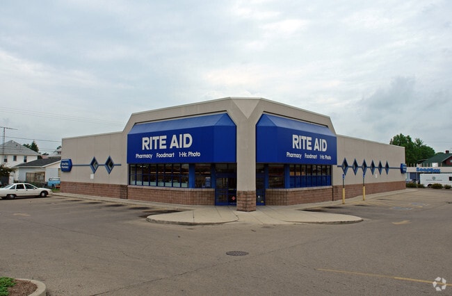
Property Record
S Limestone St, Springfield, OH 45505

Property Detail
S Limestone St
Springfield, OH
SINGER ALL 7243
34-00700-03313-0013
CLARK
Commercialacreage
Ohio
B and X Area of moderate flood hazard, usually the area between the limits of the 100-year and 500-year floods.
15
2024
0.16 AC
2025
Northeast Dayton
001300
Cincinnati/Dayton
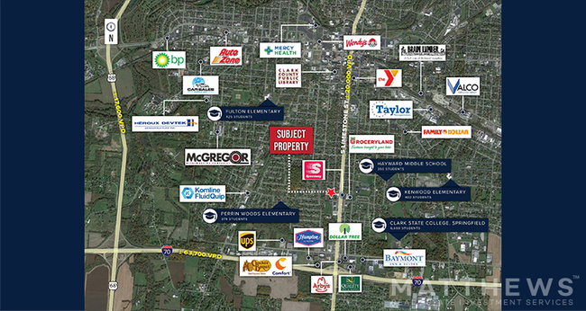
NEARBY LISTINGS FOR SALE OR LEASE
DEMOGRAPHICS near S Limestone St
1 mile
3 mile
5 mile
2025 Total Population
11,606
51,546
77,413
2030 Population
11,852
52,028
77,754
Pop Growth 2025-2030
+ 2.12%
+ 0.94%
+ 0.44%
Average Age
37
39
40
2025 Total Households
4,482
20,616
32,012
HH Growth 2025-2030
+ 1.94%
+ 0.92%
+ 0.41%
Median Household Inc
$29,793
$45,325
$50,678
Avg Household Size
2.40
2.30
2.30
2025 Avg HH Vehicles
2.00
2.00
2.00
Median Home Value
$85,348
$114,790
$150,516
Median Year Built
1949
1948
1955
Nearby Places
Map Layers
Map Styles
 Street
 Aerial
Layers
 Traffic
 Biking
Places
Listings with unknown addresses are not visible on the map
- Restaurants
- Banks
- Shops
- Fitness
- Groceries
PUBLIC TRANSPORTATION
AIRPORT
James M Cox Dayton International
Drive
Walk
Distance
James M Cox Dayton International
32 min
26.2 mi
Freight Ports
Port of Toledo
Drive
Walk
Distance
Port of Toledo
190 min
135.6 mi
SALE & LEASE HISTORY
LISTING DATE
SALE/LEASE

Sep 24, 2016
For Sale
Sep 23, 2016
For Sale
Oct 23, 2024
For Sale
Nov 21, 2017
For Sale
Nov 03, 2022
For Sale
Nearby Properties
Address
Land Use
TOTAL SIZE
Lot Size
Zoning
Address
Land Use
TOTAL SIZE
Lot Size
Zoning
1.20 AC
Address
Land Use
TOTAL SIZE
Lot Size
Zoning
479,515 SF
1.69 AC
Address
Land Use
TOTAL SIZE
Lot Size
Zoning
399,308 SF
11.06 AC
Address
Land Use
TOTAL SIZE
Lot Size
Zoning
32.89 AC
Address
Land Use
TOTAL SIZE
Lot Size
Zoning
17,280 SF
14.32 AC
Address
Land Use
TOTAL SIZE
Lot Size
Zoning
Address
Land Use
TOTAL SIZE
Lot Size
Zoning
234,478 SF
59.28 AC
Address
Land Use
TOTAL SIZE
Lot Size
Zoning
44.85 AC
Address
Land Use
TOTAL SIZE
Lot Size
Zoning
103,458 SF
5.51 AC
Address
Land Use
TOTAL SIZE
Lot Size
Zoning
12,657 SF
8.17 AC
Address
Land Use
TOTAL SIZE
Lot Size
Zoning
399,308 SF
11.06 AC
Address
Land Use
TOTAL SIZE
Lot Size
Zoning
8,316 SF
34.41 AC
R-1
Address
Land Use
TOTAL SIZE
Lot Size
Zoning
47,929 SF
2.77 AC
Address
Land Use
TOTAL SIZE
Lot Size
Zoning
Address
Land Use
TOTAL SIZE
Lot Size
Zoning
225,335 SF
22.73 AC
Address
Land Use
TOTAL SIZE
Lot Size
Zoning
103,589 SF
59.28 AC
Address
Land Use
TOTAL SIZE
Lot Size
Zoning
136,700 SF
14.37 AC
Address
Land Use
TOTAL SIZE
Lot Size
Zoning
56,381 SF
2.37 AC
Address
Land Use
TOTAL SIZE
Lot Size
Zoning
Address
Land Use
TOTAL SIZE
Lot Size
Zoning
Address
Land Use
TOTAL SIZE
Lot Size
Zoning
Address
Land Use
TOTAL SIZE
Lot Size
Zoning
32,566 SF
1.90 AC
Address
Land Use
TOTAL SIZE
Lot Size
Zoning
Address
Land Use
TOTAL SIZE
Lot Size
Zoning
111,936 SF
7.04 AC
Address
Land Use
TOTAL SIZE
Lot Size
Zoning
1.05 AC
Address
Land Use
TOTAL SIZE
Lot Size
Zoning
194,184 SF
24.01 AC
Address
Land Use
TOTAL SIZE
Lot Size
Zoning
Address
Land Use
TOTAL SIZE
Lot Size
Zoning
Address
Land Use
TOTAL SIZE
Lot Size
Zoning
77,006 SF
1.39 AC
Address
Land Use
TOTAL SIZE
Lot Size
Zoning
74,122 SF
3.39 AC
The World's #1 Commercial Real Estate Marketplace
Connect with us
© 2026 CoStar Group
The information above has been obtained from sources believed reliable. While we do not doubt its accuracy we have not verified it and make no guarantee, warranty or representation about it. It is your responsibility to independently confirm its accuracy and completeness. Any projections, opinions, assumptions, or estimates used are for example only and do not represent the current or future performance of the property. The value of this transaction to you depends on tax and other factors which should be evaluated by your tax, financial, and legal advisors. You and your advisors should conduct a careful, independent investigation of the property to determine to your satisfaction the suitability of the property for your needs.