Property Record
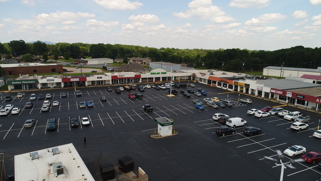
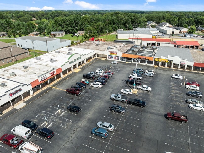
S Main St, King, NC 27021
Current Lease Availabilities
Property Detail
S Main St
599108889487
LOM PL5-81
Commercialnec
STOKES
B-2
North Carolina
B and X Area of moderate flood hazard, usually the area between the limits of the 100-year and 500-year floods.
m & m1
2025
0.07 AC
2025
Stokes County
070506
Greensboro/Winston-Salem
3,200 SF
Winston-Salem, NC
NEARBY LISTINGS FOR SALE OR LEASE
DEMOGRAPHICS near S Main St
1 mile
3 mile
5 mile
2025 Total Population
2,080
14,022
28,264
2030 Population
2,140
14,471
29,211
Pop Growth 2025-2030
+ 2.88%
+ 3.20%
+ 3.35%
Average Age
45
44
43
2025 Total Households
950
5,950
11,822
HH Growth 2025-2030
+ 2.84%
+ 3.24%
+ 3.45%
Median Household Inc
$45,542
$66,117
$68,246
Avg Household Size
2.10
2.30
2.40
2025 Avg HH Vehicles
2.00
2.00
2.00
Median Home Value
$234,400
$237,008
$228,389
Median Year Built
1984
1988
1987
Nearby Places
Map Layers
Map Styles
 Street
 Aerial
Transit
 Traffic
 Biking
Places
Listings with unknown addresses are not visible on the map
- Restaurants
- Banks
- Shops
- Fitness
- Groceries
PUBLIC TRANSPORTATION
AIRPORT
Piedmont Triad International
Drive
Walk
Distance
Piedmont Triad International
51 min
33.7 mi
Freight Ports
Virginia Port Authority - Richmond
Drive
Walk
Distance
Virginia Port Authority - Richmond
278 min
237.3 mi
Nearby Properties
Address
Land Use
TOTAL SIZE
Lot Size
Zoning
Address
Land Use
TOTAL SIZE
Lot Size
Zoning
2,289,130 SF
555.56 AC
GI
Address
Land Use
TOTAL SIZE
Lot Size
Zoning
525,977 SF
248.96 AC
GI,RS20
Address
Land Use
TOTAL SIZE
Lot Size
Zoning
70,969 SF
63.74 AC
R-20
Address
Land Use
TOTAL SIZE
Lot Size
Zoning
20,832 SF
53.09 AC
LI KING,RS
Address
Land Use
TOTAL SIZE
Lot Size
Zoning
158,096 SF
16.42 AC
L-I
Address
Land Use
TOTAL SIZE
Lot Size
Zoning
34,444 SF
44.38 AC
B-2,R-MF-T
Address
Land Use
TOTAL SIZE
Lot Size
Zoning
34,444 SF
44.12 AC
B-2,R-MF-T
Address
Land Use
TOTAL SIZE
Lot Size
Zoning
17,714 SF
5.39 AC
R-15
Address
Land Use
TOTAL SIZE
Lot Size
Zoning
51,393 SF
4.68 AC
R-MF
Address
Land Use
TOTAL SIZE
Lot Size
Zoning
56,034 SF
9.68 AC
B-2
Address
Land Use
TOTAL SIZE
Lot Size
Zoning
30,836 SF
9.33 AC
L-I
Address
Land Use
TOTAL SIZE
Lot Size
Zoning
80,634 SF
8.59 AC
B-2
Address
Land Use
TOTAL SIZE
Lot Size
Zoning
34,510 SF
13.74 AC
B-2
Address
Land Use
TOTAL SIZE
Lot Size
Zoning
43,423 SF
9.86 AC
B-2-CU
Address
Land Use
TOTAL SIZE
Lot Size
Zoning
45,064 SF
5.45 AC
LI,LI KING
Address
Land Use
TOTAL SIZE
Lot Size
Zoning
135,382 SF
10.06 AC
LI KING
Address
Land Use
TOTAL SIZE
Lot Size
Zoning
48,042 SF
14.98 AC
R-20
Address
Land Use
TOTAL SIZE
Lot Size
Zoning
30,276 SF
26.10 AC
AG,IP
Address
Land Use
TOTAL SIZE
Lot Size
Zoning
26,813 SF
2.71 AC
RS20
Address
Land Use
TOTAL SIZE
Lot Size
Zoning
35,040 SF
3.51 AC
L-I
Address
Land Use
TOTAL SIZE
Lot Size
Zoning
32,160 SF
8.30 AC
O-I
Address
Land Use
TOTAL SIZE
Lot Size
Zoning
18,930 SF
2.20 AC
L-I
Address
Land Use
TOTAL SIZE
Lot Size
Zoning
29,553 SF
14.80 AC
R-15
Address
Land Use
TOTAL SIZE
Lot Size
Zoning
12,244 SF
18.58 AC
B-2
Address
Land Use
TOTAL SIZE
Lot Size
Zoning
26,334 SF
22 AC
R-20
Address
Land Use
TOTAL SIZE
Lot Size
Zoning
41,015 SF
2.91 AC
RS20
Address
Land Use
TOTAL SIZE
Lot Size
Zoning
37,604 SF
4.82 AC
R-MF
Address
Land Use
TOTAL SIZE
Lot Size
Zoning
5,250 SF
2.74 AC
B-2
Address
Land Use
TOTAL SIZE
Lot Size
Zoning
9,930 SF
1.65 AC
B-2
Address
Land Use
TOTAL SIZE
Lot Size
Zoning
10,488 SF
4.70 AC
R-MF
The World's #1 Commercial Real Estate Marketplace
Connect with us
© 2026 CoStar Group
The information above has been obtained from sources believed reliable. While we do not doubt its accuracy we have not verified it and make no guarantee, warranty or representation about it. It is your responsibility to independently confirm its accuracy and completeness. Any projections, opinions, assumptions, or estimates used are for example only and do not represent the current or future performance of the property. The value of this transaction to you depends on tax and other factors which should be evaluated by your tax, financial, and legal advisors. You and your advisors should conduct a careful, independent investigation of the property to determine to your satisfaction the suitability of the property for your needs.