Property Record
S New Hope Rd, Gastonia, NC 28056
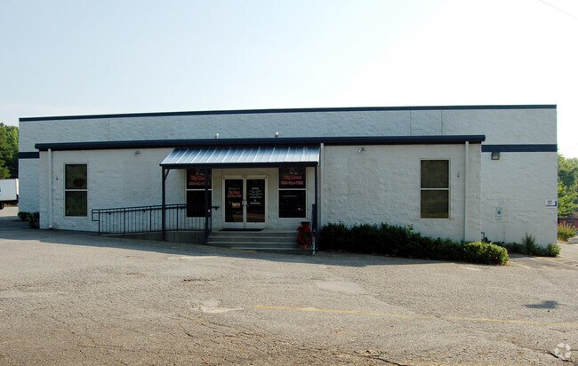
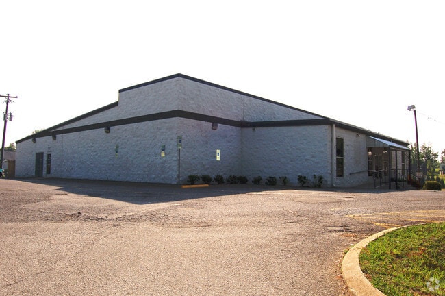

Property Detail
S New Hope Rd
188537
LINEBERGER PROPERTIES L F 15 056 002 02 000
Parkinglot
GASTON
B1
North Carolina
B and X Area of moderate flood hazard, usually the area between the limits of the 100-year and 500-year floods.
0.26 AC
2025
Gaston County
2025
Charlotte
032506
Charlotte-Concord-Gastonia, NC-SC
NEARBY LISTINGS FOR SALE OR LEASE
DEMOGRAPHICS near S New Hope Rd
1 mile
3 mile
5 mile
2025 Total Population
4,076
34,316
88,043
2030 Population
4,341
36,206
92,971
Pop Growth 2025-2030
+ 6.50%
+ 5.51%
+ 5.60%
Average Age
41
40
41
2025 Total Households
1,478
13,855
35,591
HH Growth 2025-2030
+ 6.70%
+ 5.71%
+ 5.80%
Median Household Inc
$123,411
$96,188
$85,735
Avg Household Size
2.70
2.40
2.40
2025 Avg HH Vehicles
2.00
2.00
2.00
Median Home Value
$440,000
$370,690
$359,426
Median Year Built
2001
1992
1990
Nearby Places
Map Layers
Map Styles
 Street
 Aerial
Layers
 Traffic
 Biking
Places
Listings with unknown addresses are not visible on the map
- Restaurants
- Banks
- Shops
- Fitness
- Groceries
PUBLIC TRANSPORTATION
COMMUTER RAIL
Gastonia Amtrak Station (Crescent - Amtrak)
Drive
Walk
Distance
Gastonia Amtrak Station (Crescent - Amtrak)
13 min
6.8 mi
AIRPORT
Charlotte/Douglas International
Drive
Walk
Distance
Charlotte/Douglas International
29 min
12.0 mi
Concord-Padgett Regional
Drive
Walk
Distance
Concord-Padgett Regional
43 min
29.6 mi
Freight Ports
North Charleston Terminal
Drive
Walk
Distance
North Charleston Terminal
238 min
200.2 mi
Nearby Properties
Address
Land Use
TOTAL SIZE
Lot Size
Zoning
Address
Land Use
TOTAL SIZE
Lot Size
Zoning
1,886 SF
39.30 AC
Address
Land Use
TOTAL SIZE
Lot Size
Zoning
25,137 SF
34.81 AC
Address
Land Use
TOTAL SIZE
Lot Size
Zoning
30,906 SF
14.19 AC
Address
Land Use
TOTAL SIZE
Lot Size
Zoning
98.12 AC
Address
Land Use
TOTAL SIZE
Lot Size
Zoning
78.54 AC
GR
Address
Land Use
TOTAL SIZE
Lot Size
Zoning
5,200 SF
22.98 AC
OFF01
Address
Land Use
TOTAL SIZE
Lot Size
Zoning
4,552 SF
9.22 AC
R1
Address
Land Use
TOTAL SIZE
Lot Size
Zoning
13,800 SF
58.55 AC
PUB01
Address
Land Use
TOTAL SIZE
Lot Size
Zoning
5,120 SF
9.42 AC
Address
Land Use
TOTAL SIZE
Lot Size
Zoning
44,718 SF
26.53 AC
OFF10
Address
Land Use
TOTAL SIZE
Lot Size
Zoning
1,596 SF
5.73 AC
OFF01
Address
Land Use
TOTAL SIZE
Lot Size
Zoning
1,969 SF
14.60 AC
Address
Land Use
TOTAL SIZE
Lot Size
Zoning
10,172 SF
33.34 AC
PUB01
Address
Land Use
TOTAL SIZE
Lot Size
Zoning
102,915 SF
39.29 AC
PUB01
Address
Land Use
TOTAL SIZE
Lot Size
Zoning
7,949 SF
7.95 AC
SHOP1
Address
Land Use
TOTAL SIZE
Lot Size
Zoning
67,682 SF
8.86 AC
Address
Land Use
TOTAL SIZE
Lot Size
Zoning
98,868 SF
3.30 AC
Address
Land Use
TOTAL SIZE
Lot Size
Zoning
2,836 SF
74.13 AC
OFF03
Address
Land Use
TOTAL SIZE
Lot Size
Zoning
64,381 SF
8.98 AC
SHOP1
Address
Land Use
TOTAL SIZE
Lot Size
Zoning
480 SF
3.51 AC
APT01
Address
Land Use
TOTAL SIZE
Lot Size
Zoning
1,280 SF
4.83 AC
APT01
Address
Land Use
TOTAL SIZE
Lot Size
Zoning
53,116 SF
14.54 AC
AUTO1
Address
Land Use
TOTAL SIZE
Lot Size
Zoning
27,024 SF
4.94 AC
CHUR2
Address
Land Use
TOTAL SIZE
Lot Size
Zoning
12,810 SF
70.55 AC
INDS2
Address
Land Use
TOTAL SIZE
Lot Size
Zoning
1,827 SF
39.77 AC
Address
Land Use
TOTAL SIZE
Lot Size
Zoning
113.75 AC
Address
Land Use
TOTAL SIZE
Lot Size
Zoning
39,108 SF
5.02 AC
CHUR1
Address
Land Use
TOTAL SIZE
Lot Size
Zoning
12,000 SF
8.11 AC
R1
Address
Land Use
TOTAL SIZE
Lot Size
Zoning
450 SF
3.43 AC
APT01
Address
Land Use
TOTAL SIZE
Lot Size
Zoning
46,460 SF
7.47 AC
MRKT4
The World's #1 Commercial Real Estate Marketplace
Connect with us
© 2026 CoStar Group
The information above has been obtained from sources believed reliable. While we do not doubt its accuracy we have not verified it and make no guarantee, warranty or representation about it. It is your responsibility to independently confirm its accuracy and completeness. Any projections, opinions, assumptions, or estimates used are for example only and do not represent the current or future performance of the property. The value of this transaction to you depends on tax and other factors which should be evaluated by your tax, financial, and legal advisors. You and your advisors should conduct a careful, independent investigation of the property to determine to your satisfaction the suitability of the property for your needs.