Property Record
13430 W 151St St, Olathe, KS 66062

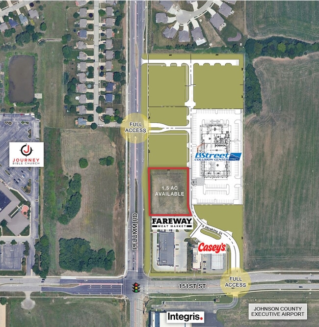
This Property Is For Sale
Property Detail
13430 W 151St St
DP23720000-0002A
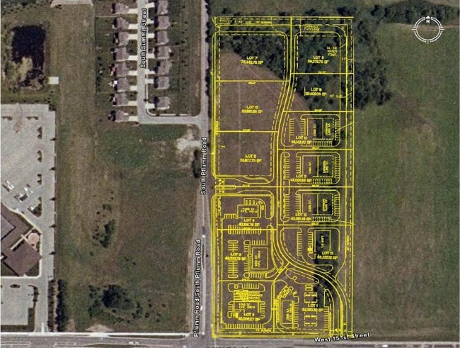
EXECUTIVE PLAZA FIRST PLAT, PT LOT 2 BG SE CR W 220.10 N 285 & 309.10 E 243.05 S 195.48 SELY CUR LF 137.71 SW 110.69 S 194.07 TO POB
Supermarket
JOHNSON
CP-2
Kansas
B and X Area of moderate flood hazard, usually the area between the limits of the 100-year and 500-year floods.
2
2024
3.24 AC
2025
South Johnson County
053426
Kansas City
13,284 SF
Kansas City, MO-KS
NEARBY LISTINGS FOR SALE OR LEASE
DEMOGRAPHICS near 13430 W 151St St
1 mile
3 mile
5 mile
2025 Total Population
6,733
84,978
201,788
2030 Population
6,883
87,511
208,186
Pop Growth 2025-2030
+ 2.23%
+ 2.98%
+ 3.17%
Average Age
38
38
39
2025 Total Households
2,189
28,724
75,571
HH Growth 2025-2030
+ 2.28%
+ 3.06%
+ 3.27%
Median Household Inc
$155,086
$136,757
$112,123
Avg Household Size
3.00
2.90
2.60
2025 Avg HH Vehicles
2.00
2.00
2.00
Median Home Value
$417,798
$441,648
$404,014
Median Year Built
1998
1997
1994
Nearby Places
Map Layers
Map Styles
 Street
 Aerial
Transit
 Traffic
 Biking
Places
Listings with unknown addresses are not visible on the map
- Restaurants
- Banks
- Shops
- Fitness
- Groceries
Nearby Properties
Address
Land Use
TOTAL SIZE
Lot Size
Zoning
Address
Land Use
TOTAL SIZE
Lot Size
Zoning
482,713 SF
77.78 AC
AG
Address
Land Use
TOTAL SIZE
Lot Size
Zoning
512,643 SF
75.55 AC
AG
Address
Land Use
TOTAL SIZE
Lot Size
Zoning
316,630 SF
62.18 AC
RE
Address
Land Use
TOTAL SIZE
Lot Size
Zoning
211,054 SF
72.40 AC
R-1
Address
Land Use
TOTAL SIZE
Lot Size
Zoning
40,647 SF
7.40 AC
R-4
Address
Land Use
TOTAL SIZE
Lot Size
Zoning
32,992 SF
3.85 AC
R-4
Address
Land Use
TOTAL SIZE
Lot Size
Zoning
137,955 SF
23.80 AC
R-1
Address
Land Use
TOTAL SIZE
Lot Size
Zoning
129,325 SF
4.50 AC
R-1
Address
Land Use
TOTAL SIZE
Lot Size
Zoning
146,832 SF
30 AC
R-1
Address
Land Use
TOTAL SIZE
Lot Size
Zoning
150,122 SF
17.48 AC
R-1
Address
Land Use
TOTAL SIZE
Lot Size
Zoning
61,479 SF
8.14 AC
C-2
Address
Land Use
TOTAL SIZE
Lot Size
Zoning
157,344 SF
12.69 AC
R-1
Address
Land Use
TOTAL SIZE
Lot Size
Zoning
130,605 SF
18.01 AC
R-1
Address
Land Use
TOTAL SIZE
Lot Size
Zoning
86,095 SF
16.95 AC
R-1
Address
Land Use
TOTAL SIZE
Lot Size
Zoning
69,855 SF
6.86 AC
R
Address
Land Use
TOTAL SIZE
Lot Size
Zoning
81,753 SF
20.88 AC
R-1
Address
Land Use
TOTAL SIZE
Lot Size
Zoning
117,084 SF
10.69 AC
R-1
Address
Land Use
TOTAL SIZE
Lot Size
Zoning
71,221 SF
13.84 AC
R-1
Address
Land Use
TOTAL SIZE
Lot Size
Zoning
55,263 SF
10.81 AC
R-1A
Address
Land Use
TOTAL SIZE
Lot Size
Zoning
81,096 SF
121.30 AC
AG
Address
Land Use
TOTAL SIZE
Lot Size
Zoning
115,263 SF
23.66 AC
R-1
Address
Land Use
TOTAL SIZE
Lot Size
Zoning
73,159 SF
12.54 AC
R-1
Address
Land Use
TOTAL SIZE
Lot Size
Zoning
65,388 SF
19.09 AC
RURJ
Address
Land Use
TOTAL SIZE
Lot Size
Zoning
72,091 SF
11.33 AC
R-1
Address
Land Use
TOTAL SIZE
Lot Size
Zoning
81,229 SF
34.32 AC
CP-O
Address
Land Use
TOTAL SIZE
Lot Size
Zoning
69,723 SF
11.29 AC
R-1
Address
Land Use
TOTAL SIZE
Lot Size
Zoning
72,324 SF
8.84 AC
R-1
Address
Land Use
TOTAL SIZE
Lot Size
Zoning
60,223 SF
5.91 AC
R-1
Address
Land Use
TOTAL SIZE
Lot Size
Zoning
62,832 SF
15.43 AC
CTY RUR
Address
Land Use
TOTAL SIZE
Lot Size
Zoning
54,005 SF
10.49 AC
R-1/PUD
The World's #1 Commercial Real Estate Marketplace
Connect with us
© 2026 CoStar Group
The information above has been obtained from sources believed reliable. While we do not doubt its accuracy we have not verified it and make no guarantee, warranty or representation about it. It is your responsibility to independently confirm its accuracy and completeness. Any projections, opinions, assumptions, or estimates used are for example only and do not represent the current or future performance of the property. The value of this transaction to you depends on tax and other factors which should be evaluated by your tax, financial, and legal advisors. You and your advisors should conduct a careful, independent investigation of the property to determine to your satisfaction the suitability of the property for your needs.