Property Record
S Providence Rd, , NC


Property Detail
S Providence Rd
06-150-001
HEMBY S PROVIDENCE RD
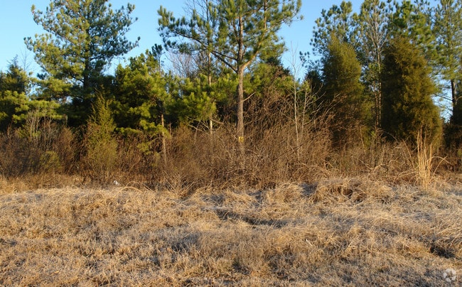
Agriculturalland
UNION
RCD WEDDIN
North Carolina
B and X Area of moderate flood hazard, usually the area between the limits of the 100-year and 500-year floods.
78 AC
2025
Union County
2025
Charlotte
021012
Charlotte-Concord-Gastonia, NC-SC
NEARBY LISTINGS FOR SALE OR LEASE
-
-
View all listings for sale on LoopNet.com
DEMOGRAPHICS near S Providence Rd
1 mile
3 mile
5 mile
2024 Total Population
1,862
42,223
129,292
2029 Population
2,017
45,445
139,463
Pop Growth 2024-2029
+ 8.32%
+ 7.63%
+ 7.87%
Average Age
40
39
39
2024 Total Households
564
13,871
44,004
HH Growth 2024-2029
+ 8.51%
+ 7.92%
+ 8.05%
Median Household Inc
$225,926
$178,726
$155,001
Avg Household Size
3.30
3.00
2.90
2024 Avg HH Vehicles
2.00
2.00
2.00
Median Home Value
$1,047,077
$802,396
$700,242
Median Year Built
2003
2005
2003
Nearby Places
Map Layers
Map Styles
 Street
 Aerial
Transit
 Traffic
 Biking
Places
Listings with unknown addresses are not visible on the map
- Restaurants
- Banks
- Shops
- Fitness
- Groceries
PUBLIC TRANSPORTATION
AIRPORT
Charlotte/Douglas International
Drive
Walk
Distance
Charlotte/Douglas International
33 min
21.7 mi
Concord-Padgett Regional
Drive
Walk
Distance
Concord-Padgett Regional
42 min
34.2 mi
Freight Ports
North Charleston Terminal
Drive
Walk
Distance
North Charleston Terminal
228 min
194.9 mi
SALE & LEASE HISTORY
LISTING DATE
SALE/LEASE

Sep 24, 2016
For Sale
Oct 03, 2023
For Sale
Nearby Properties
Address
Land Use
TOTAL SIZE
Lot Size
Zoning
Address
Land Use
TOTAL SIZE
Lot Size
Zoning
476,565 SF
13.18 AC
Address
Land Use
TOTAL SIZE
Lot Size
Zoning
324,188 SF
51.13 AC
Address
Land Use
TOTAL SIZE
Lot Size
Zoning
208,338 SF
114.77 AC
RE WEDDING
Address
Land Use
TOTAL SIZE
Lot Size
Zoning
261,874 SF
7.18 AC
Address
Land Use
TOTAL SIZE
Lot Size
Zoning
248,806 SF
6.12 AC
Address
Land Use
TOTAL SIZE
Lot Size
Zoning
296,002 SF
3 AC
Address
Land Use
TOTAL SIZE
Lot Size
Zoning
315,524 SF
3.84 AC
Address
Land Use
TOTAL SIZE
Lot Size
Zoning
234,773 SF
12.96 AC
Address
Land Use
TOTAL SIZE
Lot Size
Zoning
222,310 SF
3.51 AC
Address
Land Use
TOTAL SIZE
Lot Size
Zoning
117,672 SF
16.68 AC
CC
Address
Land Use
TOTAL SIZE
Lot Size
Zoning
192,527 SF
24.08 AC
Address
Land Use
TOTAL SIZE
Lot Size
Zoning
154,021 SF
15.08 AC
Address
Land Use
TOTAL SIZE
Lot Size
Zoning
121,464 SF
13.35 AC
Address
Land Use
TOTAL SIZE
Lot Size
Zoning
7.54 AC
Address
Land Use
TOTAL SIZE
Lot Size
Zoning
132,576 SF
3.54 AC
Address
Land Use
TOTAL SIZE
Lot Size
Zoning
134,936 SF
10 AC
MX-1(INNOV
Address
Land Use
TOTAL SIZE
Lot Size
Zoning
84,475 SF
15.19 AC
CC
Address
Land Use
TOTAL SIZE
Lot Size
Zoning
121,812 SF
13.92 AC
CC
Address
Land Use
TOTAL SIZE
Lot Size
Zoning
73.37 AC
Address
Land Use
TOTAL SIZE
Lot Size
Zoning
150,123 SF
1.62 AC
Address
Land Use
TOTAL SIZE
Lot Size
Zoning
78,180 SF
8 AC
R-3
Address
Land Use
TOTAL SIZE
Lot Size
Zoning
89,484 SF
2.05 AC
MUDD-O
Address
Land Use
TOTAL SIZE
Lot Size
Zoning
42,700 SF
3.87 AC
Address
Land Use
TOTAL SIZE
Lot Size
Zoning
63,164 SF
10.13 AC
B2CD
Address
Land Use
TOTAL SIZE
Lot Size
Zoning
87,054 SF
0.86 AC
Address
Land Use
TOTAL SIZE
Lot Size
Zoning
28,165 SF
76.76 AC
R-40 UNION
Address
Land Use
TOTAL SIZE
Lot Size
Zoning
106,124 SF
1.15 AC
R-3
Address
Land Use
TOTAL SIZE
Lot Size
Zoning
93,098 SF
53.97 AC
R-40 UNION
Address
Land Use
TOTAL SIZE
Lot Size
Zoning
82,277 SF
1.59 AC
Address
Land Use
TOTAL SIZE
Lot Size
Zoning
93,956 SF
21.28 AC
R-40 MARVI
The World's #1 Commercial Real Estate Marketplace
Connect with us
© 2026 CoStar Group
The information above has been obtained from sources believed reliable. While we do not doubt its accuracy we have not verified it and make no guarantee, warranty or representation about it. It is your responsibility to independently confirm its accuracy and completeness. Any projections, opinions, assumptions, or estimates used are for example only and do not represent the current or future performance of the property. The value of this transaction to you depends on tax and other factors which should be evaluated by your tax, financial, and legal advisors. You and your advisors should conduct a careful, independent investigation of the property to determine to your satisfaction the suitability of the property for your needs.