Property Record
S Providence Rd, Waxhaw, NC 28173


Property Detail
S Providence Rd
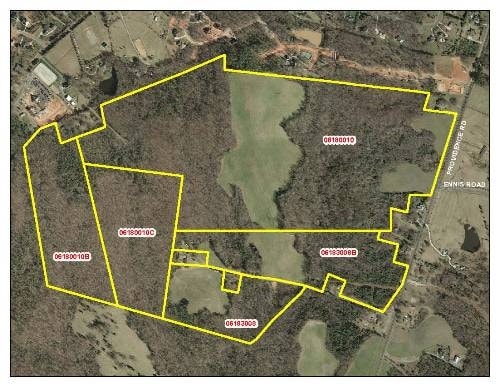
06-180-010-C
ROBICSEK S PROVIDENCE RD
Agriculturalland
UNION
RCD WEDDIN
North Carolina
B and X Area of moderate flood hazard, usually the area between the limits of the 100-year and 500-year floods.
30.71 AC
0
Union County
2025
Charlotte
021013
Charlotte-Concord-Gastonia, NC-SC
NEARBY LISTINGS FOR SALE OR LEASE
-
-
View all Waxhaw listings for sale on LoopNet.com
DEMOGRAPHICS near S Providence Rd
1 mile
3 mile
5 mile
2025 Total Population
3,081
37,921
133,038
2030 Population
3,329
40,542
144,849
Pop Growth 2025-2030
+ 8.05%
+ 6.91%
+ 8.88%
Average Age
39
39
39
2025 Total Households
894
11,491
45,916
HH Growth 2025-2030
+ 8.17%
+ 7.07%
+ 9.15%
Median Household Inc
$239,785
$201,896
$147,570
Avg Household Size
3.50
3.30
2.90
2025 Avg HH Vehicles
3.00
2.00
2.00
Median Home Value
$1,039,235
$815,818
$667,053
Median Year Built
2005
2004
2006
Nearby Places
Map Layers
Map Styles
 Street
 Aerial
Layers
 Traffic
 Biking
Places
Listings with unknown addresses are not visible on the map
- Restaurants
- Banks
- Shops
- Fitness
- Groceries
PUBLIC TRANSPORTATION
AIRPORT
Charlotte/Douglas International
Drive
Walk
Distance
Charlotte/Douglas International
39 min
23.4 mi
Concord-Padgett Regional
Drive
Walk
Distance
Concord-Padgett Regional
48 min
35.7 mi
Nearby Properties
Address
Land Use
TOTAL SIZE
Lot Size
Zoning
Address
Land Use
TOTAL SIZE
Lot Size
Zoning
324,188 SF
51.13 AC
Address
Land Use
TOTAL SIZE
Lot Size
Zoning
223,642 SF
76.75 AC
R-40 UNION
Address
Land Use
TOTAL SIZE
Lot Size
Zoning
170,725 SF
199.20 AC
R-40 UNION
Address
Land Use
TOTAL SIZE
Lot Size
Zoning
117,672 SF
16.68 AC
CC
Address
Land Use
TOTAL SIZE
Lot Size
Zoning
79,858 SF
28.88 AC
CU C-3 WAX
Address
Land Use
TOTAL SIZE
Lot Size
Zoning
84,475 SF
15.19 AC
CC
Address
Land Use
TOTAL SIZE
Lot Size
Zoning
28,165 SF
76.76 AC
R-40 UNION
Address
Land Use
TOTAL SIZE
Lot Size
Zoning
93,098 SF
53.97 AC
R-40 UNION
Address
Land Use
TOTAL SIZE
Lot Size
Zoning
93,098 SF
25.09 AC
R-40 UNION
Address
Land Use
TOTAL SIZE
Lot Size
Zoning
141,212 SF
14.59 AC
CU C-3 WAX
Address
Land Use
TOTAL SIZE
Lot Size
Zoning
93,956 SF
21.28 AC
R-40 MARVI
Address
Land Use
TOTAL SIZE
Lot Size
Zoning
55,004 SF
2.64 AC
O-1(CD)
Address
Land Use
TOTAL SIZE
Lot Size
Zoning
52,429 SF
10 AC
B-2 WEDDIN
Address
Land Use
TOTAL SIZE
Lot Size
Zoning
86,824 SF
7.68 AC
B-2 UNION
Address
Land Use
TOTAL SIZE
Lot Size
Zoning
28.11 AC
R-6 UNION
Address
Land Use
TOTAL SIZE
Lot Size
Zoning
105,891 SF
4.50 AC
B-2 UNION
Address
Land Use
TOTAL SIZE
Lot Size
Zoning
10,783 SF
71.71 AC
R-40 MARVI
Address
Land Use
TOTAL SIZE
Lot Size
Zoning
145.32 AC
RCD WEDDIN
Address
Land Use
TOTAL SIZE
Lot Size
Zoning
42,712 SF
12.57 AC
R3
Address
Land Use
TOTAL SIZE
Lot Size
Zoning
Address
Land Use
TOTAL SIZE
Lot Size
Zoning
21,261 SF
7.64 AC
RCD WEDDIN
Address
Land Use
TOTAL SIZE
Lot Size
Zoning
32,450 SF
5.87 AC
R-40 UNION
Address
Land Use
TOTAL SIZE
Lot Size
Zoning
22,059 SF
8.40 AC
R-40 UNION
Address
Land Use
TOTAL SIZE
Lot Size
Zoning
0.94 AC
RCD WEDDIN
Address
Land Use
TOTAL SIZE
Lot Size
Zoning
25,279 SF
12.83 AC
RCD WEDDIN
Address
Land Use
TOTAL SIZE
Lot Size
Zoning
2.65 AC
R-40 MARVI
Address
Land Use
TOTAL SIZE
Lot Size
Zoning
11,476 SF
16.17 AC
INSTCD
Address
Land Use
TOTAL SIZE
Lot Size
Zoning
1.54 AC
R-20 UNION
Address
Land Use
TOTAL SIZE
Lot Size
Zoning
14,372 SF
5.06 AC
MX WEDDING
Address
Land Use
TOTAL SIZE
Lot Size
Zoning
1.18 AC
R-20 UNION
The World's #1 Commercial Real Estate Marketplace
Connect with us
© 2026 CoStar Group
The information above has been obtained from sources believed reliable. While we do not doubt its accuracy we have not verified it and make no guarantee, warranty or representation about it. It is your responsibility to independently confirm its accuracy and completeness. Any projections, opinions, assumptions, or estimates used are for example only and do not represent the current or future performance of the property. The value of this transaction to you depends on tax and other factors which should be evaluated by your tax, financial, and legal advisors. You and your advisors should conduct a careful, independent investigation of the property to determine to your satisfaction the suitability of the property for your needs.