Property Record
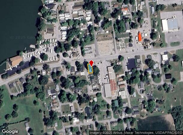
S R 366, Russells Point, OH 43348


NEARBY LISTINGS FOR SALE OR LEASE
Property Detail
S R 366
51-032-16-05-004-000
Five Parks Allot
Storebuilding
4804 51
X
Logan
39091C0155E
Ohio
2024
0.08 AC
2024
Ohio South Area
004200
Other Market Areas
1,292 SF
Bellefontaine, OH
DEMOGRAPHICS near S R 366
1 Mile
3 Mile
5 Mile
2024 Total Population
1,688
6,336
12,698
2029 Population
1,774
6,680
13,214
Pop Growth 2024-2029
+ 5.09%
+ 5.43%
+ 4.06%
Average Age
46
47
47
2024 Total Households
791
3,032
5,963
HH Growth 2024-2029
+ 5.18%
+ 5.47%
+ 4.23%
Median Household Inc
$70,898
$55,303
$58,132
Avg Household Size
2.00
2.10
2.10
2024 Avg HH Vehicles
2.00
2.00
2.00
Median Home Value
$193,509
$198,866
$194,769
Median Year Built
1983
1976
1976
Nearby Places
Map Layers
Map Styles
 Street
 Aerial
- Restaurants
- Banks
- Shops
- Fitness
- Groceries
SALE & LEASE HISTORY
LISTING DATE
SALE/LEASE

May 31, 2017
For Sale
Nearby Properties
Address
Land Use
TOTAL SIZE
Lot Size
Zoning
Address
Land Use
TOTAL SIZE
Lot Size
Zoning
133,600 SF
49.42 AC
Address
Land Use
TOTAL SIZE
Lot Size
Zoning
72,752 SF
58.34 AC
Address
Land Use
TOTAL SIZE
Lot Size
Zoning
64,102 SF
88.14 AC
Address
Land Use
TOTAL SIZE
Lot Size
Zoning
2,152 SF
73.14 AC
Address
Land Use
TOTAL SIZE
Lot Size
Zoning
24.57 AC
Address
Land Use
TOTAL SIZE
Lot Size
Zoning
10.84 AC
Address
Land Use
TOTAL SIZE
Lot Size
Zoning
27,750 SF
4.60 AC
Address
Land Use
TOTAL SIZE
Lot Size
Zoning
56.03 AC
Address
Land Use
TOTAL SIZE
Lot Size
Zoning
4,872 SF
5 AC
Address
Land Use
TOTAL SIZE
Lot Size
Zoning
798 SF
2.47 AC
Address
Land Use
TOTAL SIZE
Lot Size
Zoning
322.96 AC
Address
Land Use
TOTAL SIZE
Lot Size
Zoning
41,050 SF
9.36 AC
Address
Land Use
TOTAL SIZE
Lot Size
Zoning
5,400 SF
39.97 AC
Address
Land Use
TOTAL SIZE
Lot Size
Zoning
5,192 SF
2.32 AC
Address
Land Use
TOTAL SIZE
Lot Size
Zoning
232.36 AC
Address
Land Use
TOTAL SIZE
Lot Size
Zoning
Address
Land Use
TOTAL SIZE
Lot Size
Zoning
10,004 SF
2.06 AC
Address
Land Use
TOTAL SIZE
Lot Size
Zoning
7,825 SF
0.64 AC
Address
Land Use
TOTAL SIZE
Lot Size
Zoning
203.11 AC
Address
Land Use
TOTAL SIZE
Lot Size
Zoning
6.90 AC
Address
Land Use
TOTAL SIZE
Lot Size
Zoning
Address
Land Use
TOTAL SIZE
Lot Size
Zoning
4.85 AC
Address
Land Use
TOTAL SIZE
Lot Size
Zoning
4.23 AC
Address
Land Use
TOTAL SIZE
Lot Size
Zoning
159.94 AC
Address
Land Use
TOTAL SIZE
Lot Size
Zoning
1,774 SF
0.58 AC
Address
Land Use
TOTAL SIZE
Lot Size
Zoning
164.73 AC
Address
Land Use
TOTAL SIZE
Lot Size
Zoning
15,645 SF
2.50 AC
Address
Land Use
TOTAL SIZE
Lot Size
Zoning
7,580 SF
1.65 AC
Address
Land Use
TOTAL SIZE
Lot Size
Zoning
11,583 SF
2.26 AC
Address
Land Use
TOTAL SIZE
Lot Size
Zoning
3,832 SF
0.39 AC
The World's #1 Commercial Real Estate Marketplace
Connect with us
© 2025 CoStar Group
The information above has been obtained from sources believed reliable. While we do not doubt its accuracy we have not verified it and make no guarantee, warranty or representation about it. It is your responsibility to independently confirm its accuracy and completeness. Any projections, opinions, assumptions, or estimates used are for example only and do not represent the current or future performance of the property. The value of this transaction to you depends on tax and other factors which should be evaluated by your tax, financial, and legal advisors. You and your advisors should conduct a careful, independent investigation of the property to determine to your satisfaction the suitability of the property for your needs.