Property Record
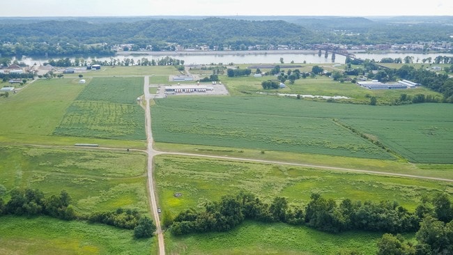
S R 7, Gallipolis, OH 45631

Property Detail
S R 7
Gallipolis, OH
S W COR N W 1/4 LOT 505 V246 P197
002-001-029-00
GALLIA
Commercialnec
Ohio
AE The base floodplain where base flood elevations are provided. AE Zones are now used on new format FIRMs instead of A1-A30 Zones.
505
2025
7 AC
2025
Ohio South Area
954000
Other Market Areas
50,550 SF
NEARBY LISTINGS FOR SALE OR LEASE
DEMOGRAPHICS near S R 7
1 mile
3 mile
5 mile
2025 Total Population
1,772
7,048
13,872
2030 Population
1,755
6,974
13,713
Pop Growth 2025-2030
(0.96%)
(1.05%)
(1.15%)
Average Age
43
43
43
2025 Total Households
815
3,174
6,092
HH Growth 2025-2030
(0.74%)
(1.01%)
(1.15%)
Median Household Inc
$40,385
$42,500
$47,659
Avg Household Size
2.10
2.10
2.20
2025 Avg HH Vehicles
1.00
2.00
2.00
Median Home Value
$129,394
$127,316
$140,873
Median Year Built
1972
1965
1969
Nearby Places
Map Layers
Map Styles
 Street
 Aerial
Layers
 Traffic
 Biking
Places
Listings with unknown addresses are not visible on the map
- Restaurants
- Banks
- Shops
- Fitness
- Groceries
SALE & LEASE HISTORY
LISTING DATE
SALE/LEASE

Sep 25, 2016
For Lease
Sep 24, 2016
For Sale
Nearby Properties
Address
Land Use
TOTAL SIZE
Lot Size
Zoning
Address
Land Use
TOTAL SIZE
Lot Size
Zoning
22.67 AC
Address
Land Use
TOTAL SIZE
Lot Size
Zoning
1,072 SF
247.90 AC
Address
Land Use
TOTAL SIZE
Lot Size
Zoning
Address
Land Use
TOTAL SIZE
Lot Size
Zoning
7.52 AC
Address
Land Use
TOTAL SIZE
Lot Size
Zoning
0.77 AC
Address
Land Use
TOTAL SIZE
Lot Size
Zoning
179,444 SF
23.37 AC
Address
Land Use
TOTAL SIZE
Lot Size
Zoning
33.65 AC
Address
Land Use
TOTAL SIZE
Lot Size
Zoning
4.37 AC
Address
Land Use
TOTAL SIZE
Lot Size
Zoning
83.70 AC
Address
Land Use
TOTAL SIZE
Lot Size
Zoning
76,268 SF
14.43 AC
Address
Land Use
TOTAL SIZE
Lot Size
Zoning
Address
Land Use
TOTAL SIZE
Lot Size
Zoning
Address
Land Use
TOTAL SIZE
Lot Size
Zoning
4,000 SF
17.70 AC
Address
Land Use
TOTAL SIZE
Lot Size
Zoning
25,516 SF
4.08 AC
Address
Land Use
TOTAL SIZE
Lot Size
Zoning
180,646 SF
22.34 AC
Address
Land Use
TOTAL SIZE
Lot Size
Zoning
5.03 AC
Address
Land Use
TOTAL SIZE
Lot Size
Zoning
12.54 AC
Address
Land Use
TOTAL SIZE
Lot Size
Zoning
54,471 SF
3.81 AC
Address
Land Use
TOTAL SIZE
Lot Size
Zoning
158,000 SF
21.35 AC
Address
Land Use
TOTAL SIZE
Lot Size
Zoning
22,995 SF
6.79 AC
Address
Land Use
TOTAL SIZE
Lot Size
Zoning
47.27 AC
Address
Land Use
TOTAL SIZE
Lot Size
Zoning
22,200 SF
3.41 AC
Address
Land Use
TOTAL SIZE
Lot Size
Zoning
0.72 AC
Address
Land Use
TOTAL SIZE
Lot Size
Zoning
85,022 SF
9.74 AC
Address
Land Use
TOTAL SIZE
Lot Size
Zoning
3,572 SF
65.41 AC
Address
Land Use
TOTAL SIZE
Lot Size
Zoning
1.96 AC
Address
Land Use
TOTAL SIZE
Lot Size
Zoning
Address
Land Use
TOTAL SIZE
Lot Size
Zoning
7.01 AC
Address
Land Use
TOTAL SIZE
Lot Size
Zoning
Address
Land Use
TOTAL SIZE
Lot Size
Zoning
41,328 SF
1.88 AC
The World's #1 Commercial Real Estate Marketplace
Connect with us
© 2026 CoStar Group
The information above has been obtained from sources believed reliable. While we do not doubt its accuracy we have not verified it and make no guarantee, warranty or representation about it. It is your responsibility to independently confirm its accuracy and completeness. Any projections, opinions, assumptions, or estimates used are for example only and do not represent the current or future performance of the property. The value of this transaction to you depends on tax and other factors which should be evaluated by your tax, financial, and legal advisors. You and your advisors should conduct a careful, independent investigation of the property to determine to your satisfaction the suitability of the property for your needs.