Property Record
S Rt 59, Plainfield, IL 60544


Save to a Folder
{{folder.Name}}
{{folder.ListingIds.length}} Properties
{{folder.ListingIds.length}} Property
Create a New Folder
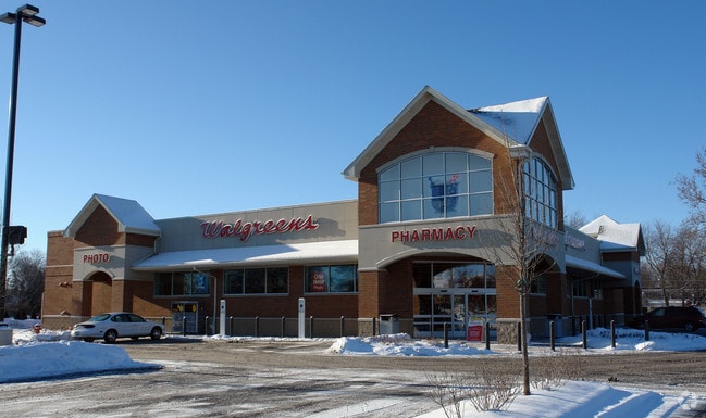
Property Detail
S Rt 59
Chicago-Naperville-Elgin, IL-IN
THE NE'LY 12 FT OF THE NW'LY 100 FT OF LOT 2, ALSO THE NW'LY 100 FT OF THE SW'LY 18 FT OF LOT 1 IN BLK IN OF ARNOLD'S ADDITIO
06-03-09-406-014
WILL
Commercialnec
Illinois
B and X Area of moderate flood hazard, usually the area between the limits of the 100-year and 500-year floods.
1
2025
0.14 AC
2024
Joliet/Central Will
880411
Chicago
1,299 SF
NEARBY LISTINGS FOR SALE OR LEASE
DEMOGRAPHICS near S Rt 59
1 mile
3 mile
5 mile
2025 Total Population
6,639
51,791
160,663
2030 Population
6,895
53,150
163,907
Pop Growth 2025-2030
+ 3.86%
+ 2.62%
+ 2.02%
Average Age
40
38
39
2025 Total Households
2,261
16,306
52,167
HH Growth 2025-2030
+ 3.76%
+ 2.59%
+ 2.01%
Median Household Inc
$103,388
$122,426
$116,651
Avg Household Size
2.80
3.10
3.00
2025 Avg HH Vehicles
2.00
2.00
2.00
Median Home Value
$370,986
$370,264
$330,133
Median Year Built
1997
2000
2000
Nearby Places
Map Layers
Map Styles
 Street
 Aerial
Layers
 Traffic
 Biking
Places
Listings with unknown addresses are not visible on the map
- Restaurants
- Banks
- Shops
- Fitness
- Groceries
PUBLIC TRANSPORTATION
COMMUTER RAIL
Lockport (Heritage Corridor - Metra)
Drive
Walk
Distance
Lockport (Heritage Corridor - Metra)
20 min
9.2 mi
AIRPORT
Chicago Midway International
Drive
Walk
Distance
Chicago Midway International
38 min
27.7 mi
Chicago O'Hare International
Drive
Walk
Distance
Chicago O'Hare International
55 min
39.1 mi
Freight Ports
Port Milwaukee
Drive
Walk
Distance
Port Milwaukee
136 min
110.8 mi
SALE & LEASE HISTORY
LISTING DATE
SALE/LEASE

Jan 30, 2020
For Sale
Nearby Properties
Address
Land Use
TOTAL SIZE
Lot Size
Zoning
Address
Land Use
TOTAL SIZE
Lot Size
Zoning
135.28 AC
Address
Land Use
TOTAL SIZE
Lot Size
Zoning
952,135 SF
21.86 AC
Address
Land Use
TOTAL SIZE
Lot Size
Zoning
20.75 AC
Address
Land Use
TOTAL SIZE
Lot Size
Zoning
14.67 AC
Address
Land Use
TOTAL SIZE
Lot Size
Zoning
12.47 AC
Address
Land Use
TOTAL SIZE
Lot Size
Zoning
14.59 AC
Address
Land Use
TOTAL SIZE
Lot Size
Zoning
10.47 AC
Address
Land Use
TOTAL SIZE
Lot Size
Zoning
33.04 AC
Address
Land Use
TOTAL SIZE
Lot Size
Zoning
448,352 SF
15.67 AC
Address
Land Use
TOTAL SIZE
Lot Size
Zoning
30.80 AC
Address
Land Use
TOTAL SIZE
Lot Size
Zoning
23.79 AC
Address
Land Use
TOTAL SIZE
Lot Size
Zoning
24.91 AC
Address
Land Use
TOTAL SIZE
Lot Size
Zoning
29.03 AC
Address
Land Use
TOTAL SIZE
Lot Size
Zoning
232,964 SF
28.66 AC
Address
Land Use
TOTAL SIZE
Lot Size
Zoning
36.79 AC
Address
Land Use
TOTAL SIZE
Lot Size
Zoning
1.66 AC
Address
Land Use
TOTAL SIZE
Lot Size
Zoning
643,468 SF
14.77 AC
Address
Land Use
TOTAL SIZE
Lot Size
Zoning
521,457 SF
11.97 AC
Address
Land Use
TOTAL SIZE
Lot Size
Zoning
42.16 AC
Address
Land Use
TOTAL SIZE
Lot Size
Zoning
Address
Land Use
TOTAL SIZE
Lot Size
Zoning
8.10 AC
Address
Land Use
TOTAL SIZE
Lot Size
Zoning
345,727 SF
7.94 AC
Address
Land Use
TOTAL SIZE
Lot Size
Zoning
7.08 AC
Address
Land Use
TOTAL SIZE
Lot Size
Zoning
8.85 AC
Address
Land Use
TOTAL SIZE
Lot Size
Zoning
7.23 AC
Address
Land Use
TOTAL SIZE
Lot Size
Zoning
Address
Land Use
TOTAL SIZE
Lot Size
Zoning
4.89 AC
Address
Land Use
TOTAL SIZE
Lot Size
Zoning
12.66 AC
Address
Land Use
TOTAL SIZE
Lot Size
Zoning
48.21 AC
Address
Land Use
TOTAL SIZE
Lot Size
Zoning
20.40 AC
The World's #1 Commercial Real Estate Marketplace
Connect with us
© 2026 CoStar Group
The information above has been obtained from sources believed reliable. While we do not doubt its accuracy we have not verified it and make no guarantee, warranty or representation about it. It is your responsibility to independently confirm its accuracy and completeness. Any projections, opinions, assumptions, or estimates used are for example only and do not represent the current or future performance of the property. The value of this transaction to you depends on tax and other factors which should be evaluated by your tax, financial, and legal advisors. You and your advisors should conduct a careful, independent investigation of the property to determine to your satisfaction the suitability of the property for your needs.