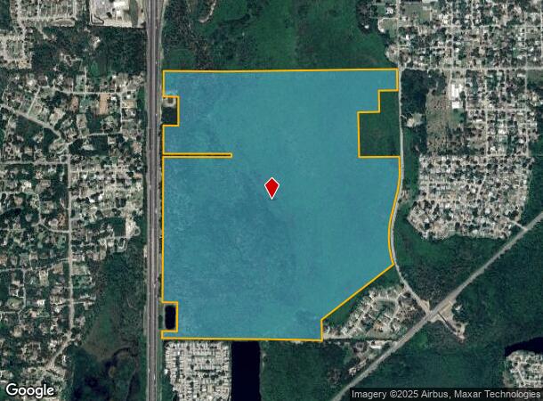
Property Record
1909 Unknown, Titusville, FL 32796
NEARBY LISTINGS FOR SALE OR LEASE
Property Detail
1909 Unknown
22-35-05-00-00262.0-0000.00
S 3/4 OF W 1/2 LYING W OF SINGLETON AVE & S 3/4 OF SECTION 6 LYING E OF I-95 EXC ORB 4895 PG 495, 5468 PG 3533, 5485 PG 3279, 6199 PG 1253 & RD R/W PARS 263,264,500,501,507 & IN SEC 6 PARS 4,750,751
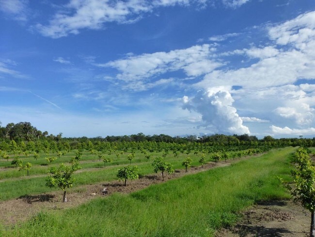
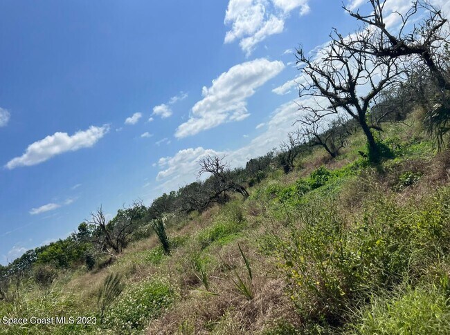
Residentialacreage
Brevard
AE
Florida
12009C0205H
304.09 AC
2024
Brevard County
2025
Orlando
0605001000
Palm Bay-Melbourne-Titusville, FL
DEMOGRAPHICS near 1909 Unknown
1 Mile
3 Mile
5 Mile
2024 Total Population
242
1,908
4,520
2029 Population
264
2,070
4,939
Pop Growth 2024-2029
+ 9.09%
+ 8.49%
+ 9.27%
Average Age
43
45
46
2024 Total Households
93
786
1,870
HH Growth 2024-2029
+ 8.60%
+ 8.27%
+ 9.09%
Median Household Inc
$76,389
$53,382
$63,010
Avg Household Size
2.60
2.40
2.40
2024 Avg HH Vehicles
2.00
2.00
2.00
Median Home Value
$408,064
$309,483
$298,858
Median Year Built
1988
1986
1988
Nearby Places
- Restaurants
- Banks
- Shops
- Fitness
- Groceries
PUBLIC TRANSPORTATION
AIRPORT
Orlando Sanford International
DRIVE
WALK
Distance
Orlando Sanford International
65 min
45.9 mi
Freight Ports
Port Canaveral
DRIVE
WALK
Distance
Port Canaveral
36 min
28.7 mi
SALE & LEASE HISTORY
LISTING DATE
SALE/LEASE

Aug 02, 2017
For Sale
Apr 22, 2024
For Sale
Nearby Properties
Address
Land Use
TOTAL SIZE
Lot Size
Zoning
Address
Land Use
TOTAL SIZE
Lot Size
Zoning
440,368 SF
60.44 AC
HM
Address
Land Use
TOTAL SIZE
Lot Size
Zoning
18,000 SF
16.54 AC
P
Address
Land Use
TOTAL SIZE
Lot Size
Zoning
301,357 SF
23.86 AC
P
Address
Land Use
TOTAL SIZE
Lot Size
Zoning
172,172 SF
116.12 AC
P
Address
Land Use
TOTAL SIZE
Lot Size
Zoning
243,389 SF
29.15 AC
RC
Address
Land Use
TOTAL SIZE
Lot Size
Zoning
267,207 SF
36.82 AC
P
Address
Land Use
TOTAL SIZE
Lot Size
Zoning
225,896 SF
19.01 AC
R3
Address
Land Use
TOTAL SIZE
Lot Size
Zoning
3.25 AC
P
Address
Land Use
TOTAL SIZE
Lot Size
Zoning
118,056 SF
11.52 AC
R3
Address
Land Use
TOTAL SIZE
Lot Size
Zoning
206,579 SF
15.90 AC
R3
Address
Land Use
TOTAL SIZE
Lot Size
Zoning
164,378 SF
12.45 AC
R3
Address
Land Use
TOTAL SIZE
Lot Size
Zoning
130,615 SF
16.15 AC
RC
Address
Land Use
TOTAL SIZE
Lot Size
Zoning
187,335 SF
5.92 AC
P
Address
Land Use
TOTAL SIZE
Lot Size
Zoning
141,654 SF
10.43 AC
R3
Address
Land Use
TOTAL SIZE
Lot Size
Zoning
59,953 SF
0.71 AC
Address
Land Use
TOTAL SIZE
Lot Size
Zoning
54,816 SF
10.11 AC
BU-1
Address
Land Use
TOTAL SIZE
Lot Size
Zoning
79,548 SF
4.89 AC
R3
Address
Land Use
TOTAL SIZE
Lot Size
Zoning
113,576 SF
19.98 AC
P
Address
Land Use
TOTAL SIZE
Lot Size
Zoning
163,141 SF
18.58 AC
P
Address
Land Use
TOTAL SIZE
Lot Size
Zoning
2,536 SF
75.81 AC
OR
Address
Land Use
TOTAL SIZE
Lot Size
Zoning
64,036 SF
2.45 AC
R3
Address
Land Use
TOTAL SIZE
Lot Size
Zoning
97,504 SF
14.70 AC
OR
Address
Land Use
TOTAL SIZE
Lot Size
Zoning
97,463 SF
19.50 AC
P
Address
Land Use
TOTAL SIZE
Lot Size
Zoning
121,859 SF
16.07 AC
R3/OR
Address
Land Use
TOTAL SIZE
Lot Size
Zoning
111,540 SF
6.83 AC
R3
Address
Land Use
TOTAL SIZE
Lot Size
Zoning
68,077 SF
13.60 AC
P
Address
Land Use
TOTAL SIZE
Lot Size
Zoning
68,385 SF
12 AC
P
Address
Land Use
TOTAL SIZE
Lot Size
Zoning
85,938 SF
5.75 AC
R3
Address
Land Use
TOTAL SIZE
Lot Size
Zoning
103,923 SF
19.41 AC
R1B
Address
Land Use
TOTAL SIZE
Lot Size
Zoning
68,376 SF
2.57 AC
R3
The World's #1 Commercial Real Estate Marketplace
Connect with us
© 2025 CoStar Group
The information above has been obtained from sources believed reliable. While we do not doubt its accuracy we have not verified it and make no guarantee, warranty or representation about it. It is your responsibility to independently confirm its accuracy and completeness. Any projections, opinions, assumptions, or estimates used are for example only and do not represent the current or future performance of the property. The value of this transaction to you depends on tax and other factors which should be evaluated by your tax, financial, and legal advisors. You and your advisors should conduct a careful, independent investigation of the property to determine to your satisfaction the suitability of the property for your needs.