Property Record
Harwood Dr, Saline, MI 48176
This Property Is For Sale
NEARBY LISTINGS FOR SALE OR LEASE
Property Detail
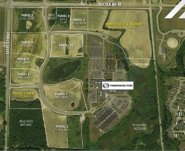
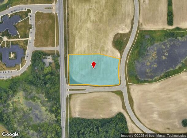
Harwood Dr
Ann Arbor, MI
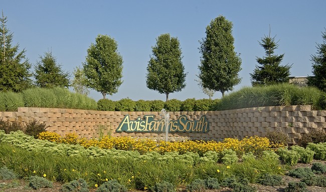
Avis South Condos
12-28-210-004
M.D. L4055 P113 UNIT 4 AVIS SOUTH CONDOMINIUM SPLIT ON 01/23/2002 FROM L -12-28-100-008;
Commercialacreage
Washtenaw
X
Michigan
26161C0405E
3.07 AC
2025
Washtenaw W of 23
2025
Detroit
423400
DEMOGRAPHICS near Harwood Dr
1 mile
3 mile
5 mile
2024 Total Population
2,297
25,723
94,990
2029 Population
2,303
25,390
93,986
Pop Growth 2024-2029
+ 0.26%
(1.29%)
(1.06%)
Average Age
39
40
40
2024 Total Households
803
9,666
39,573
HH Growth 2024-2029
+ 0.37%
(1.54%)
(1.23%)
Median Household Inc
$136,184
$97,514
$90,485
Avg Household Size
2.80
2.40
2.30
2024 Avg HH Vehicles
2.00
2.00
2.00
Median Home Value
$463,259
$395,485
$365,256
Median Year Built
2002
1991
1981
Nearby Places
Map Layers
Map Styles
 Street
 Aerial
Transit
 Traffic
 Biking
Places
Listings with unknown addresses are not visible on the map
- Restaurants
- Banks
- Shops
- Fitness
- Groceries
PUBLIC TRANSPORTATION
COMMUTER RAIL
Drive
Walk
Distance
15 min
6.6 mi
AIRPORT
Detroit Metro Wayne County
Drive
Walk
Distance
Detroit Metro Wayne County
36 min
26.6 mi
Freight Ports
Drive
Walk
Distance
72 min
55.2 mi
Nearby Properties
Address
Land Use
TOTAL SIZE
Lot Size
Zoning
Address
Land Use
TOTAL SIZE
Lot Size
Zoning
112,994 SF
45.12 AC
IH
Address
Land Use
TOTAL SIZE
Lot Size
Zoning
140,039 SF
Address
Land Use
TOTAL SIZE
Lot Size
Zoning
253,702 SF
30.23 AC
Address
Land Use
TOTAL SIZE
Lot Size
Zoning
111,435 SF
21.38 AC
R4B
Address
Land Use
TOTAL SIZE
Lot Size
Zoning
317,872 SF
11.79 AC
M1
Address
Land Use
TOTAL SIZE
Lot Size
Zoning
18,148 SF
21.62 AC
BI
Address
Land Use
TOTAL SIZE
Lot Size
Zoning
167,294 SF
40.67 AC
Address
Land Use
TOTAL SIZE
Lot Size
Zoning
74,481 SF
3.40 AC
R5
Address
Land Use
TOTAL SIZE
Lot Size
Zoning
178,367 SF
10.70 AC
R5
Address
Land Use
TOTAL SIZE
Lot Size
Zoning
159,947 SF
14.19 AC
Address
Land Use
TOTAL SIZE
Lot Size
Zoning
132,937 SF
13.92 AC
R4A
Address
Land Use
TOTAL SIZE
Lot Size
Zoning
105,615 SF
26.31 AC
Address
Land Use
TOTAL SIZE
Lot Size
Zoning
Address
Land Use
TOTAL SIZE
Lot Size
Zoning
136,968 SF
10.53 AC
R4A
Address
Land Use
TOTAL SIZE
Lot Size
Zoning
64,989 SF
9.03 AC
R4A
Address
Land Use
TOTAL SIZE
Lot Size
Zoning
125,740 SF
11.89 AC
M1
Address
Land Use
TOTAL SIZE
Lot Size
Zoning
1,562,480 SF
189.08 AC
I-4
Address
Land Use
TOTAL SIZE
Lot Size
Zoning
191,215 SF
30.23 AC
Address
Land Use
TOTAL SIZE
Lot Size
Zoning
100,136 SF
3.47 AC
C2B
Address
Land Use
TOTAL SIZE
Lot Size
Zoning
17,228 SF
8.40 AC
Address
Land Use
TOTAL SIZE
Lot Size
Zoning
99,663 SF
6.89 AC
R-1A
Address
Land Use
TOTAL SIZE
Lot Size
Zoning
19,236 SF
13.13 AC
BI
Address
Land Use
TOTAL SIZE
Lot Size
Zoning
24,000 SF
21.97 AC
Address
Land Use
TOTAL SIZE
Lot Size
Zoning
154,987 SF
17.08 AC
II
Address
Land Use
TOTAL SIZE
Lot Size
Zoning
4,964 SF
5.86 AC
Address
Land Use
TOTAL SIZE
Lot Size
Zoning
88,657 SF
14.98 AC
Address
Land Use
TOTAL SIZE
Lot Size
Zoning
63,702 SF
2.30 AC
O
Address
Land Use
TOTAL SIZE
Lot Size
Zoning
67,220 SF
9 AC
Address
Land Use
TOTAL SIZE
Lot Size
Zoning
255,838 SF
31.64 AC
II
Address
Land Use
TOTAL SIZE
Lot Size
Zoning
99,000 SF
12.22 AC
I-2
The World's #1 Commercial Real Estate Marketplace
Connect with us
© 2026 CoStar Group
The information above has been obtained from sources believed reliable. While we do not doubt its accuracy we have not verified it and make no guarantee, warranty or representation about it. It is your responsibility to independently confirm its accuracy and completeness. Any projections, opinions, assumptions, or estimates used are for example only and do not represent the current or future performance of the property. The value of this transaction to you depends on tax and other factors which should be evaluated by your tax, financial, and legal advisors. You and your advisors should conduct a careful, independent investigation of the property to determine to your satisfaction the suitability of the property for your needs.