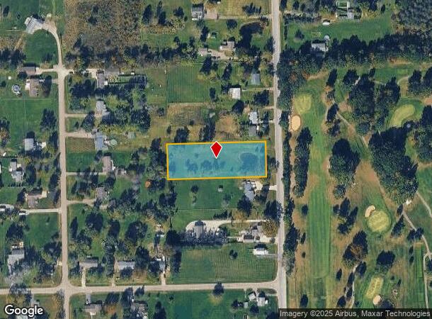
Property Record
S Vassar Rd, Burton, MI 48519


NEARBY LISTINGS FOR SALE OR LEASE
Property Detail
S Vassar Rd
Flint, MI
Wagners Acres
59-36-576-003
LOT 3 WAGNERS ACRES
Residentialacreage
Genesee
X
Michigan
26049C0329D
3
2024
1.29 AC
2025
Flint
011402
Detroit
DEMOGRAPHICS near S Vassar Rd
1 mile
3 mile
5 mile
2024 Total Population
1,523
23,644
71,476
2029 Population
1,452
22,916
69,654
Pop Growth 2024-2029
(4.66%)
(3.08%)
(2.55%)
Average Age
41
40
41
2024 Total Households
579
9,267
29,639
HH Growth 2024-2029
(4.49%)
(2.97%)
(2.50%)
Median Household Inc
$81,866
$74,154
$59,516
Avg Household Size
2.60
2.50
2.40
2024 Avg HH Vehicles
2.00
2.00
2.00
Median Home Value
$191,218
$196,753
$180,387
Median Year Built
1991
1975
1972
Nearby Places
Map Layers
Map Styles
 Street
 Aerial
Transit
 Traffic
 Biking
Places
Listings with unknown addresses are not visible on the map
- Restaurants
- Banks
- Shops
- Fitness
- Groceries
PUBLIC TRANSPORTATION
COMMUTER RAIL
Flint Amtrak Station (Blue Water - Amtrak)
Drive
Walk
Distance
Flint Amtrak Station (Blue Water - Amtrak)
15 min
7.5 mi
AIRPORT
Bishop International
Drive
Walk
Distance
Bishop International
31 min
13.5 mi
Freight Ports
Port of Toledo
Drive
Walk
Distance
Port of Toledo
144 min
118.3 mi
SALE & LEASE HISTORY
LISTING DATE
SALE/LEASE

Apr 28, 2021
For Sale
Nearby Properties
Address
Land Use
TOTAL SIZE
Lot Size
Zoning
Address
Land Use
TOTAL SIZE
Lot Size
Zoning
507,562 SF
39.37 AC
HDM
Address
Land Use
TOTAL SIZE
Lot Size
Zoning
157,756 SF
21.17 AC
MDM
Address
Land Use
TOTAL SIZE
Lot Size
Zoning
66,576 SF
5.98 AC
OS-1
Address
Land Use
TOTAL SIZE
Lot Size
Zoning
24.38 AC
RM
Address
Land Use
TOTAL SIZE
Lot Size
Zoning
2,829 SF
75.78 AC
RMH
Address
Land Use
TOTAL SIZE
Lot Size
Zoning
132,480 SF
10.99 AC
HDMF
Address
Land Use
TOTAL SIZE
Lot Size
Zoning
115,108 SF
9.40 AC
HDMF
Address
Land Use
TOTAL SIZE
Lot Size
Zoning
95,524 SF
16.62 AC
HDMF
Address
Land Use
TOTAL SIZE
Lot Size
Zoning
127,043 SF
8.98 AC
HDMF
Address
Land Use
TOTAL SIZE
Lot Size
Zoning
27,391 SF
137.30 AC
NOT AVAILA
Address
Land Use
TOTAL SIZE
Lot Size
Zoning
26,046 SF
4.66 AC
C-2
Address
Land Use
TOTAL SIZE
Lot Size
Zoning
20,098 SF
174 AC
NOT AVAILA
Address
Land Use
TOTAL SIZE
Lot Size
Zoning
Address
Land Use
TOTAL SIZE
Lot Size
Zoning
22,519 SF
3.75 AC
NC
Address
Land Use
TOTAL SIZE
Lot Size
Zoning
4,608 SF
4.30 AC
GC
Address
Land Use
TOTAL SIZE
Lot Size
Zoning
22,738 SF
147.75 AC
RSA
Address
Land Use
TOTAL SIZE
Lot Size
Zoning
11,100 SF
2.25 AC
NC
Address
Land Use
TOTAL SIZE
Lot Size
Zoning
11,695 SF
12.83 AC
NOT AVAILA
Address
Land Use
TOTAL SIZE
Lot Size
Zoning
22,692 SF
2.49 AC
C-2
Address
Land Use
TOTAL SIZE
Lot Size
Zoning
23,688 SF
1.65 AC
C-2
Address
Land Use
TOTAL SIZE
Lot Size
Zoning
7.78 AC
NC
Address
Land Use
TOTAL SIZE
Lot Size
Zoning
4,511 SF
1.53 AC
R2
Address
Land Use
TOTAL SIZE
Lot Size
Zoning
3,583 SF
3.26 AC
NC
Address
Land Use
TOTAL SIZE
Lot Size
Zoning
3,373 SF
37.37 AC
NOT AVAILA
Address
Land Use
TOTAL SIZE
Lot Size
Zoning
4,476 SF
30.52 AC
Address
Land Use
TOTAL SIZE
Lot Size
Zoning
3,184 SF
69.50 AC
NOT AVAILA
Address
Land Use
TOTAL SIZE
Lot Size
Zoning
5,415 SF
1.70 AC
NC
Address
Land Use
TOTAL SIZE
Lot Size
Zoning
3,516 SF
10.01 AC
R3
Address
Land Use
TOTAL SIZE
Lot Size
Zoning
4,457 SF
11.38 AC
RA
Address
Land Use
TOTAL SIZE
Lot Size
Zoning
5,625 SF
0.75 AC
R-1
The World's #1 Commercial Real Estate Marketplace
Connect with us
© 2026 CoStar Group
The information above has been obtained from sources believed reliable. While we do not doubt its accuracy we have not verified it and make no guarantee, warranty or representation about it. It is your responsibility to independently confirm its accuracy and completeness. Any projections, opinions, assumptions, or estimates used are for example only and do not represent the current or future performance of the property. The value of this transaction to you depends on tax and other factors which should be evaluated by your tax, financial, and legal advisors. You and your advisors should conduct a careful, independent investigation of the property to determine to your satisfaction the suitability of the property for your needs.