Property Record
S Vine St, Orrville, OH 44667

NEARBY LISTINGS FOR SALE OR LEASE
-
-
View all Orrville listings for sale on LoopNet.com
Property Detail
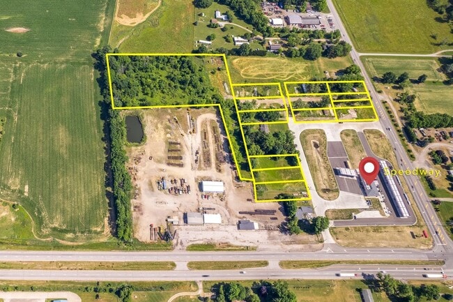
S Vine St
Wooster, OH
T E Rice Allotment
26-00083-000
12-16-12 LOT 13 T E RICE ALT 60' CD 104
Commercialacreage
Wayne
X
Ohio
39169C0250E
13
2024
0.27 AC
2024
Ohio North Area
001200
Other Market Areas
DEMOGRAPHICS near S Vine St
1 Mile
3 Mile
5 Mile
2024 Total Population
430
7,627
22,028
2029 Population
427
7,651
21,947
Pop Growth 2024-2029
(0.70%)
+ 0.31%
(0.37%)
Average Age
40
40
39
2024 Total Households
151
2,889
8,149
HH Growth 2024-2029
(0.66%)
+ 0.24%
(0.44%)
Median Household Inc
$47,916
$58,017
$59,303
Avg Household Size
2.70
2.50
2.60
2024 Avg HH Vehicles
2.00
2.00
2.00
Median Home Value
$181,034
$171,576
$184,054
Median Year Built
1980
1970
1975
Nearby Places
Map Layers
Map Styles
 Street
 Aerial
- Restaurants
- Banks
- Shops
- Fitness
- Groceries
PUBLIC TRANSPORTATION
AIRPORT
Akron-Canton Regional
DRIVE
WALK
Distance
Akron-Canton Regional
41 min
32.6 mi
Freight Ports
Port of Toledo
DRIVE
WALK
Distance
Port of Toledo
173 min
128.8 mi
SALE & LEASE HISTORY
LISTING DATE
SALE/LEASE

Jul 21, 2022
For Sale
Aug 06, 2024
For Sale
Nearby Properties
Address
Land Use
TOTAL SIZE
Lot Size
Zoning
Address
Land Use
TOTAL SIZE
Lot Size
Zoning
15,294 SF
28.13 AC
C1
Address
Land Use
TOTAL SIZE
Lot Size
Zoning
37.44 AC
Address
Land Use
TOTAL SIZE
Lot Size
Zoning
46,494 SF
43.61 AC
Address
Land Use
TOTAL SIZE
Lot Size
Zoning
30,035 SF
2.79 AC
Address
Land Use
TOTAL SIZE
Lot Size
Zoning
29.38 AC
I2
Address
Land Use
TOTAL SIZE
Lot Size
Zoning
43,200 SF
21.44 AC
Address
Land Use
TOTAL SIZE
Lot Size
Zoning
40,636 SF
5.20 AC
Address
Land Use
TOTAL SIZE
Lot Size
Zoning
38,496 SF
2.46 AC
R2
Address
Land Use
TOTAL SIZE
Lot Size
Zoning
2,492 SF
308.59 AC
Address
Land Use
TOTAL SIZE
Lot Size
Zoning
44,421 SF
8.23 AC
Address
Land Use
TOTAL SIZE
Lot Size
Zoning
63,100 SF
4.73 AC
Address
Land Use
TOTAL SIZE
Lot Size
Zoning
25,540 SF
8.69 AC
Address
Land Use
TOTAL SIZE
Lot Size
Zoning
32,318 SF
7.72 AC
Address
Land Use
TOTAL SIZE
Lot Size
Zoning
9,592 SF
135.02 AC
Address
Land Use
TOTAL SIZE
Lot Size
Zoning
9,268 SF
0.06 AC
Address
Land Use
TOTAL SIZE
Lot Size
Zoning
79,936 SF
5.27 AC
Address
Land Use
TOTAL SIZE
Lot Size
Zoning
15,738 SF
26.93 AC
Address
Land Use
TOTAL SIZE
Lot Size
Zoning
21,986 SF
6.17 AC
Address
Land Use
TOTAL SIZE
Lot Size
Zoning
91,763 SF
5.74 AC
Address
Land Use
TOTAL SIZE
Lot Size
Zoning
16,864 SF
117.09 AC
Address
Land Use
TOTAL SIZE
Lot Size
Zoning
8,391 SF
116.06 AC
Address
Land Use
TOTAL SIZE
Lot Size
Zoning
9,920 SF
7.07 AC
Address
Land Use
TOTAL SIZE
Lot Size
Zoning
31,362 SF
1.96 AC
C1
Address
Land Use
TOTAL SIZE
Lot Size
Zoning
150.27 AC
Address
Land Use
TOTAL SIZE
Lot Size
Zoning
2,086 SF
4.39 AC
Address
Land Use
TOTAL SIZE
Lot Size
Zoning
Address
Land Use
TOTAL SIZE
Lot Size
Zoning
33.39 AC
Address
Land Use
TOTAL SIZE
Lot Size
Zoning
100,000 SF
19.62 AC
Address
Land Use
TOTAL SIZE
Lot Size
Zoning
105.37 AC
Address
Land Use
TOTAL SIZE
Lot Size
Zoning
21,062 SF
2.10 AC
C1
The World's #1 Commercial Real Estate Marketplace
Connect with us
© 2026 CoStar Group
The information above has been obtained from sources believed reliable. While we do not doubt its accuracy we have not verified it and make no guarantee, warranty or representation about it. It is your responsibility to independently confirm its accuracy and completeness. Any projections, opinions, assumptions, or estimates used are for example only and do not represent the current or future performance of the property. The value of this transaction to you depends on tax and other factors which should be evaluated by your tax, financial, and legal advisors. You and your advisors should conduct a careful, independent investigation of the property to determine to your satisfaction the suitability of the property for your needs.