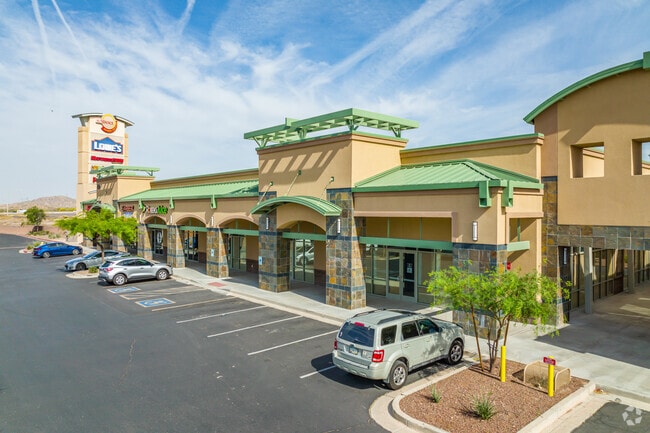
Property Record
422 S Watson Rd, Buckeye, AZ 85326


Property Detail
422 S Watson Rd
504-19-956C
SUNDANCE TOWNE CENTER MCR 800-38
Regionalshoppingcenterormallwithanchorstore
MARICOPA
PAD
Arizona
C and X Area of minimal flood hazard, usually depicted on FIRMs as above the 500-year flood level.
4
2025
0.87 AC
2025
South Buckeye
050615
Phoenix
17,111 SF
Phoenix-Mesa-Chandler, AZ
NEARBY LISTINGS FOR SALE OR LEASE
DEMOGRAPHICS near 422 S Watson Rd
1 mile
3 mile
5 mile
2025 Total Population
7,384
34,006
80,706
2030 Population
7,742
36,048
85,556
Pop Growth 2025-2030
+ 4.85%
+ 6.00%
+ 6.01%
Average Age
38
36
35
2025 Total Households
2,370
10,212
24,292
HH Growth 2025-2030
+ 5.02%
+ 6.07%
+ 6.10%
Median Household Inc
$92,534
$101,117
$102,681
Avg Household Size
3.10
3.30
3.30
2025 Avg HH Vehicles
2.00
2.00
2.00
Median Home Value
$381,276
$393,087
$415,223
Median Year Built
2007
2008
2009
Nearby Places
Map Layers
Map Styles
 Street
 Aerial
Transit
 Traffic
 Biking
Places
Listings with unknown addresses are not visible on the map
- Restaurants
- Banks
- Shops
- Fitness
- Groceries
SALE & LEASE HISTORY
LISTING DATE
SALE/LEASE

Mar 28, 2018
For Lease
Nearby Properties
Address
Land Use
TOTAL SIZE
Lot Size
Zoning
Address
Land Use
TOTAL SIZE
Lot Size
Zoning
862,622 SF
75.39 AC
GC
Address
Land Use
TOTAL SIZE
Lot Size
Zoning
18.64 AC
Address
Land Use
TOTAL SIZE
Lot Size
Zoning
269,665 SF
54.66 AC
PC
Address
Land Use
TOTAL SIZE
Lot Size
Zoning
13.06 AC
Address
Land Use
TOTAL SIZE
Lot Size
Zoning
326,103 SF
21.54 AC
Address
Land Use
TOTAL SIZE
Lot Size
Zoning
1.98 AC
PAD
Address
Land Use
TOTAL SIZE
Lot Size
Zoning
217,965 SF
23.03 AC
PAD
Address
Land Use
TOTAL SIZE
Lot Size
Zoning
174.17 AC
Address
Land Use
TOTAL SIZE
Lot Size
Zoning
93,337 SF
15.37 AC
PC
Address
Land Use
TOTAL SIZE
Lot Size
Zoning
78,774 SF
7.57 AC
PUD
Address
Land Use
TOTAL SIZE
Lot Size
Zoning
108,818 SF
10.65 AC
C-C
Address
Land Use
TOTAL SIZE
Lot Size
Zoning
78,165 SF
15.81 AC
PUD
Address
Land Use
TOTAL SIZE
Lot Size
Zoning
858,000 SF
69.08 AC
GC
Address
Land Use
TOTAL SIZE
Lot Size
Zoning
73,130 SF
3.68 AC
PAD
Address
Land Use
TOTAL SIZE
Lot Size
Zoning
138,134 SF
13.14 AC
PAD
Address
Land Use
TOTAL SIZE
Lot Size
Zoning
44,463 SF
79.72 AC
RR
Address
Land Use
TOTAL SIZE
Lot Size
Zoning
3.34 AC
Address
Land Use
TOTAL SIZE
Lot Size
Zoning
75,026 SF
14.07 AC
PAD
Address
Land Use
TOTAL SIZE
Lot Size
Zoning
57,950 SF
9.89 AC
PAD
Address
Land Use
TOTAL SIZE
Lot Size
Zoning
102,640 SF
3.73 AC
PC
Address
Land Use
TOTAL SIZE
Lot Size
Zoning
40,104 SF
4.75 AC
PAD
Address
Land Use
TOTAL SIZE
Lot Size
Zoning
55,485 SF
2.10 AC
PC
Address
Land Use
TOTAL SIZE
Lot Size
Zoning
188,937 SF
20.87 AC
Address
Land Use
TOTAL SIZE
Lot Size
Zoning
50,445 SF
2.05 AC
PAD
Address
Land Use
TOTAL SIZE
Lot Size
Zoning
38,620 SF
20.87 AC
C-G
Address
Land Use
TOTAL SIZE
Lot Size
Zoning
48,556 SF
7.68 AC
Address
Land Use
TOTAL SIZE
Lot Size
Zoning
26,239 SF
6.26 AC
RR
Address
Land Use
TOTAL SIZE
Lot Size
Zoning
30,320 SF
13.81 AC
PAD
Address
Land Use
TOTAL SIZE
Lot Size
Zoning
106,305 SF
9.11 AC
C-G
Address
Land Use
TOTAL SIZE
Lot Size
Zoning
65,023 SF
12.52 AC
C-C
The World's #1 Commercial Real Estate Marketplace
Connect with us
© 2026 CoStar Group
The information above has been obtained from sources believed reliable. While we do not doubt its accuracy we have not verified it and make no guarantee, warranty or representation about it. It is your responsibility to independently confirm its accuracy and completeness. Any projections, opinions, assumptions, or estimates used are for example only and do not represent the current or future performance of the property. The value of this transaction to you depends on tax and other factors which should be evaluated by your tax, financial, and legal advisors. You and your advisors should conduct a careful, independent investigation of the property to determine to your satisfaction the suitability of the property for your needs.