Property Record
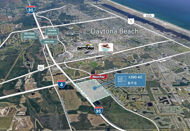
S Williamson Blvd, Daytona Beach, FL 32119


Current Lease Availabilities
Property Detail
S Williamson Blvd
5235-00-00-0010
35-15-32 E OF I-95 & S OF BEVILLE RD EXC N 800.31 FT W OF BELT LINE & EXC PART E OF W/L OF BELT LINE & EXC W 1040.27 FT OF E 1140.27 FT OF N 45 FT OF S 2613.14 FT W OF WILLIAMSON BLVD PER OR 2692 PGS 1874-1880 INC PER OR 3794 PG 4304 PER OR 7790 PG 3
Pasture
VOLUSIA
A21
Florida
AH Areas with a 1% annual chance of shallow flooding, usually in the form of a pond, withan average depth ranging from 1 to 3 feet. These areas have a 26% chance of flooding over the life of a 30-year mortgage.
110.98 AC
2025
South Daytona Beach
2026
Deltona/Daytona Beach
082405
Deltona-Daytona Beach-Ormond Beach, FL
NEARBY LISTINGS FOR SALE OR LEASE
DEMOGRAPHICS near S Williamson Blvd
1 mile
3 mile
5 mile
2025 Total Population
1,498
30,886
109,561
2030 Population
1,587
32,920
117,573
Pop Growth 2025-2030
+ 5.94%
+ 6.59%
+ 7.31%
Average Age
46
43
43
2025 Total Households
801
13,317
46,917
HH Growth 2025-2030
+ 5.99%
+ 6.83%
+ 7.34%
Median Household Inc
$55,065
$59,165
$57,558
Avg Household Size
1.90
2.10
2.10
2025 Avg HH Vehicles
2.00
2.00
2.00
Median Home Value
$353,144
$263,045
$285,208
Median Year Built
1994
1988
1985
Nearby Places
Map Layers
Map Styles
 Street
 Aerial
Layers
 Traffic
 Biking
Places
Listings with unknown addresses are not visible on the map
- Restaurants
- Banks
- Shops
- Fitness
- Groceries
PUBLIC TRANSPORTATION
AIRPORT
Daytona Beach International
Drive
Walk
Distance
Daytona Beach International
7 min
3.0 mi
Orlando Sanford International
Drive
Walk
Distance
Orlando Sanford International
51 min
38.4 mi
Freight Ports
Port Canaveral
Drive
Walk
Distance
Port Canaveral
81 min
69.5 mi
Nearby Properties
Address
Land Use
TOTAL SIZE
Lot Size
Zoning
Address
Land Use
TOTAL SIZE
Lot Size
Zoning
863,820 SF
374 AC
AP
Address
Land Use
TOTAL SIZE
Lot Size
Zoning
2,673,647 SF
110.95 AC
I12
Address
Land Use
TOTAL SIZE
Lot Size
Zoning
1,842,969 SF
25.56 AC
Address
Land Use
TOTAL SIZE
Lot Size
Zoning
626,109 SF
72.96 AC
Address
Land Use
TOTAL SIZE
Lot Size
Zoning
490,775 SF
34.26 AC
01MH1
Address
Land Use
TOTAL SIZE
Lot Size
Zoning
442,125 SF
0.98 AC
A21
Address
Land Use
TOTAL SIZE
Lot Size
Zoning
396,385 SF
10 AC
01A2
Address
Land Use
TOTAL SIZE
Lot Size
Zoning
462,136 SF
31.84 AC
01A2
Address
Land Use
TOTAL SIZE
Lot Size
Zoning
13,965 SF
0.70 AC
MH1
Address
Land Use
TOTAL SIZE
Lot Size
Zoning
275,814 SF
13 AC
Address
Land Use
TOTAL SIZE
Lot Size
Zoning
286,461 SF
945.48 AC
B62
Address
Land Use
TOTAL SIZE
Lot Size
Zoning
197,581 SF
14.58 AC
Address
Land Use
TOTAL SIZE
Lot Size
Zoning
226,459 SF
0.57 AC
Address
Land Use
TOTAL SIZE
Lot Size
Zoning
330,883 SF
19.59 AC
Address
Land Use
TOTAL SIZE
Lot Size
Zoning
300,516 SF
70 AC
A2
Address
Land Use
TOTAL SIZE
Lot Size
Zoning
379,591 SF
21.62 AC
MH1
Address
Land Use
TOTAL SIZE
Lot Size
Zoning
10,360 SF
1.56 AC
Address
Land Use
TOTAL SIZE
Lot Size
Zoning
306,467 SF
20.76 AC
Address
Land Use
TOTAL SIZE
Lot Size
Zoning
5,774 SF
0.94 AC
B4
Address
Land Use
TOTAL SIZE
Lot Size
Zoning
12,871 SF
0.20 AC
R4
Address
Land Use
TOTAL SIZE
Lot Size
Zoning
198,182 SF
7.43 AC
Address
Land Use
TOTAL SIZE
Lot Size
Zoning
250,935 SF
34.24 AC
Address
Land Use
TOTAL SIZE
Lot Size
Zoning
324,364 SF
11.59 AC
02RPUD
Address
Land Use
TOTAL SIZE
Lot Size
Zoning
146,580 SF
2.80 AC
02R3
Address
Land Use
TOTAL SIZE
Lot Size
Zoning
201,947 SF
0.23 AC
Address
Land Use
TOTAL SIZE
Lot Size
Zoning
185,278 SF
15.85 AC
Address
Land Use
TOTAL SIZE
Lot Size
Zoning
206,059 SF
20.13 AC
Address
Land Use
TOTAL SIZE
Lot Size
Zoning
158,492 SF
3.38 AC
Address
Land Use
TOTAL SIZE
Lot Size
Zoning
8,355 SF
1 AC
MH1
Address
Land Use
TOTAL SIZE
Lot Size
Zoning
147,354 SF
4.08 AC
The World's #1 Commercial Real Estate Marketplace
Connect with us
© 2026 CoStar Group
The information above has been obtained from sources believed reliable. While we do not doubt its accuracy we have not verified it and make no guarantee, warranty or representation about it. It is your responsibility to independently confirm its accuracy and completeness. Any projections, opinions, assumptions, or estimates used are for example only and do not represent the current or future performance of the property. The value of this transaction to you depends on tax and other factors which should be evaluated by your tax, financial, and legal advisors. You and your advisors should conduct a careful, independent investigation of the property to determine to your satisfaction the suitability of the property for your needs.