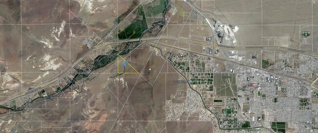
Property Record
S17 Ptn T20n, Sparks, NV 89434
NEARBY LISTINGS FOR SALE OR LEASE
Property Detail
S17 Ptn T20n
004-021-09
PARCEL MAP ID : LOT : BLOCK : TOWN : OUTSIDE RIVER
Vacantlandnec
Storey
AE
Nevada
32031C3131G
574 AC
2024
Storey County
2025
Reno/Sparks
003109
Reno, NV
DEMOGRAPHICS near S17 Ptn T20n
1 Mile
3 Mile
5 Mile
2024 Total Population
3
2,244
15,233
2029 Population
3
2,430
16,715
Pop Growth 2024-2029
0.00%
+ 8.29%
+ 9.73%
Average Age
0
41
39
2024 Total Households
1
819
5,618
HH Growth 2024-2029
0.00%
+ 8.30%
+ 9.77%
Median Household Inc
$0
$72,115
$81,802
Avg Household Size
.00
2.60
2.70
2024 Avg HH Vehicles
.00
3.00
2.00
Median Home Value
$750,000
$365,999
$294,304
Median Year Built
0
1993
1998
Nearby Places
Map Layers
Map Styles
 Street
 Aerial
- Restaurants
- Banks
- Shops
- Fitness
- Groceries
PUBLIC TRANSPORTATION
AIRPORT
Reno/Tahoe International
DRIVE
WALK
Distance
Reno/Tahoe International
58 min
36.0 mi
Freight Ports
Port of Stockton
DRIVE
WALK
Distance
Port of Stockton
243 min
210.3 mi
SALE & LEASE HISTORY
LISTING DATE
SALE/LEASE

Dec 21, 2020
For Sale
Nearby Properties
Address
Land Use
TOTAL SIZE
Lot Size
Zoning
Address
Land Use
TOTAL SIZE
Lot Size
Zoning
267.40 AC
M1
Address
Land Use
TOTAL SIZE
Lot Size
Zoning
28.88 AC
RR1
Address
Land Use
TOTAL SIZE
Lot Size
Zoning
465,120 SF
24.16 AC
I
Address
Land Use
TOTAL SIZE
Lot Size
Zoning
20,357 SF
74.69 AC
A
Address
Land Use
TOTAL SIZE
Lot Size
Zoning
111,142 SF
19.32 AC
I
Address
Land Use
TOTAL SIZE
Lot Size
Zoning
44,589 SF
1.95 AC
C2
Address
Land Use
TOTAL SIZE
Lot Size
Zoning
33,840 SF
11.98 AC
I
Address
Land Use
TOTAL SIZE
Lot Size
Zoning
10,645 SF
10.03 AC
C2
Address
Land Use
TOTAL SIZE
Lot Size
Zoning
10,308 SF
9.07 AC
C2
Address
Land Use
TOTAL SIZE
Lot Size
Zoning
23,439 SF
15,292.84 AC
WB 1% / TL
Address
Land Use
TOTAL SIZE
Lot Size
Zoning
13,800 SF
2.39 AC
C2
Address
Land Use
TOTAL SIZE
Lot Size
Zoning
30.74 AC
GR
Address
Land Use
TOTAL SIZE
Lot Size
Zoning
28,000 SF
5.47 AC
I
Address
Land Use
TOTAL SIZE
Lot Size
Zoning
13,128 SF
5.05 AC
I
Address
Land Use
TOTAL SIZE
Lot Size
Zoning
16,200 SF
4.40 AC
C2
Address
Land Use
TOTAL SIZE
Lot Size
Zoning
12,000 SF
8.70 AC
EC
Address
Land Use
TOTAL SIZE
Lot Size
Zoning
24,936 SF
0.57 AC
C1
Address
Land Use
TOTAL SIZE
Lot Size
Zoning
28,050 SF
3.81 AC
I
Address
Land Use
TOTAL SIZE
Lot Size
Zoning
27,396 SF
9.16 AC
I
Address
Land Use
TOTAL SIZE
Lot Size
Zoning
0.94 AC
I
Address
Land Use
TOTAL SIZE
Lot Size
Zoning
795.84 AC
NOLU
Address
Land Use
TOTAL SIZE
Lot Size
Zoning
20,952 SF
12 AC
PSP
Address
Land Use
TOTAL SIZE
Lot Size
Zoning
3,528 SF
6.49 AC
C2
Address
Land Use
TOTAL SIZE
Lot Size
Zoning
14,812 SF
0.34 AC
C1
Address
Land Use
TOTAL SIZE
Lot Size
Zoning
27.83 AC
I
Address
Land Use
TOTAL SIZE
Lot Size
Zoning
1,890 SF
112.91 AC
MDS 60% /
Address
Land Use
TOTAL SIZE
Lot Size
Zoning
632.86 AC
GR
Address
Land Use
TOTAL SIZE
Lot Size
Zoning
27.90 AC
MU
Address
Land Use
TOTAL SIZE
Lot Size
Zoning
9,231 SF
5.33 AC
TC
Address
Land Use
TOTAL SIZE
Lot Size
Zoning
11.32 AC
C2
The World's #1 Commercial Real Estate Marketplace
Connect with us
© 2026 CoStar Group
The information above has been obtained from sources believed reliable. While we do not doubt its accuracy we have not verified it and make no guarantee, warranty or representation about it. It is your responsibility to independently confirm its accuracy and completeness. Any projections, opinions, assumptions, or estimates used are for example only and do not represent the current or future performance of the property. The value of this transaction to you depends on tax and other factors which should be evaluated by your tax, financial, and legal advisors. You and your advisors should conduct a careful, independent investigation of the property to determine to your satisfaction the suitability of the property for your needs.