Property Record
Sand Bar Ferry Rd, Beech Island, SC 29842

NEARBY LISTINGS FOR SALE OR LEASE
-
-
View all Beech Island listings for sale on LoopNet.com
Property Detail
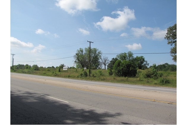
Sand Bar Ferry Rd
Augusta-Richmond County, GA-SC
S/SD HWY 28
026-19-02-001
Aiken
Commercialnec
South Carolina
X
006
13245C0145H
8 AC
2025
Outlying Aiken County
2025
Augusta/Richmond County
020904
DEMOGRAPHICS near Sand Bar Ferry Rd
1 Mile
3 Mile
5 Mile
2024 Total Population
1,159
4,438
18,614
2029 Population
1,272
4,751
19,490
Pop Growth 2024-2029
+ 9.75%
+ 7.05%
+ 4.71%
Average Age
43
42
40
2024 Total Households
468
1,821
7,692
HH Growth 2024-2029
+ 9.62%
+ 6.81%
+ 4.56%
Median Household Inc
$52,000
$40,400
$33,433
Avg Household Size
2.40
2.40
2.30
2024 Avg HH Vehicles
2.00
2.00
2.00
Median Home Value
$115,294
$111,315
$91,785
Median Year Built
1984
1985
1974
Nearby Places
Map Layers
Map Styles
 Street
 Aerial
- Restaurants
- Banks
- Shops
- Fitness
- Groceries
PUBLIC TRANSPORTATION
AIRPORT
Augusta Regional at Bush Field
DRIVE
WALK
Distance
Augusta Regional at Bush Field
21 min
10.6 mi
Freight Ports
Georgia Ports - Savannah
DRIVE
WALK
Distance
Georgia Ports - Savannah
159 min
120.3 mi
SALE & LEASE HISTORY
LISTING DATE
SALE/LEASE

Sep 24, 2016
For Sale
Nearby Properties
Address
Land Use
TOTAL SIZE
Lot Size
Zoning
Address
Land Use
TOTAL SIZE
Lot Size
Zoning
41,937 SF
37.84 AC
HI
Address
Land Use
TOTAL SIZE
Lot Size
Zoning
1,225 SF
87.87 AC
HI
Address
Land Use
TOTAL SIZE
Lot Size
Zoning
40,190 SF
25.91 AC
R-3B
Address
Land Use
TOTAL SIZE
Lot Size
Zoning
194,900 SF
9.56 AC
HI
Address
Land Use
TOTAL SIZE
Lot Size
Zoning
2,954 SF
25.91 AC
R-3B
Address
Land Use
TOTAL SIZE
Lot Size
Zoning
473 AC
Address
Land Use
TOTAL SIZE
Lot Size
Zoning
38,492 SF
37.84 AC
HI
Address
Land Use
TOTAL SIZE
Lot Size
Zoning
28,776 SF
36.08 AC
HI
Address
Land Use
TOTAL SIZE
Lot Size
Zoning
67,090 SF
25.91 AC
R-3B
Address
Land Use
TOTAL SIZE
Lot Size
Zoning
56,000 SF
6.70 AC
LI
Address
Land Use
TOTAL SIZE
Lot Size
Zoning
5,200 SF
51.59 AC
HI
Address
Land Use
TOTAL SIZE
Lot Size
Zoning
3,000 SF
90.94 AC
007
Address
Land Use
TOTAL SIZE
Lot Size
Zoning
221.25 AC
Address
Land Use
TOTAL SIZE
Lot Size
Zoning
17,640 SF
9.35 AC
HI
Address
Land Use
TOTAL SIZE
Lot Size
Zoning
19,500 SF
109.16 AC
HI
Address
Land Use
TOTAL SIZE
Lot Size
Zoning
268,011 SF
12.96 AC
HI
Address
Land Use
TOTAL SIZE
Lot Size
Zoning
159,225 SF
14.48 AC
LI
Address
Land Use
TOTAL SIZE
Lot Size
Zoning
51.45 AC
Address
Land Use
TOTAL SIZE
Lot Size
Zoning
3,592 SF
25.91 AC
R-3B
Address
Land Use
TOTAL SIZE
Lot Size
Zoning
6,426 SF
3.07 AC
HI
Address
Land Use
TOTAL SIZE
Lot Size
Zoning
3,592 SF
26.31 AC
R-3B
Address
Land Use
TOTAL SIZE
Lot Size
Zoning
25,325 SF
29 AC
HI
Address
Land Use
TOTAL SIZE
Lot Size
Zoning
93,214 SF
19.96 AC
HI
Address
Land Use
TOTAL SIZE
Lot Size
Zoning
384.41 AC
Address
Land Use
TOTAL SIZE
Lot Size
Zoning
13,416 SF
7.45 AC
Address
Land Use
TOTAL SIZE
Lot Size
Zoning
351.97 AC
Address
Land Use
TOTAL SIZE
Lot Size
Zoning
68,345 SF
7.14 AC
LI
Address
Land Use
TOTAL SIZE
Lot Size
Zoning
9,446 SF
2.40 AC
Address
Land Use
TOTAL SIZE
Lot Size
Zoning
25,840 SF
5 AC
LI
Address
Land Use
TOTAL SIZE
Lot Size
Zoning
15,774 SF
46 AC
007
The World's #1 Commercial Real Estate Marketplace
Connect with us
© 2026 CoStar Group
The information above has been obtained from sources believed reliable. While we do not doubt its accuracy we have not verified it and make no guarantee, warranty or representation about it. It is your responsibility to independently confirm its accuracy and completeness. Any projections, opinions, assumptions, or estimates used are for example only and do not represent the current or future performance of the property. The value of this transaction to you depends on tax and other factors which should be evaluated by your tax, financial, and legal advisors. You and your advisors should conduct a careful, independent investigation of the property to determine to your satisfaction the suitability of the property for your needs.